File:Berlin Karte Stahlstich 1860.jpg
Jump to navigation
Jump to search
Size of this preview: 607 × 600 pixels. Other resolutions: 243 × 240 pixels | 486 × 480 pixels | 777 × 768 pixels | 1,036 × 1,024 pixels | 1,560 × 1,542 pixels.
Original file (1,560 × 1,542 pixels, file size: 2.11 MB, MIME type: image/jpeg)
Captions
Captions
Add a one-line explanation of what this file represents
Summary
[edit]
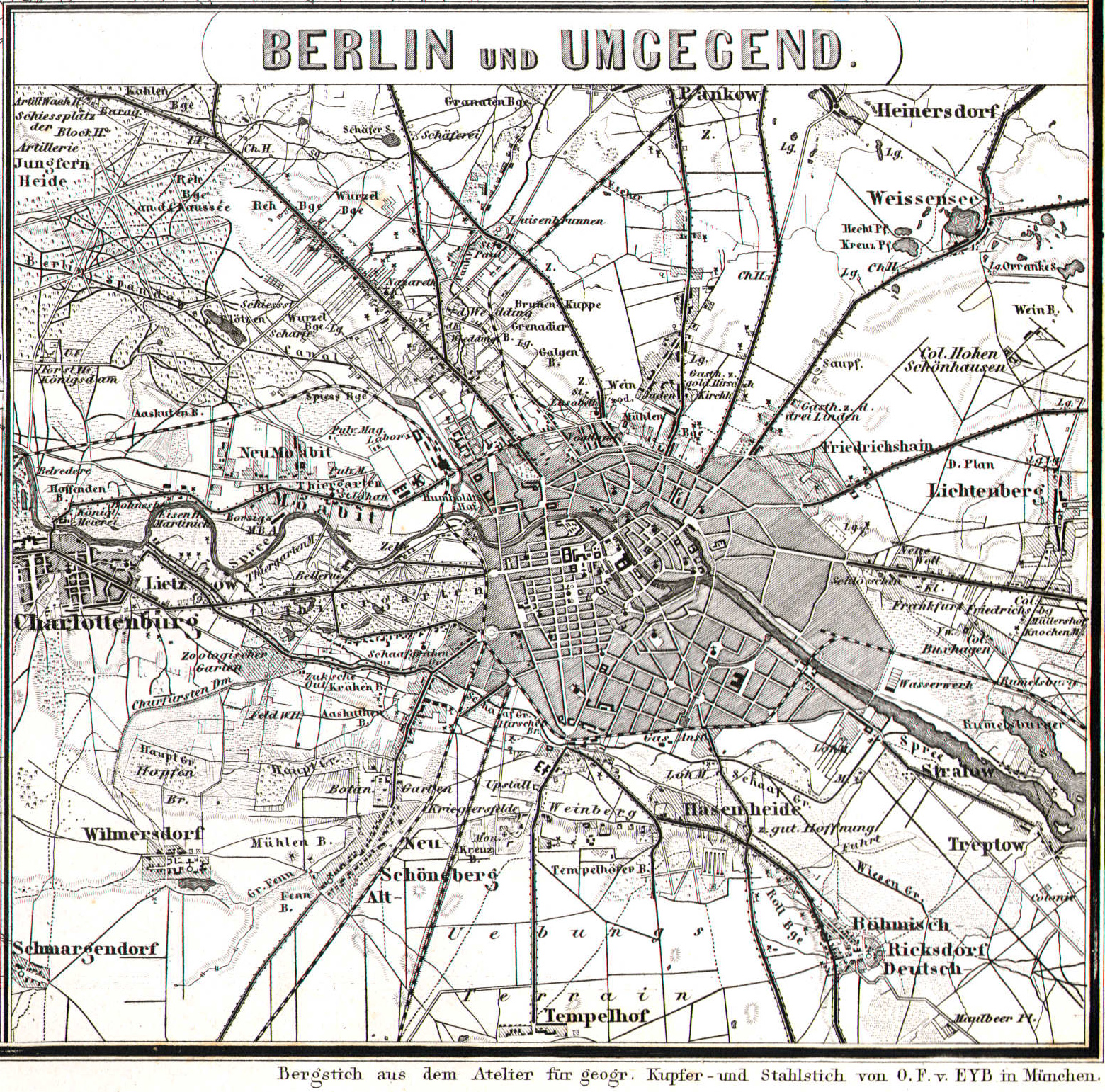
| Title |
Berlin und Umgegend |
|||||||||
| Source | Hand-Atlas der Erde und des Himmels, 42nd edition (1860 printing) atlassen.info | |||||||||
| Creator |
Bearbeitet von Dr. H. Kiepert, C. Gräf, A. Gräf und Dr. C. Bruhns. |
|||||||||
| Geotemporal data | ||||||||||
| Map location | Berlin | |||||||||
| Heading |
 |
|||||||||
| Bounding box |
|
|||||||||
| Georeferencing | ||||||||||
| Bibliographic data | ||||||||||
| Language | German | |||||||||
| Publisher |
Weimar, Geographisches Institut. |
|||||||||
Licensing
[edit]
|
This work is in the public domain in its country of origin and other countries and areas where the copyright term is the author's life plus 70 years or fewer. | |
| This file has been identified as being free of known restrictions under copyright law, including all related and neighboring rights. | |
File history
Click on a date/time to view the file as it appeared at that time.
| Date/Time | Thumbnail | Dimensions | User | Comment | |
|---|---|---|---|---|---|
| current | 22:51, 10 January 2016 | | 1,560 × 1,542 (2.11 MB) | Alexrk2 (talk | contribs) | better version |
| 19:20, 8 April 2006 |  | 1,200 × 1,151 (374 KB) | Jcornelius (talk | contribs) | {{English}} * Description: Map of Berlin, steel engraving * Author: unknown * Date: 1860 * Source: [http://de.wikipedia.org/wiki/Bild:Berlin_1860.jpg German Wikipedia] * License: public domain {{Deutsch}} * Beschreibung: Karte von Berlin, Stahlstich * Au |
You cannot overwrite this file.
File usage on Commons
The following page uses this file:
File usage on other wikis
The following other wikis use this file:
- Usage on de.wikipedia.org
- Usage on ru.wikipedia.org
- Usage on tg.wikipedia.org