File:Barnegat Peninsula Communities, Along State Route 35 on Barnegat Penninsula, south of Point Pleasant, Seaside Heights, Ocean County, NJ HABS NJ,15-SEHG,2-3.tif
Jump to navigation
Jump to search

Size of this JPG preview of this TIF file: 750 × 599 pixels. Other resolutions: 301 × 240 pixels | 601 × 480 pixels | 961 × 768 pixels | 1,280 × 1,023 pixels | 2,560 × 2,045 pixels | 5,000 × 3,995 pixels.
Original file (5,000 × 3,995 pixels, file size: 19.05 MB, MIME type: image/tiff)
Captions
Captions
Add a one-line explanation of what this file represents
Summary
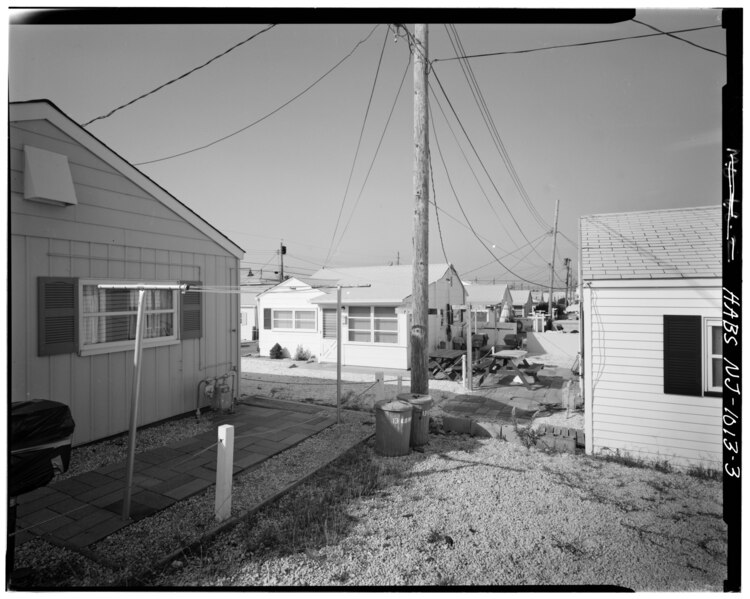
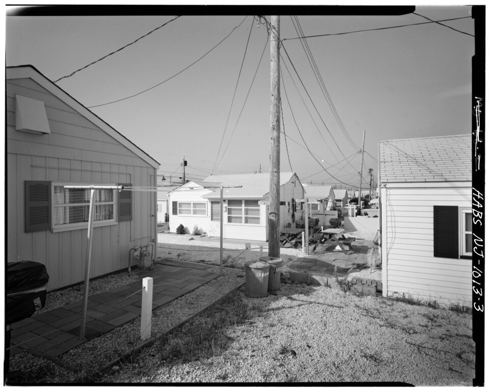
[edit]| - Barnegat Peninsula Communities, Along State Route 35 on Barnegat Penninsula, south of Point Pleasant, Seaside Heights, Ocean County, NJ | ||||
|---|---|---|---|---|
| Photographer |
Related names:
|
|||
| Title |
- Barnegat Peninsula Communities, Along State Route 35 on Barnegat Penninsula, south of Point Pleasant, Seaside Heights, Ocean County, NJ |
|||
| Depicted place | New Jersey; Ocean County; Seaside Heights | |||
| Date | Documentation compiled after 1933 | |||
| Dimensions | 4 x 5 in. | |||
| Current location |
Library of Congress Prints and Photographs Division Washington, D.C. 20540 USA http://hdl.loc.gov/loc.pnp/pp.print |
|||
| Accession number |
HABS NJ,15-SEHG,2-3 |
|||
| Credit line |
|
|||
| Notes |
|
|||
| Source | https://www.loc.gov/pictures/item/nj1299.photos.038155p | |||
| Permission (Reusing this file) |
|
|||

| Object location | | View this and other nearby images on: OpenStreetMap |
|---|
File history
Click on a date/time to view the file as it appeared at that time.
| Date/Time | Thumbnail | Dimensions | User | Comment | |
|---|---|---|---|---|---|
| current | 18:53, 28 July 2014 |  | 5,000 × 3,995 (19.05 MB) | Fæ (talk | contribs) | GWToolset: Creating mediafile for Fæ. HABS 24 July 2014 (2301:2600) |
You cannot overwrite this file.
File usage on Commons
The following 2 pages use this file:
- File:- Barnegat Peninsula Communities, Along State Route 35 on Barnegat Penninsula, south of Point Pleasant, Seaside Heights, Ocean County, NJ HABS NJ,15-SEHG,2-3.tif (file redirect)
- File:Barnegat Peninsula Communities, Along State Route 35 on Barnegat Penninsula, south of Point Pleasant, Seaside Heights, Ocean County, NJ HABS NJ,15-SEHG,2-3.tif