File:Baku on Jenkinson map.jpg
Jump to navigation
Jump to search
Size of this preview: 800 × 487 pixels. Other resolutions: 320 × 195 pixels | 640 × 390 pixels | 1,172 × 714 pixels.
Original file (1,172 × 714 pixels, file size: 193 KB, MIME type: image/jpeg)
Captions
Captions
Add a one-line explanation of what this file represents
| Description |
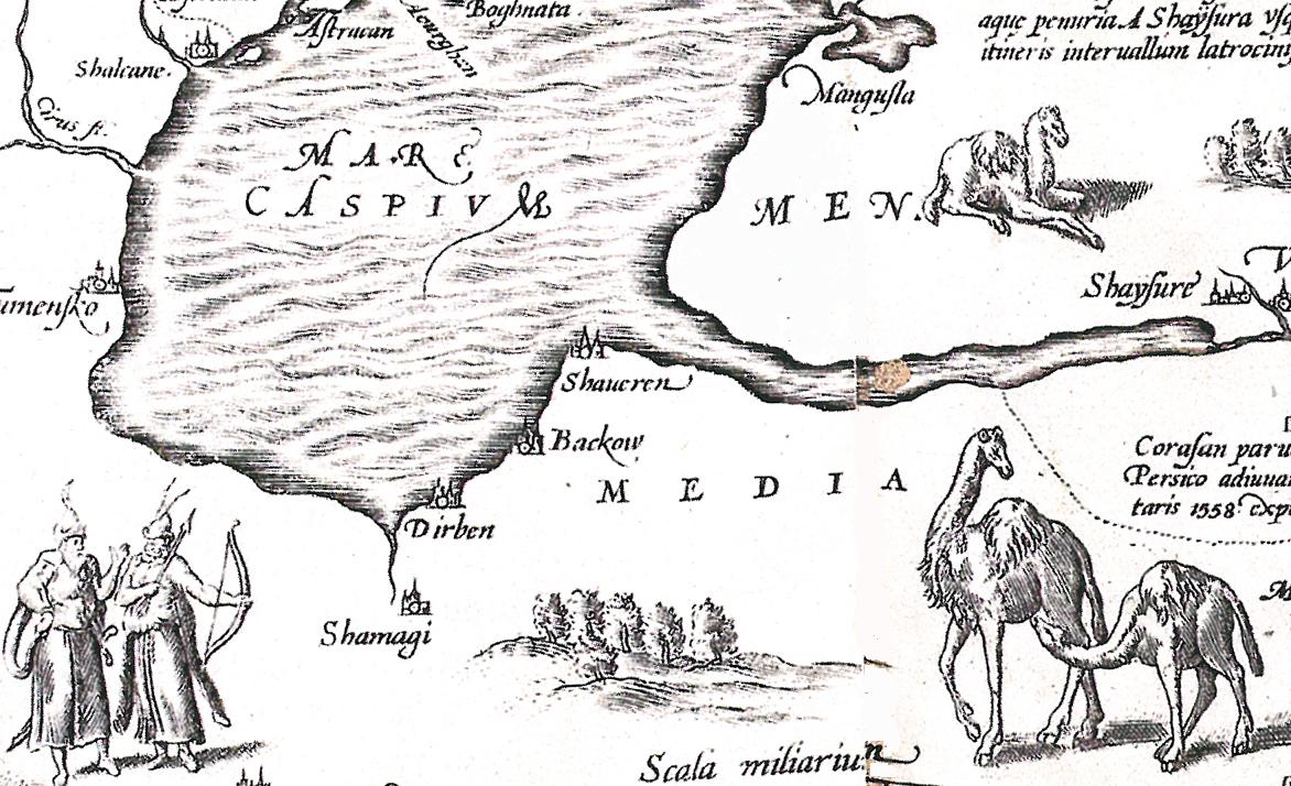
Русский: Россия Московия Тартария. Англо-голландская карта 1562 года (Лондон) с исправлениями 1598 года (Антверпен). Побережье Каспийского моря с указанием Дербента (Dirben), Шемахи (Shemagi) и Баку (Bakhow) |
| Date | and 1598 |
| Source | Атлас "Украина на старинных картах", своё сканирование |
| Author | Антоний Дженкинсон |
| Other versions | see also ruwiki |
|
This work is in the public domain in its country of origin and other countries and areas where the copyright term is the author's life plus 70 years or fewer. | |
| This file has been identified as being free of known restrictions under copyright law, including all related and neighboring rights. | |
File history
Click on a date/time to view the file as it appeared at that time.
| Date/Time | Thumbnail | Dimensions | User | Comment | |
|---|---|---|---|---|---|
| current | 07:35, 15 June 2010 | | 1,172 × 714 (193 KB) | Interfase (talk | contribs) | cleaning |
| 06:58, 15 June 2010 |  | 1,172 × 714 (737 KB) | Interfase (talk | contribs) | {{Information |Description={{ru|1=Россия Московия Тартария. Англо-голландская карта 1562 года (Лондон) с исправлениями 1598 года (Антверпен). Побережье Каспийс |
You cannot overwrite this file.
File usage on Commons
There are no pages that use this file.
File usage on other wikis
The following other wikis use this file:
- Usage on azb.wikipedia.org
- Usage on az.wikipedia.org
- Usage on ru.wikipedia.org
- Usage on tr.wikipedia.org