Category:Old maps of the Caspian Sea
Jump to navigation
Jump to search
Subcategories
This category has the following 8 subcategories, out of 8 total.
P
- Ptolemy's 7th Asian Map (41 F)
Media in category "Old maps of the Caspian Sea"
The following 49 files are in this category, out of 49 total.
-
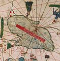 1450 ¿ Carta Catalana jpeg copy.I.jpg 574 × 585; 109 KB
-
 1450 ¿ Carta Catalana jpeg copy.G.jpg 1,205 × 734; 278 KB
-
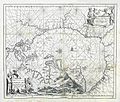
 Maris Caspii (Reiner Ottens).jpg 1,583 × 1,355; 642 KB
-
 A Map of the Earliest Known Civilizations.jpg 2,050 × 3,042; 652 KB
-
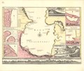
 A New Card of the Caspian Sea.jpg 1,482 × 1,258; 536 KB
-
 Asterabad from Asie 1 to 1,000,000. flle 40N-54E.jpg 8,968 × 7,096; 8.3 MB
-
 AtlasMiller BNF desplegable Mediterraneo.jpg 18,767 × 9,834; 35.89 MB
-
 AtlasMiller BNF Euromed MarCaspio.jpg 836 × 734; 144 KB
-
 Baku on Gerritsz map.jpg 531 × 441; 52 KB
-
 Baku on Jenkinson map.jpg 1,172 × 714; 193 KB
-
 Basra bahrefars.jpg 1,340 × 1,140; 887 KB
-
 Caspian sea Ibn Hawqal.JPG 1,435 × 1,846; 404 KB
-
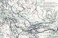 Central Asian trade routes V2.jpg 1,280 × 836; 398 KB
-
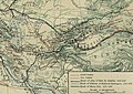 Central Asian trade routes.jpg 954 × 674; 206 KB
-

-
 Iranian Armenia (Safavid Empire).png 703 × 513; 684 KB
-
 Iranian Armenia (Safavid Empire; version 2).png 793 × 513; 758 KB
-
 Kaart van de Kaspische zee, objectnr A 16237.jpg 7,220 × 5,912; 34.34 MB
-
 Kadusier.jpg 1,193 × 1,256; 300 KB
-
 Kunyu Wanguo Quantu (坤輿萬國全圖).Caspian Sea.jpg 989 × 667; 287 KB
-
 L'Empire des Turcs (Jollain).jpg 652 × 511; 138 KB
-
 Le Tour du monde-01-p117.jpg 814 × 772; 158 KB
-
 Map - Special Collections University of Amsterdam - OTM- HB-KZL 31-08-26.tif 7,522 × 6,352; 136.7 MB
-
 Map - Special Collections University of Amsterdam - OTM- HB-KZL 31-08-29.tif 7,530 × 6,377; 137.38 MB
-
 Map - Special Collections University of Amsterdam - OTM- HB-KZL 31-08-30.tif 5,116 × 6,720; 98.36 MB
-
 Map - Special Collections University of Amsterdam - OTM- HB-KZL 31-08-35.tif 3,106 × 4,234; 37.63 MB
-
 Map - Special Collections University of Amsterdam - OTM- HB-KZL 33.11.20.tif 7,456 × 6,488; 138.4 MB
-
 Map - Special Collections University of Amsterdam - OTM- HB-KZL 33.11.27.tif 7,616 × 6,387; 139.17 MB
-
 Map of Caspian Sea (Ibn Hawqal, Surat al-Ard).jpg 1,481 × 2,025; 1.2 MB
-
 Map of Caspian Sea (Ibn Hawqal, Surat al-Ard, p. 328).jpg 2,092 × 3,098; 1.28 MB
-
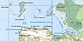
 North-East part of Caspian Sea (IMW NL39) (cropped to Buzachi peninsula).jpg 2,600 × 1,300; 1.81 MB
-
-

-
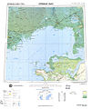 North-East part of Caspian Sea (IMW NL39).jpg 4,364 × 5,172; 5.24 MB
-
 Northwestern domains of the Safavid Empire (cropped).png 461 × 502; 468 KB
-
 Northwestern part of the Safavid Empire (cropped, more zoomed).png 477 × 659; 631 KB
-
 Northwestern part of the Safavid Empire (cropped, v2).png 550 × 665; 722 KB
-
 Northwestern provinces and domains of the Safavid Empire (cropped).png 479 × 700; 675 KB
-
 Ordubad on the map Carte des Pays voisins de la Mer Caspiene.jpg 822 × 636; 164 KB
-
 Ortelius.Russia.jpg 1,600 × 1,267; 401 KB
-
 PCSIT (cropped).png 408 × 649; 543 KB
-
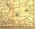
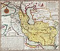
 Persia, Caspian Sea, part of Independent Tartary (cropped).png 539 × 699; 744 KB
-
 Persia, Caspian Sea, part of Independent Tartary (Makeran).png 780 × 513; 659 KB
-
 Persia, Caspian Sea, part of Independent Tartary.png 2,163 × 1,991; 6.98 MB
-
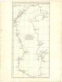
 Piri Reis - Map of the Caspian Sea - Walters W658374A - Full Page.jpg 1,216 × 1,799; 2.69 MB
-
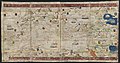
 Scithia intra imavm (MAPS 77).jpg 7,746 × 5,179; 6.78 MB
-
 USSR map NK 39-7 Kuba.jpg 5,738 × 4,743; 9.35 MB
-
-
 صورة الأرض - ابن حوقل A Page 419.JPG 1,435 × 1,965; 398 KB


.jpg)


.png)
.png)


.Caspian_Sea.jpg)
.jpg)

.jpg)
.jpg)
_(cropped_to_Buzachi_peninsula).jpg)
_(cropped_to_Mangyshlak_Bay_and_Tyuleny_Archipelago).jpg)
_(cropped_to_Tyuleny_Archipelago).jpg)
.jpg)
.png)
.png)
.png)
.png)


.png)
.png)
.png)


.jpg)


