File:BV043423239.tif
Jump to navigation
Jump to search

Size of this JPG preview of this TIF file: 800 × 549 pixels. Other resolutions: 320 × 219 pixels | 640 × 439 pixels | 1,024 × 702 pixels | 1,280 × 878 pixels | 2,560 × 1,756 pixels | 7,924 × 5,434 pixels.
Original file (7,924 × 5,434 pixels, file size: 78.05 MB, MIME type: image/tiff)
Captions
Captions
Add a one-line explanation of what this file represents
Summary
[edit]| Description |
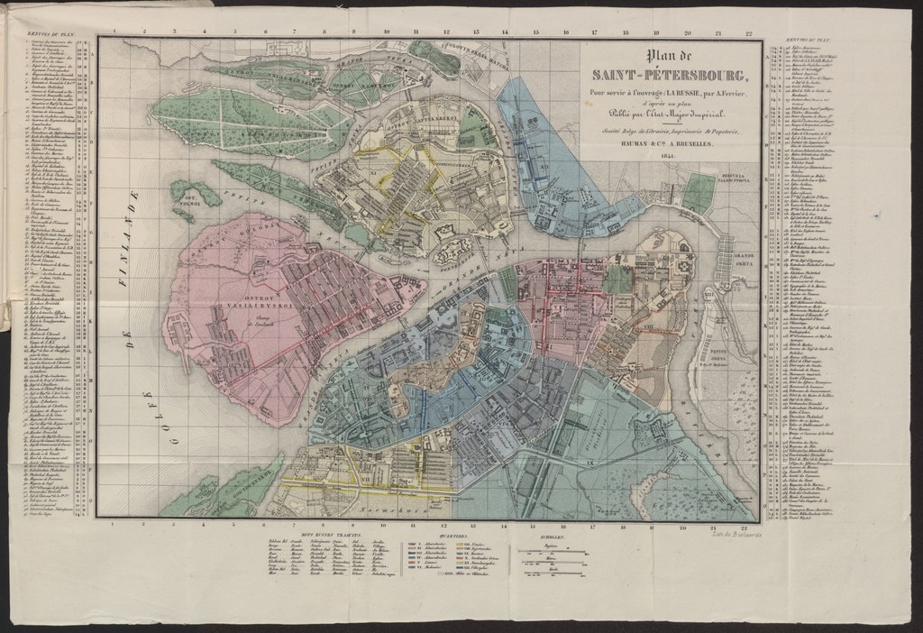
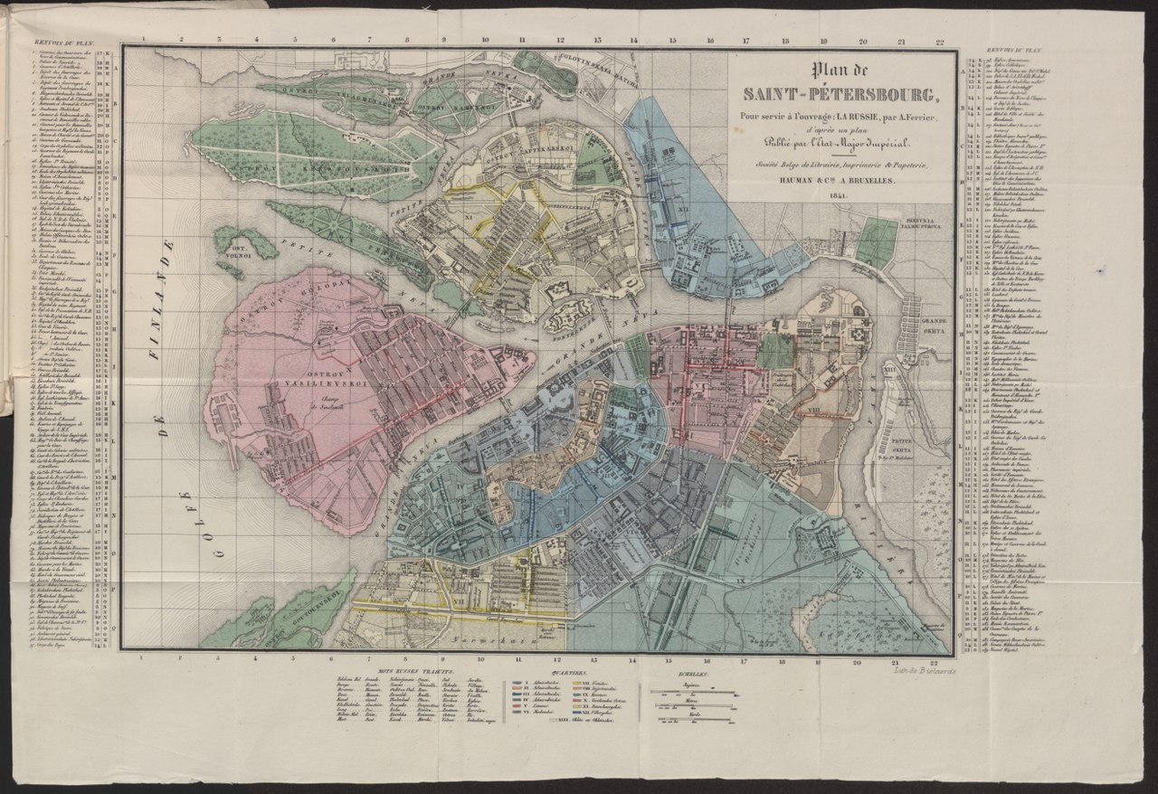
Français : Plan de Saint-Pétersbourg (Kartenbeschreibung, Details) |
| Date | |
| Source |
La Russie. Karte aus dem Bestand des Projekts GeoPortOst am Leibniz-Instituts für Ost- und Südosteuropaforschung English: Map from the collection GeoPortOst at the Leibniz-Institute for East and Southeast European Studies |
| Author | Ferrier, Alexandre |
File digitized within the project GeoPortOst (http://geoportost.ios-regensburg.de/) by the University Library Regensburg 2016.
Licensing
[edit]|
This work is in the public domain in its country of origin and other countries and areas where the copyright term is the author's life plus 70 years or fewer. | |
| This file has been identified as being free of known restrictions under copyright law, including all related and neighboring rights. | |
File history
Click on a date/time to view the file as it appeared at that time.
| Date/Time | Thumbnail | Dimensions | User | Comment | |
|---|---|---|---|---|---|
| current | 20:45, 2 December 2017 |  | 7,924 × 5,434 (78.05 MB) | H.bauer26 (talk | contribs) | Transferred from http://geoportost.ios-regensburg.de/image/BV043423239.tif |
You cannot overwrite this file.
File usage on Commons
There are no pages that use this file.
File usage on other wikis
The following other wikis use this file:
- Usage on ru.wikipedia.org