File:Azerbaijani khanates map.png
Jump to navigation
Jump to search

Size of this preview: 800 × 525 pixels. Other resolutions: 320 × 210 pixels | 640 × 420 pixels | 807 × 530 pixels.
Original file (807 × 530 pixels, file size: 187 KB, MIME type: image/png)
Captions
Captions
Add a one-line explanation of what this file represents
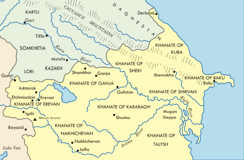
| Description | Map of Azerbaijani khanates in the 19th century | ||
| Source | File:Transcaucasia XIX 01.png | ||
| Author | Emin Bashirov | ||
| Permission (Reusing this file) |
I, the copyright holder of this work, hereby publish it under the following licenses: This file is licensed under the Creative Commons Attribution-Share Alike 3.0 Unported license.
You may select the license of your choice. |
||
| Other versions |
|

| This is a retouched picture, which means that it has been digitally altered from its original version. Modifications: cropped to emphasize Azerbaijan, label parts removed. Modifications made by Brandmeister.
|
File history
Click on a date/time to view the file as it appeared at that time.
| Date/Time | Thumbnail | Dimensions | User | Comment | |
|---|---|---|---|---|---|
| current | 02:45, 8 December 2010 | | 807 × 530 (187 KB) | Brandmeister~commonswiki (talk | contribs) | {{Information |Description= |Source=File:Transcaucasia XIX 01.png |Date= |Author= |Permission={{self|cc-by-sa-3.0|GFDL}} |other_versions=File:Transcaucasia XIX 01.png }} {{RetouchedPicture|cropped to emphasize Azerbaijan, label parts removed|edi |
You cannot overwrite this file.
File usage on Commons
There are no pages that use this file.
File usage on other wikis
The following other wikis use this file:
- Usage on de.wikipedia.org