Category:Maps of Khanates of the South Caucasus
Jump to navigation
Jump to search
Wikimedia category | |||||
| Upload media | |||||
| Instance of | |||||
|---|---|---|---|---|---|
| Category combines topics | |||||
| |||||
Subcategories
This category has only the following subcategory.
Media in category "Maps of Khanates of the South Caucasus"
The following 26 files are in this category, out of 26 total.
-
 Карта театра войны с персиянами 1827.jpg 8,520 × 6,773; 14.72 MB
-
 Administrative Division of the Erivan Khanate in 1828.png 5,000 × 3,000; 1.32 MB
-
 Administrative Division of the Shirvan Khanate in 1820.png 4,000 × 4,000; 1.22 MB
-
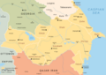
 Azerbaijan Khanates 01.png 1,200 × 1,024; 267 KB
-
 Azerbaijani Khanates 18th-19th century.png 1,450 × 2,020; 1.29 MB
-
 Azerbaijani khanates in the 18th-19th centuries.png 1,093 × 1,466; 541 KB
-
 Azerbaijani khanates map.png 807 × 530; 187 KB
-
 Azerbaijani khanates.png 7,509 × 7,711; 825 KB
-
 Carte des Khanats du Caucase-19emeS (cropped).png 974 × 1,123; 93 KB
-
 Carte des Khanats du Caucase-19emeS.png 3,118 × 2,268; 426 KB
-
 Ethnic Map of the Erivan Khanate (1828).png 5,000 × 3,000; 2.37 MB
-
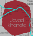 Javad khanate (eng).png 800 × 881; 228 KB
-
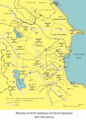
 Khanates of the Caucasus.png 6,953 × 4,913; 1.51 MB
-
 Map of Caucasus 1801.jpg 4,936 × 4,049; 4.07 MB
-
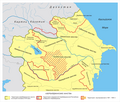
 Map of historical carpet-weaving zones of Azerbaijan.png 1,679 × 1,966; 1.3 MB
-
 Map of the Erivan Khanate in 1820 (rus).png 3,748 × 2,189; 1.12 MB
-
 Map of the Erivan Khanate in 1820.svg 3,748 × 2,188; 2.11 MB
-
 Map of the Karabakh Khanate 2.svg 1,711 × 1,384; 1.28 MB
-
 Map of the Karabakh Khanate.svg 1,711 × 1,384; 2.31 MB
-
 Political map of the Caucasus and its surroundings between 1795–1801.svg 4,973 × 2,735; 8.94 MB
-
 Political map of the eastern part of the Southern Caucasus between 1795–1801.svg 2,669 × 1,966; 8.89 MB
-
 Salyan sultanate (eng).png 800 × 881; 144 KB
-
 Tabriz Khanate (eng).png 800 × 881; 367 KB
-
 TALIŞ XANLIĞI - xəritə 1829cu il A.Ağayev R.Xansuvar (orijinal).png 2,224 × 2,674; 728 KB
-
 The South Caucasus in the last quarter of the 18th century.svg 942 × 737; 2.45 MB
-
 Transcaucasia XIX 01.png 1,130 × 710; 248 KB


.png)

.png)
.png)


.png)


.png)
.png)
.png)
