File:Atlas Van der Hagen-KW1049B11 065-FLANDRIAE COMITATUS Accuratissima Descriptio, edita.jpeg
Jump to navigation
Jump to search

Size of this preview: 723 × 600 pixels. Other resolutions: 289 × 240 pixels | 579 × 480 pixels | 926 × 768 pixels | 1,234 × 1,024 pixels | 2,469 × 2,048 pixels | 5,500 × 4,563 pixels.
Original file (5,500 × 4,563 pixels, file size: 5.22 MB, MIME type: image/jpeg)
Captions
Captions
Add a one-line explanation of what this file represents
Summary
[edit]| Dirk Jansz van Santen: Atlas van Dirk van der Hagen (volledig, collectie KB)
|
|||||||||||||||||||||||||||
|---|---|---|---|---|---|---|---|---|---|---|---|---|---|---|---|---|---|---|---|---|---|---|---|---|---|---|---|
| Artist |
|
 | |||||||||||||||||||||||||
| Author |
Author and publisher: Nicolaes Visscher II |
||||||||||||||||||||||||||
| Title |
FLANDRIAE COMITATUS Accuratissima Descriptio, edita |
||||||||||||||||||||||||||
| Object type | map | ||||||||||||||||||||||||||
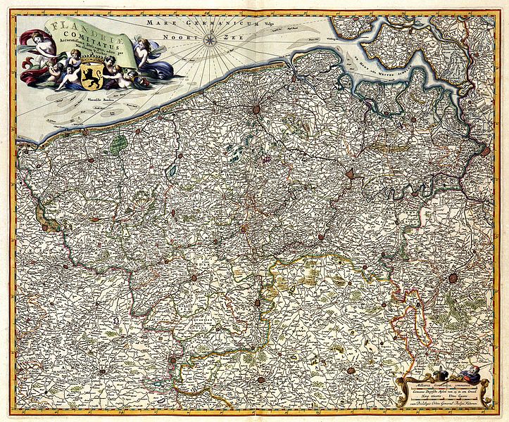
| Description |
Nederlands: Deze kaart van het graafschap Vlaanderen werd gepubliceerd door Nicolaes Visscher I (1618-1679). Als bron greep Visscher waarschijnlijk terug op kaartmateriaal dat in de eerste helft van de 17de eeuw door Willem Jansz. Blaeu (1571-1638) en Joan Blaeu (1598-1673) was uitgegeven.
English: This map of the county Flanders was published by Nicolaes Visscher I (1618-1679). For this map, Visscher may have used maps by Willem Jansz. Blaeu (1571-1638) and Joan Blaeu (1598-1673) from the first half of the 17th century. |
||||||||||||||||||||||||||
| Language |
Dutch |
||||||||||||||||||||||||||
| Date |
Nederlands: voor 1680
English: before 1680 |
||||||||||||||||||||||||||
| Publication date |
circa |
||||||||||||||||||||||||||
| Medium |
Nederlands: kopergravure
English: copper engraving print |
||||||||||||||||||||||||||
| Dimensions | 46 x 56 cm | ||||||||||||||||||||||||||
| Collection |
|
||||||||||||||||||||||||||
| Accession number |
Description of the Atlas Van der Hagen in the catalogue of the KB: http://opc4.kb.nl/DB=1/TTL=1/LNG=EN/PPN?PPN=353012750 |
||||||||||||||||||||||||||
| Place of creation | Amsterdam | ||||||||||||||||||||||||||
| Notes | KW1049B11_065 - Volume 1 | ||||||||||||||||||||||||||
| Related persons | Joan Blaeu - Willem Jansz. Blaeu - Nicolaes Visscher II | ||||||||||||||||||||||||||
| Depicted locations | Belgium - Flanders | ||||||||||||||||||||||||||
| References | |||||||||||||||||||||||||||
| Source/Photographer |
Source page at the Geheugen van Nederland / Memory of the Netherlands website.
|
||||||||||||||||||||||||||
| Permission (Reusing this file) |
|
||||||||||||||||||||||||||

File history
Click on a date/time to view the file as it appeared at that time.
| Date/Time | Thumbnail | Dimensions | User | Comment | |
|---|---|---|---|---|---|
| current | 14:28, 18 July 2015 | | 5,500 × 4,563 (5.22 MB) | OlafJanssen (talk | contribs) | GWToolset: Creating mediafile for OlafJanssen. |
You cannot overwrite this file.
File usage on Commons
The following 3 pages use this file: