File:Atlanta Guard Station icehouse - Boise NF, ID HABS ID,20-ATLA.V,2A--1.tiff
Jump to navigation
Jump to search

Size of this JPG preview of this TIF file: 476 × 599 pixels. Other resolutions: 191 × 240 pixels | 381 × 480 pixels | 610 × 768 pixels | 814 × 1,024 pixels | 1,628 × 2,048 pixels | 3,663 × 4,608 pixels.
Original file (3,663 × 4,608 pixels, file size: 16.1 MB, MIME type: image/tiff)
Captions
Captions
Add a one-line explanation of what this file represents
Summary
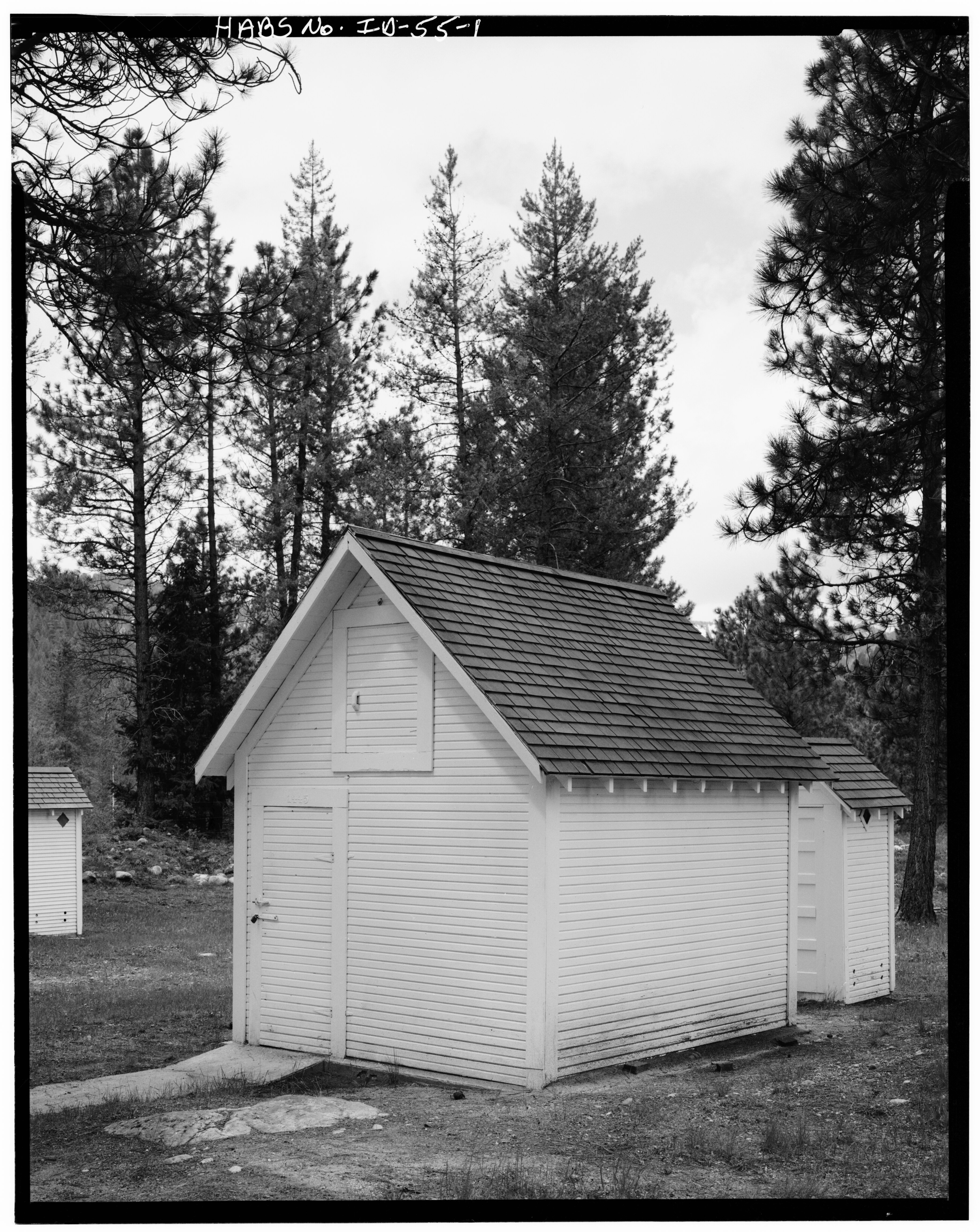
[edit]| Icehouse, Atlanta Guard Station, Atlanta, Elmore County, ID(This image was originally uploaded titled as a bunkhouse at the Dutch Creek Work Station. While the title and categorization have been corrected, the remaining information may be incorrect.) | ||||
|---|---|---|---|---|
| Title |
Icehouse, Atlanta Guard Station, Atlanta, Elmore County, ID (This image was originally uploaded titled as a bunkhouse at the Dutch Creek Work Station. While the title and categorization have been corrected, the remaining information may be incorrect.) |
|||
| Depicted place | Idaho; Elmore County; Atlanta | |||
| Date | Documentation compiled after 1933 | |||
| Dimensions | 4 x 5 in. | |||
| Current location |
Library of Congress Prints and Photographs Division Washington, D.C. 20540 USA http://hdl.loc.gov/loc.pnp/pp.print |
|||
| Accession number |
HABS ID,20-ATLA.V,2A-1 |
|||
| Credit line |
|
|||
| Notes |
|
|||
| Source | https://www.loc.gov/pictures/item/id0077.photos.059155p | |||
| Permission (Reusing this file) |
|
|||

| Object location | | View this and other nearby images on: OpenStreetMap |
|---|
File history
Click on a date/time to view the file as it appeared at that time.
| Date/Time | Thumbnail | Dimensions | User | Comment | |
|---|---|---|---|---|---|
| current | 21:58, 14 July 2014 |  | 3,663 × 4,608 (16.1 MB) | Fæ (talk | contribs) | GWToolset: Creating mediafile for Fæ. HABS 11 July 2014 (1001:1200) |
You cannot overwrite this file.
File usage on Commons
The following 3 pages use this file:
File usage on other wikis
The following other wikis use this file:
- Usage on en.wikipedia.org
- Usage on www.wikidata.org