File:Arcuate fractures on the southeastern edge of Elysium Planitia.png
Jump to navigation
Jump to search
Size of this preview: 400 × 600 pixels. Other resolutions: 160 × 240 pixels | 320 × 480 pixels | 512 × 768 pixels | 683 × 1,024 pixels | 1,365 × 2,048 pixels | 3,214 × 4,820 pixels.
Original file (3,214 × 4,820 pixels, file size: 10.64 MB, MIME type: image/png)
Captions
Captions
Add a one-line explanation of what this file represents
Summary
[edit]
| Description |
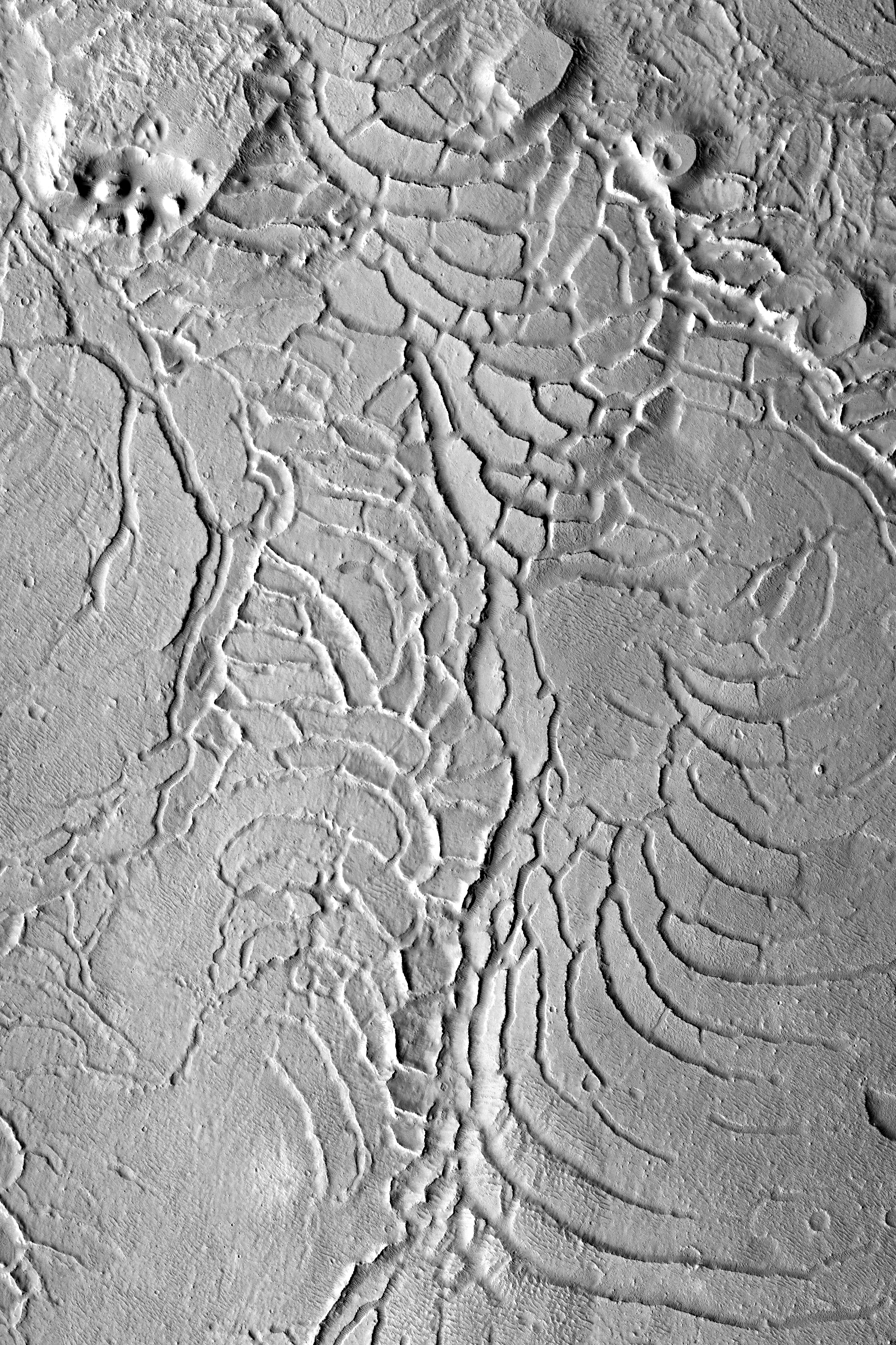
Українська: Поверхня Марса на південно-східному краю рівнини Елізій, на схід від пагорбів Аверн (Avernus Colles). Координати центра — 0,39°S, 175,37°E. Розмір зображення — близько 17×26 км, північ угорі. Знімок камери Context Camera (CTX) на супутнику Mars Reconnaissance Orbiter, зроблений 17 грудня 2010. Висота Сонця — 35,0°; висота супутника — 267 км. Контраст збільшено.
English: Surface of Mars on the southeastern edge of Elysium Planitia, to the east from Avernus Colles. Centered at 0.39°S, 175.37°E. Size of the image is approximately 17×26 km, north is up. Photo by Mars Reconnaissance Orbiter's Context Camera (CTX), taken 17 December 2010. Sun elevation is 35.0°; spacecraft altitude is 267 km. Contrast is increased. |
| Date | |
| Source | Part of Mars Reconnaissance Orbiter's Context Camera image G06_020580_1792_XN_00S184W with increased contrast |
| Author | NASA |
| Other versions |
 |
Licensing
[edit]
| This file is in the public domain in the United States because it was solely created by NASA. NASA copyright policy states that "NASA material is not protected by copyright unless noted". (See Template:PD-USGov, NASA copyright policy page or JPL Image Use Policy.) | ||
 |
Warnings:
|
File history
Click on a date/time to view the file as it appeared at that time.
| Date/Time | Thumbnail | Dimensions | User | Comment | |
|---|---|---|---|---|---|
| current | 08:46, 3 January 2019 | | 3,214 × 4,820 (10.64 MB) | Sneeuwschaap (talk | contribs) | User created page with UploadWizard |
You cannot overwrite this file.
File usage on Commons
There are no pages that use this file.
File usage on other wikis
The following other wikis use this file:
- Usage on ru.wikipedia.org
- Usage on uk.wikipedia.org