File:AradCountyJosephinischeLandesaufnahme.jpg
Jump to navigation
Jump to search

Size of this preview: 800 × 528 pixels. Other resolutions: 320 × 211 pixels | 640 × 423 pixels | 1,024 × 676 pixels.
Original file (1,024 × 676 pixels, file size: 904 KB, MIME type: image/jpeg)
Captions
Captions
Add a one-line explanation of what this file represents
Summary
[edit]| Description |
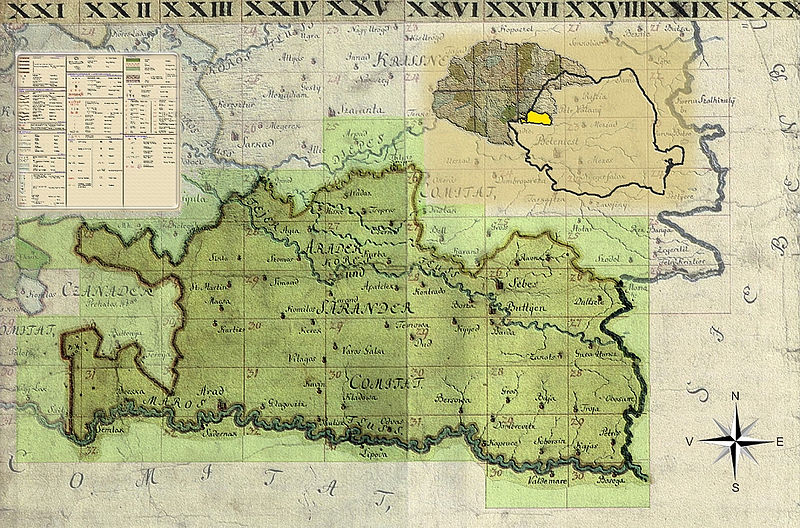
Română: Harta iozefina a Aradului folosita ca background la formatul de lansare a planselor, 1782-1785 |
||
| Date | |||
| Source | Own work | ||
| Author | Asybaris01 | ||
| Permission (Reusing this file) |
I, the copyright holder of this work, hereby publish it under the following licenses: This file is licensed under the Creative Commons Attribution-Share Alike 3.0 Unported license.
You may select the license of your choice. |

Clickable Map of the Arad County
[edit]
File history
Click on a date/time to view the file as it appeared at that time.
| Date/Time | Thumbnail | Dimensions | User | Comment | |
|---|---|---|---|---|---|
| current | 05:43, 16 April 2010 | | 1,024 × 676 (904 KB) | Asybaris01 (talk | contribs) | background colors Category:Josephinische Landaufnahme |
| 18:17, 15 April 2010 |  | 1,024 × 676 (891 KB) | Asybaris01 (talk | contribs) | Reverted to version as of 16:41, 15 April 2010 | |
| 16:46, 15 April 2010 |  | 1,024 × 676 (648 KB) | Asybaris01 (talk | contribs) | Reverted to version as of 19:50, 12 March 2010 | |
| 16:41, 15 April 2010 |  | 1,024 × 676 (891 KB) | Asybaris01 (talk | contribs) | background colors Category:Josephinische Landaufnahme | |
| 19:50, 12 March 2010 |  | 1,024 × 676 (648 KB) | Asybaris01 (talk | contribs) | {{Information |Description={{ro|1=Harta iozefina a Aradului, 1782-1785}} |Source={{own}} |Author=Asybaris01 |Date=12/mar/2010 |Permission= |other_versions= }} Category:Josephinische Landaufnahme |
You cannot overwrite this file.
File usage on Commons
The following 54 pages use this file:
- Josephinische Landaufnahme
- File:AradCountyJosephinischeLandesaufnahme.jpg
- File:Arad Josephinische Landesaufnahme pg21-27.jpg
- File:Arad Josephinische Landesaufnahme pg21-29.jpg
- File:Arad Josephinische Landesaufnahme pg21-30.jpg
- File:Arad Josephinische Landesaufnahme pg21-31.jpg
- File:Arad Josephinische Landesaufnahme pg22-28.jpg
- File:Arad Josephinische Landesaufnahme pg22-29.jpg
- File:Arad Josephinische Landesaufnahme pg22-30.jpg
- File:Arad Josephinische Landesaufnahme pg22-31.jpg
- File:Arad Josephinische Landesaufnahme pg22-32.jpg
- File:Arad Josephinische Landesaufnahme pg23-27.jpg
- File:Arad Josephinische Landesaufnahme pg23-28.jpg
- File:Arad Josephinische Landesaufnahme pg23-29.jpg
- File:Arad Josephinische Landesaufnahme pg23-30.jpg
- File:Arad Josephinische Landesaufnahme pg23-31.jpg
- File:Arad Josephinische Landesaufnahme pg23-32.jpg
- File:Arad Josephinische Landesaufnahme pg24-27.jpg
- File:Arad Josephinische Landesaufnahme pg24-28.jpg
- File:Arad Josephinische Landesaufnahme pg24-29.jpg
- File:Arad Josephinische Landesaufnahme pg24-30.jpg
- File:Arad Josephinische Landesaufnahme pg24-31.jpg
- File:Arad Josephinische Landesaufnahme pg24-32.jpg
- File:Arad Josephinische Landesaufnahme pg25-25.jpg
- File:Arad Josephinische Landesaufnahme pg25-26.jpg
- File:Arad Josephinische Landesaufnahme pg25-27.jpg
- File:Arad Josephinische Landesaufnahme pg25-28.jpg
- File:Arad Josephinische Landesaufnahme pg25-29.jpg
- File:Arad Josephinische Landesaufnahme pg25-30.jpg
- File:Arad Josephinische Landesaufnahme pg25-31.jpg
- File:Arad Josephinische Landesaufnahme pg26-25.jpg
- File:Arad Josephinische Landesaufnahme pg26-26.jpg
- File:Arad Josephinische Landesaufnahme pg26-27.jpg
- File:Arad Josephinische Landesaufnahme pg26-28.jpg
- File:Arad Josephinische Landesaufnahme pg26-29.jpg
- File:Arad Josephinische Landesaufnahme pg26-30.jpg
- File:Arad Josephinische Landesaufnahme pg26-31.jpg
- File:Arad Josephinische Landesaufnahme pg27-25.jpg
- File:Arad Josephinische Landesaufnahme pg27-26.jpg
- File:Arad Josephinische Landesaufnahme pg27-27.jpg
- File:Arad Josephinische Landesaufnahme pg27-28.jpg
- File:Arad Josephinische Landesaufnahme pg27-29.jpg
- File:Arad Josephinische Landesaufnahme pg27-30.jpg
- File:Arad Josephinische Landesaufnahme pg28-25.jpg
- File:Arad Josephinische Landesaufnahme pg28-26.jpg
- File:Arad Josephinische Landesaufnahme pg28-27.jpg
- File:Arad Josephinische Landesaufnahme pg28-28.jpg
- File:Arad Josephinische Landesaufnahme pg28-29.jpg
- File:Arad Josephinische Landesaufnahme pg28-30.jpg
- File:Josephinische Landaufnahme, 1763-87.png
- File:RO HU DE Banat Josephinische Landaufnahme Legend.jpg
- Template:AradCountyJosephinischeLandesaufnahme
- Category:First Military Mapping Survey of Austrian Empire
- Category:Josephinische Landaufnahme
File usage on other wikis
The following other wikis use this file:
- Usage on en.wikipedia.org
- Usage on hu.wikipedia.org
- Usage on ro.wikipedia.org