File:Antarktis falschfarben viaNASAsatellite.jpg
Jump to navigation
Jump to search

Size of this preview: 600 × 600 pixels. Other resolutions: 240 × 240 pixels | 480 × 480 pixels | 768 × 768 pixels | 1,024 × 1,024 pixels | 2,048 × 2,048 pixels | 6,400 × 6,400 pixels.
Original file (6,400 × 6,400 pixels, file size: 3.07 MB, MIME type: image/jpeg)
Captions
Captions
Add a one-line explanation of what this file represents
| Description |
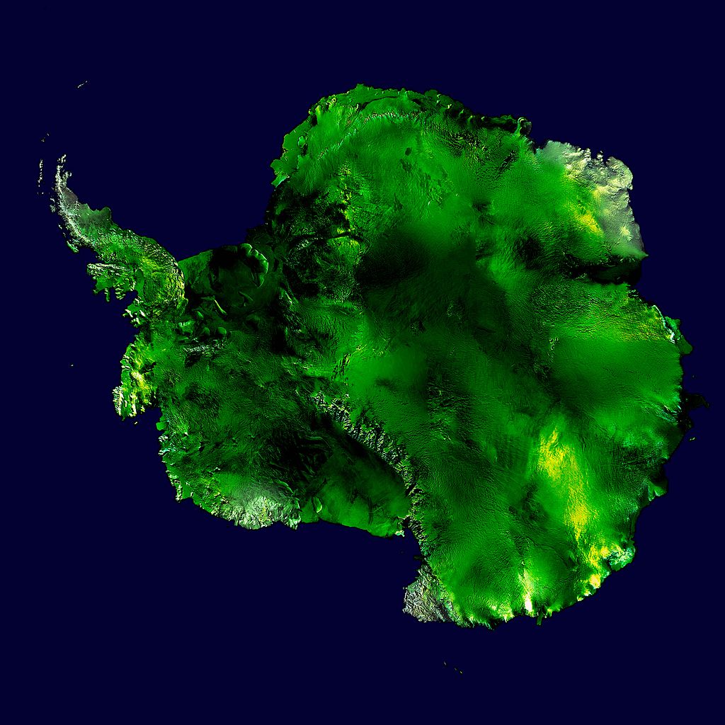
English: Antarctica. False colour coding of an orthographic projection of NASA's Blue Marble data set (1 km resolution global satellite composite). The original image shows a mainly white landscape, whereas this version is depicting a continent with rich green colours, suggesting a vivid biodiversity. It can be considered as a future rendering of antarctica showing a drastic impact of global warming. |
||
| Date | 2006-10-05, modified 2014-10-05 | ||
| Source | derivative from Dave Pape's version, using Blue Marble data from http://visibleearth.nasa.gov/view_rec.php?id=2433 | ||
| Author | Maximilian Schönherr | ||
| Permission (Reusing this file) |
|
||
| Other versions | Derivative works of this file: Antarctic Peninsula satellite image.jpgImage:Antarctica satellite globe.jpg |
Assessment
[edit]
| Annotations | This image is annotated: View the annotations at Commons |
File history
Click on a date/time to view the file as it appeared at that time.
| Date/Time | Thumbnail | Dimensions | User | Comment | |
|---|---|---|---|---|---|
| current | 11:40, 5 October 2014 | | 6,400 × 6,400 (3.07 MB) | Maximilian Schönherr (talk | contribs) | {{Information |Description= {{en|Antarctica. False colour coding of an orthographic projection of NASA's Blue Marble data set (1 km resolution global satellite composite). The original image shows a mainly white landscape, whereas th... |
You cannot overwrite this file.
File usage on Commons
The following page uses this file: