Category:Blue Marble 2002 images
Jump to navigation
Jump to search
See also categories: The Blue Marble and Blue Marble Next Generation images.
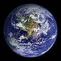
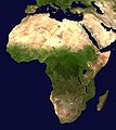
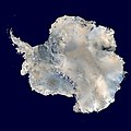
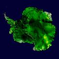
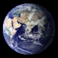
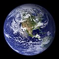
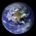
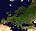
English: Images from NASA's Blue Marble 2002 series made with the MODIS instrument, named after the famous Blue Marble photograph taken during the Apollo 17 mission in 1972.[1] Observations in this release were taken by MODIS between June and September 2001.
Media in category "Blue Marble 2002 images"
The following 142 files are in this category, out of 142 total.
-
1024px Earth lighting equinox CY.svg 1,024 × 672; 277 KB
-
1024px-Antichthon.jpg 2,048 × 2,048; 729 KB
-
Africa satellite orthographic.jpg 1,624 × 1,824; 535 KB
-
Africa topic image Satellite image.jpg 4,868 × 3,245; 6.71 MB
-
Aitoff-projection.jpg 2,048 × 1,025; 757 KB
-
Antarctic Peninsula satellite image.jpg 1,509 × 1,846; 706 KB
-
Antarctica 6400px from Blue Marble.jpg 6,400 × 6,400; 3.31 MB
-
Antarctica satellite globe.jpg 800 × 678; 95 KB
-
Antarktis falschfarben viaNASAsatellite.jpg 6,400 × 6,400; 3.07 MB
-
AntarktisUndAfrika.png 830 × 830; 305 KB
-
AntarktisUndAustralien.png 820 × 820; 328 KB
-
AntarktisUndSuedamerika.png 820 × 820; 328 KB
-
Asia satellite orthographic.jpg 1,887 × 1,962; 855 KB
-
Atlantic hurricane tracks.jpg 9,000 × 5,044; 35.69 MB
-
Australia and New Zealand topic image Satellite image.jpg 2,931 × 1,954; 1.78 MB
-
Azerbaijan topic image Satellite image.jpg 608 × 678; 426 KB
-
Azimuthal-equidistant.jpg 2,048 × 1,992; 984 KB
-
Blue Marble - 2002 (4392965590).jpg 2,048 × 2,048; 532 KB
-
Blue Marble 2002 (comparison).png 600 × 300; 170 KB
-
Blue Marble 2002 Azimuthal Highres.png 10,800 × 10,800; 74.54 MB
-
Blue Marble 2002 bg21600.png 21,600 × 10,800; 140.95 MB
-
Blue Marble 2002.jpg 43,200 × 21,600; 316.49 MB
-
Blue Marble 2002.png 43,200 × 21,600; 529.58 MB
-
Blue Marble Animation (4401845574).jpg 640 × 480; 106 KB
-
Blue Marble animation, 2002.webm 8.0 s, 1,280 × 720; 6.12 MB
-
Blue Marble rotating 1024x1024.ogv 12 s, 1,024 × 1,024; 3.27 MB
-
Blue Marble rotating.gif 320 × 240; 14.37 MB
-
Bluemarble banner WV HY.jpg 1,125 × 326; 114 KB
-
Bluemarble banner WV.jpg 1,125 × 326; 64 KB
-
BlueMarble-2001-2002.jpg 4,096 × 2,048; 1.22 MB
-
Bm taklamakan.jpg 1,900 × 950; 938 KB
-
Bonne-projection.jpg 2,048 × 1,944; 1.14 MB
-
Brahmaputra-verlaufsgebiet.jpg 1,280 × 836; 296 KB
-
Cassini-projection.jpg 1,027 × 2,048; 882 KB
-
Compare world low high res.png 655 × 267; 51 KB
-
Comparison of Earth and Moon size experiments 2.jpg 2,050 × 2,050; 602 KB
-
Craig-retroazimuthal.jpg 2,048 × 1,353; 942 KB
-
Distribution - Colias phicomone.png 590 × 450; 323 KB
-
Distribution - Colias werdandi.png 400 × 425; 193 KB
-
Earth cube map.png 2,048 × 1,536; 2.03 MB
-
Earth Eastern Hemisphere 2002.png 2,048 × 2,048; 4.23 MB
-
Earth Eastern Hemisphere.jpg 2,048 × 2,048; 524 KB
-
Earth Eastern Hemisphere.tif 2,048 × 2,048; 7.18 MB
-
Earth Western Hemisphere 2002.png 2,048 × 2,048; 4.47 MB
-
Earth Western Hemisphere.jpg 2,048 × 2,048; 579 KB
-
Earth Western Hemisphere.tif 2,048 × 2,048; 9.91 MB
-
Earth-lighting-equinox af.png 1,560 × 1,024; 381 KB
-
Earth-lighting-equinox EN.png 1,560 × 1,024; 393 KB
-
Earth-lighting-equinox FI.png 1,560 × 1,024; 397 KB
-
Earth-lighting-equinox HI.png 958 × 639; 242 KB
-
Earth-lighting-equinox PL.png 1,560 × 1,024; 399 KB
-
Earth-lighting-equinox TR.png 1,560 × 1,024; 396 KB
-
Earth-lighting-summer-solstice af.png 1,560 × 1,024; 190 KB
-
Earth-lighting-summer-solstice BN.png 1,494 × 1,024; 380 KB
-
Earth-lighting-summer-solstice ES.PNG 800 × 525; 132 KB
-
Earth-lighting-summer-solstice ES.png 800 × 525; 160 KB
-
Earth-lighting-summer-solstice FI.png 1,560 × 1,024; 414 KB
-
Earth-lighting-summer-solstice HU.png 1,560 × 1,024; 392 KB
-
Earth-lighting-summer-solstice IT.png 1,560 × 1,024; 420 KB
-
Earth-lighting-summer-solstice NL.png 1,560 × 1,024; 156 KB
-
Earth-lighting-summer-solstice PL.png 1,560 × 1,024; 418 KB
-
Earth-lighting-winter-solstice CS.png 1,560 × 1,024; 496 KB
-
Earth-lighting-winter-solstice EN.png 1,560 × 1,024; 428 KB
-
Earth-lighting-winter-solstice ES.png 800 × 525; 158 KB
-
Earth-lighting-winter-solstice FI.png 1,560 × 1,024; 432 KB
-
Earth-lighting-winter-solstice FR.png 1,560 × 1,024; 433 KB
-
Earth-lighting-winter-solstice GA.png 1,560 × 1,024; 483 KB
-
Earth-lighting-winter-solstice HU cropped.png 900 × 900; 386 KB
-
Earth-lighting-winter-solstice HU.png 1,560 × 1,024; 512 KB
-
Earth-lighting-winter-solstice LA.jpg 1,560 × 1,024; 149 KB
-
Earth-lighting-winter-solstice PL.png 1,560 × 1,024; 433 KB
-
Earth-lighting-winter-solstice TR.png 1,560 × 1,024; 432 KB
-
Equirectangular-projection+terminator.jpg 2,048 × 1,025; 817 KB
-
Equirectangular-projection.jpg 2,048 × 1,025; 937 KB
-
Ethiopia hornafrica.jpg 1,280 × 672; 109 KB
-
Europe satellite globe.jpg 800 × 704; 110 KB
-
Europe satellite orthographic.jpg 1,158 × 909; 135 KB
-
Europe topic image Satellite image (Ukraine).jpg 1,060 × 713; 693 KB
-
Europe topic image Satellite image.jpg 3,520 × 2,347; 4.73 MB
-
Fareast islands satellite picture by NASA's Blue Marble project.jpg 1,277 × 311; 200 KB
-
Fareast islands satellite picture of The Blue Marble.jpg 1,277 × 311; 278 KB
-
Gall-peters.png 1,616 × 1,024; 1.34 MB
-
Goode-homolosine-projection.jpg 2,048 × 888; 663 KB
-
Hoelzelbluemarble.png 2,058 × 1,034; 1.56 MB
-
IPhone free desktop (retina).png 640 × 960; 458 KB
-
Kavrayskiy-vii-projection.jpg 2,048 × 1,182; 940 KB
-
Lambert-azimuthal-equal-area.jpg 2,048 × 2,047; 1.26 MB
-
Lambert-cylindrical-equal-area-projection.jpg 2,048 × 652; 631 KB
-
Land ocean ice cloud 1024.jpg 1,024 × 512; 223 KB
-
Land ocean ice cloud hires.jpg 8,192 × 4,096; 9.77 MB
-
Land shallow topo 2048.jpg 21,600 × 10,800; 54.96 MB
-
Letny slnovrat.jpg 800 × 525; 97 KB
-
Loxodromie2.png 1,280 × 1,024; 570 KB
-
Mercator-projection.jpg 2,048 × 1,588; 1.33 MB
-
Miller-projection.jpg 2,048 × 1,502; 1.26 MB
-
Mittelmeer aus Visible Earth - Blue Marble.jpg 1,024 × 424; 72 KB
-
Mollweide-projection.jpg 2,048 × 1,025; 766 KB
-
NASA Earth America 2002.jpg 2,048 × 2,048; 588 KB
-
Navarino Bay in Peloponnese.jpg 657 × 600; 225 KB
-
North America satellite globe.jpg 686 × 800; 94 KB
-
North America satellite orthographic.jpg 1,624 × 1,748; 474 KB
-
North America topic image Satellite image.jpg 5,665 × 3,777; 6.77 MB
-
North Atlantic Basin blank low.JPG 962 × 648; 39 KB
-
Peirce-quincuncial-projection.jpg 2,048 × 2,048; 1.19 MB
-
Peloponnese-Map satview BlueMarbleProject.jpg 1,200 × 1,095; 1.23 MB
-
Planisferio Latitud templada comparada.png 2,358 × 343; 868 KB
-
Polyconic-projection.jpg 2,048 × 1,569; 928 KB
-
Post-Soviet satellite orthographic.jpg 1,605 × 954; 517 KB
-
Robinson world.png 7,510 × 3,760; 18.9 MB
-
Robinson-5400.jpg 5,400 × 2,739; 3.49 MB
-
Robinson-projection.jpg 2,048 × 1,039; 849 KB
-
Rovnodennost.jpg 800 × 525; 91 KB
-
Satellite image of Northern Europe2.jpg 622 × 488; 31 KB
-
Silk route ar.jpg 1,920 × 1,249; 721 KB
-
Silk route-sr.jpg 2,868 × 1,866; 743 KB
-
Silk route.jpg 2,868 × 1,866; 819 KB
-
Sinusoid-projection.jpg 2,048 × 1,024; 668 KB
-
Sinusoid-south-america.jpg 1,775 × 2,048; 854 KB
-
South America - Blue Marble orthographic.jpg 7,200 × 10,000; 13.01 MB
-
South America topic image Satellite image 3-4.jpg 4,053 × 3,040; 2.37 MB
-
South America topic image Satellite image.jpg 4,560 × 3,040; 3.1 MB
-
Stellarium5.jpg 683 × 484; 73 KB
-
Sydney, Australia - Flickr - NASA Goddard Photo and Video.jpg 2,048 × 2,048; 816 KB
-
Thermohaline circulation.png 1,600 × 800; 1,001 KB
-
Utm-zones.jpg 2,048 × 1,024; 821 KB
-
Van der grinten projection of Earth.jpg 2,048 × 1,024; 582 KB
-
Van-der-Grinten-I-projection.jpg 2,048 × 1,456; 1.14 MB
-
Vendekretser-NO.jpg 800 × 525; 62 KB
-
Wagner-vi-projection.jpg 2,048 × 1,024; 845 KB
-
Werner-projection.jpg 2,040 × 2,048; 1.23 MB
-
Werner-projection.png 2,040 × 2,048; 3.26 MB
-
Whole world - land and oceans 12000.jpg 24,000 × 12,000; 19.11 MB
-
Whole world - land and oceans.jpg 8,192 × 4,096; 5.84 MB
-
Winkel-tripel-projection.jpg 2,048 × 1,252; 940 KB
-
Winterzonnewende.png 800 × 525; 149 KB
-
World upside down.jpg 800 × 400; 50 KB
-
Zimny slnovrat.jpg 800 × 525; 100 KB
-
Žiemos saulėgrįža.png 1,281 × 769; 402 KB

