File:Amby, sectie B, blad 2 (detail, Het Kerksken).jpg
Jump to navigation
Jump to search
Size of this preview: 800 × 581 pixels. Other resolutions: 320 × 232 pixels | 640 × 465 pixels | 1,024 × 743 pixels | 1,280 × 929 pixels | 2,021 × 1,467 pixels.
Original file (2,021 × 1,467 pixels, file size: 546 KB, MIME type: image/jpeg)
Captions
Captions
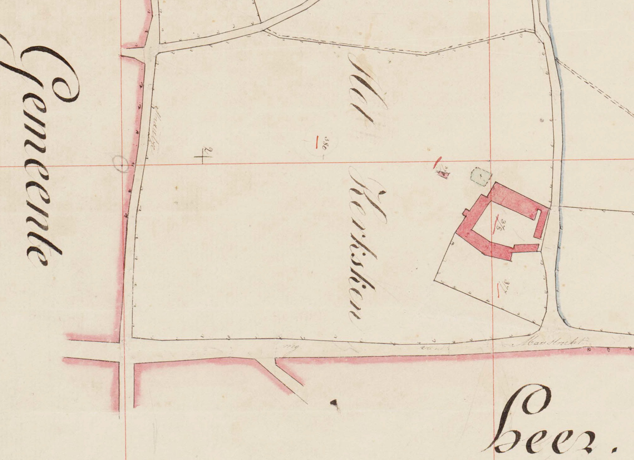
Detail of 1830 maps of Amby near Maastricht, the Netherlands.
Summary
[edit]| Description |
Nederlands: Detail van de kadastrale minuutkaart van de gemeente Amby, sectie A, blad 2. Hier afgebeeld: hoeve met kapel Het Kerksken ofwel Kerkskenshoeve. In de 12e en 13e eeuw was hier een augustinessenklooster gevestigd, de Priorij Scharn, een dochterklooster van Rolduc, dat in 1246 werd overgeplaatst naar het Klooster van Sinnich. In 1852 brandde de hoeve af. |
| Date | |
| Source | https://beeldbank.rhcl.nl/detail.php?nav_id=5-1&id=2610312&index=4 |
| Author | mr. J. Dirriks, landmeter |
| Other versions |
.jpg)
.jpg&action=edit§ion=1)
Licensing
[edit].jpg&action=edit§ion=2)
| This file is made available under the Creative Commons CC0 1.0 Universal Public Domain Dedication. | |
| The person who associated a work with this deed has dedicated the work to the public domain by waiving all of their rights to the work worldwide under copyright law, including all related and neighboring rights, to the extent allowed by law. You can copy, modify, distribute and perform the work, even for commercial purposes, all without asking permission.
|
File history
Click on a date/time to view the file as it appeared at that time.
| Date/Time | Thumbnail | Dimensions | User | Comment | |
|---|---|---|---|---|---|
| current | 20:09, 23 August 2023 | | 2,021 × 1,467 (546 KB) | Kleon3 (talk | contribs) | Uploaded a work by mr. J. Dirriks, landmeter from https://beeldbank.rhcl.nl/detail.php?nav_id=5-1&id=2610312&index=4 with UploadWizard |
You cannot overwrite this file.
File usage on Commons
The following page uses this file:
File usage on other wikis
The following other wikis use this file:
- Usage on nl.wikipedia.org
.jpg&oldid=801155725)