File:Almaty landsat.jpg
Jump to navigation
Jump to search

Size of this preview: 800 × 593 pixels. Other resolutions: 320 × 237 pixels | 640 × 474 pixels | 1,024 × 758 pixels | 1,280 × 948 pixels.
Original file (1,280 × 948 pixels, file size: 425 KB, MIME type: image/jpeg)
Captions
Captions
Add a one-line explanation of what this file represents
Summary
[edit]
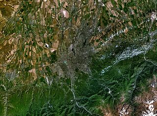
Español: Imagen satelital de Almaty
From en:Image:Almaty landsat.jpg
- Landsat image of Almaty in Kazakhstan.
- I made this with World wind programme
Licensing
[edit]
| This image is in the public domain because it is a screenshot from NASA’s globe software World Wind using a public domain layer, such as Blue Marble, MODIS, Landsat, SRTM, USGS or GLOBE.
|
 |
File history
Click on a date/time to view the file as it appeared at that time.
| Date/Time | Thumbnail | Dimensions | User | Comment | |
|---|---|---|---|---|---|
| current | 22:55, 29 July 2005 | | 1,280 × 948 (425 KB) | B1mbo (talk | contribs) | Imagen satelital de Almaty {{PD-USGov-NASA}} Category:Landsat images |
You cannot overwrite this file.
File usage on Commons
There are no pages that use this file.
File usage on other wikis
The following other wikis use this file:
- Usage on ba.wikipedia.org
- Usage on ca.wikipedia.org
- Usage on ckb.wikipedia.org
- Usage on cv.wikipedia.org
- Usage on de.wikipedia.org
- Usage on eo.wikipedia.org
- Usage on eu.wikipedia.org
- Usage on fa.wikipedia.org
- Usage on he.wikipedia.org
- Usage on incubator.wikimedia.org
- Usage on kaa.wikipedia.org
- Usage on kk.wikipedia.org
- Usage on mzn.wikipedia.org
- Usage on ru.wikipedia.org
- Usage on tk.wikipedia.org
- Usage on uk.wikipedia.org