Category:Landsat images
Jump to navigation
Jump to search

Subcategories
This category has the following 12 subcategories, out of 12 total.
F
- Photos of floods by Landsat (2 F)
K
- Landsat images with Kashmir 3D (2 P, 125 F)
L
- Satellite pictures by Landsat 5 (205 F)
- Satellite pictures by Landsat 7 (97 F)
- Satellite pictures by Landsat 9 (51 F)
- Landsat perspective view (14 F)
P
W
- Photos of wildfires by Landsat (14 F)
Media in category "Landsat images"
The following 200 files are in this category, out of 225 total.
(previous page) (next page)-
 2011年鄱阳湖、洞庭湖5月份和6月份水量对比之5月.jpg 720 × 360; 120 KB
-
 2011年鄱阳湖、洞庭湖5月份和6月份水量对比之6月.jpg 720 × 360; 142 KB
-
-
 A Chip off the King Baudouin Ice Shelf (16278813147) (cropped).jpg 720 × 480; 88 KB
-
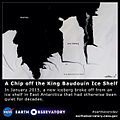 A Chip off the King Baudouin Ice Shelf (16278813147).jpg 640 × 640; 78 KB
-
 A Chip off the King Baudouin Ice Shelf (full resolution).jpg 4,000 × 4,000; 3.74 MB
-
Above the Earth, Below the Surface- Landsat's Role in Monitoring Water Quality (SVS14403).webm 7 min 31 s, 1,920 × 1,080; 60.18 MB
-
 Abu Musa (USGS).png 1,577 × 1,578; 2.47 MB
-
 Agriates.png 1,655 × 1,093; 2.63 MB
-
 Aleutian Vortices - 123892606.jpg 1,280 × 1,024; 405 KB
-
 Amanda Bay Satellite Image Map.jpg 11,811 × 8,264; 39.9 MB
-
 Anyuyskiy Volcano sat image.jpg 1,280 × 1,024; 525 KB
-
 Apataki Atoll - Landsat S-06-15 2000 (1-225,000).jpg 1,255 × 877; 118 KB
-
 Bangweulu oli 2020136 lrg Zambia.jpg 4,840 × 4,033; 3.89 MB
-
 Bangweulu oli 2020136 Zambia.jpg 720 × 600; 634 KB
-
 Barbuda 2017 09 12 (37065176231).jpg 3,000 × 3,120; 856 KB
-
 Barbuda20170827 (36393151993).jpg 3,000 × 3,120; 979 KB
-
 Blenheim Reef Landsat.jpg 508 × 348; 70 KB
-
 Buba River - 123886084.jpg 1,280 × 1,024; 370 KB
-
 Byrd Glacier - 123886085.jpg 1,280 × 1,024; 170 KB
-
 Byrd glacier landsat.jpg 1,000 × 1,000; 140 KB
-
 Cabo San Antonio - 123886086.jpg 1,280 × 1,024; 350 KB
-
 Cargados Carajos - Landsat OLI 151.jpg 2,000 × 2,500; 329 KB
-

-
 Chandeleur L5 Oct2004Sep2005.jpg 540 × 356; 15 KB
-
 Chinese Lights - 5208792893.jpg 1,280 × 1,024; 414 KB
-
 Coral Reefs in the Persian Gulf.jpg 7,200 × 4,800; 4.1 MB
-
 Dardzha Peninsula - 5209508948.jpg 1,280 × 1,024; 552 KB
-
 Daru Island (Landsat).jpg 274 × 185; 4 KB
-
Data in Harmony- NASA's Harmonized Landsat and Sentinel-2 Project (SVS14565).webm 8 min 28 s, 1,920 × 1,080; 67.19 MB
-
 Denman oli 2020-057-059 lrg-labeled.svg 5,120 × 3,414; 3.06 MB
-
 Desert Fireball - 5208792937.jpg 1,280 × 1,024; 459 KB
-
 Desert Whorls - 123886087.jpg 1,280 × 1,024; 170 KB
-
 Gufa volcanic field.jpg 640 × 478; 61 KB
-
 GufaNASA.png 1,262 × 920; 1.77 MB
-
 Dog Island Aguilla Landsat.jpg 290 × 196; 13 KB
-
 Dzanganp oli 202187 lrg.jpg 2,248 × 2,479; 2.92 MB
-
 Dzanganp oli 202187.jpg 720 × 800; 170 KB
-
 Dzangazm oli 202187 lrg.jpg 1,395 × 930; 686 KB
-
 Dzangazm oli 202187.jpg 720 × 480; 275 KB
-
 Egmont Islands (Landsat).png 512 × 256; 231 KB
-
 Epirus landsat.jpg 1,024 × 768; 469 KB
-
 Erongo Massif - 5209391308.jpg 1,280 × 1,024; 486 KB
-
 Euskalherria landsat.jpg 1,000 × 913; 421 KB
-
 Fasduthere Atoll (Landsat).jpg 788 × 337; 33 KB
-
 Flint Island Landsat.jpg 1,252 × 877; 124 KB
-
 Framnes Mountains Satellite Image Map.jpg 8,256 × 11,808; 18.35 MB
-
 Freddy Brings Lean Times to Malawi.jpg 3,812 × 2,541; 4 MB
-
 French Frigate Shoals.jpg 1,350 × 1,350; 946 KB
-
From Orbit to A I - Harnessing Machine Learning with Landsat Data (SVS14336).webm 5 min 34 s, 1,920 × 1,080; 44.46 MB
-
 Glowing Sea - 5208793163.jpg 1,280 × 1,024; 214 KB
-
 Gotland Bloom 1 - 123886088.jpg 1,280 × 1,024; 384 KB
-
 Gotland Bloom 2 - 123889000.jpg 1,280 × 1,024; 233 KB
-
 Gotland Bloom 3 - 123889001.jpg 1,280 × 1,024; 414 KB
-
 Gough Island Landsat.jpg 1,259 × 879; 139 KB
-
 Gulf of Finland NLT Landsat7.png 2,500 × 1,159; 4.79 MB
-
 Gun Island, Pelsart Group.jpg 1,043 × 891; 150 KB
-
 Hall Islands Landsat.jpg 1,200 × 673; 140 KB
-
 Hanish Island.jpg 640 × 442; 31 KB
-

-
 Himalayas Mountain Range & Mahalangur Himal, Nepal - Tibet (China) (34954655592).jpg 25,386 × 26,207; 74.16 MB
-
 Houk Island Landsat.jpg 1,000 × 759; 145 KB
-
 Hunter Island, Tasmania, Landsat-7.png 322 × 903; 162 KB
-
 Ihavandhippolhu Atoll (Landsat).JPG 899 × 867; 87 KB
-
 Ile aux Cochons.jpg 1,000 × 712; 116 KB
-
 Ile des Pingouins.jpg 1,000 × 634; 52 KB
-
 Ile houat satellite.png 500 × 500; 195 KB
-
 Ilots des Apotres - Landsat 7.jpg 759 × 537; 60 KB
-
 Infrared imagery as obtained by the Landsat satellite of upper Chesapeake Bay (2282-102).jpg 1,200 × 1,496; 1.25 MB
-
 Infrared imagery as obtained by the Landsat satellite of upper Chesapeake Bay (2282-6).jpg 1,228 × 1,196; 1.01 MB
-
 Jetty Peninsula Satellite Image Map.jpg 8,268 × 6,496; 20.09 MB
-
 Johnston Islands (Landsat).JPG 227 × 145; 10 KB
-
 Joulter Cays p013r043 7x20010516.jpg 1,100 × 1,000; 267 KB
-
 Kaashidhoo Island (Landsat).JPG 320 × 204; 10 KB
-
 Kaimear Island (Landsat).JPG 230 × 224; 11 KB
-
 Kairiru & Muschu (Landsat).JPG 619 × 597; 83 KB
-
 Kaloum Peninsula 2000.jpg 2,000 × 1,500; 4.47 MB
-
 Kara-kul lake.jpg 1,200 × 1,402; 372 KB
-
 Karmoy Haugesund 5.19379E 59.27570N.png 780 × 938; 1.33 MB
-
 Karmoy Karmsund Haugesund 5.19379E 59.27570N.png 780 × 938; 1.49 MB
-
 Kasiui Island (Landsat).JPG 392 × 478; 32 KB
-
 Kermadec - Landsat OLI 70.png 4,500 × 10,000; 19.28 MB
-
 Konari, Iran - 123889002.jpg 1,280 × 1,024; 342 KB
-
 Kootenay River 751 pan crop 15 (35460819871).jpg 5,756 × 11,335; 52.8 MB
-
 KureAtoll.jpg 1,000 × 1,000; 427 KB
-
 Kuril Clouds - 5208792975.jpg 1,280 × 1,024; 213 KB
-
 Kurkap Island (Landsat).JPG 277 × 165; 9 KB
-
 Kuwait 1991 02 23 (36688257555).jpg 6,103 × 5,634; 5.41 MB
-
 Kvarneric Islands - 5209508980.jpg 1,280 × 1,024; 304 KB
-
 La Paz, Bolivia (lapaz).jpg 2,200 × 1,800; 761 KB
-
 Lakekariba2 oli 2018344 lrg 01.jpg 1,066 × 1,036; 766 KB
-
 Lakekariba2 oli 2018344 lrg 02.jpg 720 × 700; 432 KB
-
 Lamotrek Landsat.jpg 508 × 348; 48 KB
-
 Landsat 2 with Data Striping.gif 399 × 399; 85 KB
-
 Landsat art Ghadamis.jpg 4,227 × 4,224; 4.44 MB
-
 Landsat dili lrg.jpg 1,000 × 1,000; 240 KB
-
 LANDSAT Potrillo Volcanic Field.jpg 1,935 × 1,888; 2.39 MB
-
 LANDSAT semenanjung malaysia - 2.jpg 5,392 × 5,680; 5.71 MB
-
 LANDSAT Taitung City.jpg 1,248 × 712; 954 KB
-
Landsat Tracks Brunt Ice Shelf Evolution 1986-2023 (SVS31228 - ForAmy BruntHyperwall-selected v2 1080p30 2).webm 36 s, 1,920 × 1,080; 4.13 MB
-
Landsat Tracks Brunt Ice Shelf Evolution 1986-2023 (SVS31228 - ForAmy BruntHyperwall-selected v2 2160p30 2).webm 36 s, 3,840 × 2,160; 77.49 MB
-
 Landsat-farallon-de-pajaros-adjusted.png 97 × 105; 40 KB
-
 Landsat-pagan-island-adjusted.png 450 × 558; 983 KB
-
 Landsat-pagan-island.png 450 × 558; 983 KB
-
 Lars Christensen Coast, Mac.Robertson Land.jpg 8,268 × 8,976; 20.98 MB
-
 Laughlan Islands (Landsat).JPG 360 × 240; 19 KB
-

-
 Leleuvia Island (Landsat).jpg 187 × 150; 7 KB
-
 Libaran Landsat 1990.PNG 1,282 × 898; 2.2 MB
-
 Libyaflooding oli 2023237 lrg.jpg 1,719 × 1,048; 1.25 MB
-
 Libyaflooding oli 2023237.jpg 720 × 480; 377 KB
-
 Libyaflooding oli2 2023261 lrg.jpg 1,719 × 1,048; 1.33 MB
-
 Libyaflooding oli2 2023261.jpg 720 × 480; 395 KB
-
 Lihir Group (Landsat).JPG 1,201 × 1,909; 566 KB
-
 Litovelske Pomoravi.jpg 844 × 633; 511 KB
-
 Lousiana 2020-08-29 1640Z.jpg 5,197 × 3,465; 4.22 MB
-
 Mabaduan, Offshore Islands, (Landsat).jpg 361 × 205; 4 KB
-
 Malai Island, Papua New Guinea, Landsat.png 512 × 256; 224 KB
-
 Malawicrops oli 2023068 lrg.jpg 3,812 × 2,541; 4.05 MB
-
 Malawicrops oli 2023068.jpg 720 × 480; 435 KB
-
 Malawicrops oli 2023100.jpg 720 × 480; 431 KB
-
 Mamakunudhoo Atoll (Landsat).JPG 753 × 855; 76 KB
-
 Manengouba-Tombel.jpg 622 × 480; 64 KB
-
Mapping The Future With Landsat.ogv 4 min 22 s, 640 × 360; 50.11 MB
-
 Maria Island, Tasmania, Landsat.jpg 500 × 691; 129 KB
-
 Mawson Escarpment North, Mac.Robertson Land, Ostantarktika.jpg 1,181 × 827; 1.11 MB
-
 Mawson Escarpment South, Mac.Robertson Land, Ostantarktika.jpg 1,902 × 1,014; 413 KB
-
 Mayotte oli 2015196.jpg 720 × 800; 379 KB
-
 Mayottezm oli 2015196.jpg 720 × 480; 270 KB
-
 Mayottezm2 oli 2015196.jpg 720 × 480; 237 KB
-
 Mbuke Islands (Landsat).JPG 413 × 563; 57 KB
-
 Mejit LANDSAT 2000.PNG 1,033 × 697; 1.35 MB
-
 Mexican Rainbow Mountains - 123892608.jpg 1,280 × 1,024; 276 KB
-
 Minto.jpg 1,100 × 671; 116 KB
-
 Mokil Landsat.jpg 508 × 348; 49 KB
-
 Mount Sidley - Antarctica’s Tallest Volcano.jpg 720 × 480; 175 KB
-
 Mulaku Atoll (Landsat).jpg 1,227 × 1,630; 336 KB
-
 Mulanje ETM 26may02.jpg 6,400 × 4,800; 3.66 MB
-
 Murilo Landsat.jpg 1,000 × 739; 127 KB
-
 NASA Flyover of Lake Victoria and Mt. Elgon (hd video) (8892767623).jpg 1,280 × 720; 80 KB
-
 NASA Flyover of Medina and Jeddah (hd video) (8893387336).jpg 1,280 × 720; 70 KB
-
 NASA Flyover of the Volga River (hd video) (8892769317).jpg 1,280 × 720; 94 KB
-
 NASA Sees Fields of Green Spring up in Saudi Arabia (7027523783).jpg 2,050 × 1,405; 1.65 MB
-
 NASA's Landsat Satellite Looks for a Cloud-Free View (8778994889).jpg 4,000 × 4,000; 9.69 MB
-
 Nilande-Atoll (Nord).jpg 895 × 1,045; 730 KB
-
 Nilande-Atoll (Sued).jpg 891 × 1,329; 917 KB
-
 Nord-Maalhosmadulu Atoll (Landsat).jpg 1,026 × 2,240; 287 KB
-
 Nouakchott SandDunesEncroaching.jpg 500 × 182; 34 KB
-
 Oil Spill deep water horizon.jpg 1,280 × 1,024; 306 KB
-
 Opticks.png 880 × 923; 393 KB
-
 Pamilacan Island (Landsat).jpg 264 × 178; 14 KB
-
 Pana Tinani (Landsat).JPG 713 × 499; 82 KB
-
 Parque Nacional Llullaillaco (Salar de Punta Negra).jpg 1,113 × 1,708; 449 KB
-
 Parque Nacional Llullaillaco - NASA Earth Observatory.jpg 720 × 720; 129 KB
-
 Parque Nacional Llullaillaco.jpg 4,113 × 4,113; 2.83 MB
-
 Peros Banhos Landsat.jpg 1,472 × 1,105; 184 KB
-

-
 Poyang Lake, China (poyang).jpg 3,790 × 3,400; 1.49 MB
-
 Pulap Landsat.jpg 508 × 348; 38 KB
-
 Quessant (Landsat).JPG 399 × 239; 21 KB
-
 Rasdhoo Atoll (Landsat).JPG 387 × 361; 25 KB
-
 Ravenga Landsat.jpg 155 × 219; 9 KB
-
Rivers of the World- A Unifying Journey through Landsat's Lens, Set to Vltava by Bedřich Smetana (SVS14329).webm 5 min 55 s, 1,920 × 1,080; 46.08 MB
-
 Robbins Island, Tasmania, Landsat-7.png 664 × 478; 176 KB
-
 Robinson Glacier - 5209391208.jpg 1,280 × 1,024; 534 KB
-
 Rossel Island (Landsat).JPG 1,291 × 691; 242 KB
-
 Rotuma NASA.png 591 × 321; 384 KB
-
 Rotuma.png 631 × 634; 546 KB
-
 Rub’ al Khali-Empty Quarter-2001.jpg 5,038 × 5,080; 6.46 MB
-
 Sable Island PNG (Landsat).png 512 × 256; 247 KB
-
 SafsafOasis SAR comparison.jpg 540 × 588; 154 KB
-
 Santa Cruz de la Sierra, Bolivia (bolivia).jpg 2,400 × 2,334; 1.45 MB
-
 Satelites image of Lake Maracaibo.png 640 × 780; 991 KB
-
 Satellite image of Singapore (Landsat 7) - 20000428.jpg 4,800 × 2,800; 3.77 MB
-
 Satellitenfoto Sylt mit Erklärungen.jpg 445 × 600; 91 KB
-
 Saudi Desert Farming.jpg 1,280 × 1,024; 540 KB
-
 Scarborough Shoal Landsat.jpg 1,000 × 648; 97 KB
-
 Sermeq Konrad Steffen.png 2,380 × 2,378; 5.82 MB
-
 Sherbro Landsat.jpg 1,276 × 885; 176 KB
-
 Slovenia NLT Landsat7.jpg 3,791 × 2,513; 8.48 MB
-
 Somaliaflooding oli 2023255 lrg.jpg 2,070 × 1,725; 2.98 MB
-
 Somaliaflooding oli 2023319 lrg.jpg 2,070 × 1,725; 3.72 MB
-
 Somaliafloodingzm oli 2023255.jpg 720 × 480; 444 KB
-
 St Matthias Islands (Landsat).JPG 1,221 × 1,173; 344 KB
-
 St. Matthew Grease Ice - 5208852351.jpg 1,280 × 1,024; 548 KB
-
 Sue Island (Landsat).png 512 × 256; 257 KB
-
 Sued-Maalhosmadulu Atoll (Landsat).jpg 1,557 × 1,138; 203 KB
-
 Sued-Male-Atoll (Landsat).jpg 788 × 1,258; 150 KB
-
 Summer Pools Appear in Antarctica.jpg 1,200 × 331; 79 KB
-
 Tahiti, French Polynesia - NASA Earth Observatory.jpg 720 × 480; 137 KB
-
 Tangjiashan Lake 2016 Landsat.jpg 696 × 500; 119 KB
-
 Tematangi Atoll - Landsat S-07-20 2000 (1-70,000).jpg 1,266 × 877; 71 KB
-
 The Dead Sea 1972-2011 - NASA Earth Observatory.jpg 720 × 720; 240 KB
-
 Thoddoo Atoll (Landsat).JPG 336 × 191; 9 KB
-
 Three Hummock Island, Tasmania, Landsat-7.png 426 × 425; 101 KB
-
 Tiga LANDSAT-2000.png 571 × 325; 81 KB
-
 Tijuana 1987 03 28 (32549241271).jpg 1,942 × 1,128; 642 KB
-
 Tijuana 2017 01 25 (32671334715).jpg 1,942 × 1,128; 620 KB
-
 Tioor Island (Landsat).JPG 307 × 348; 27 KB
-
 Tolokiwa, Papua New Guinea, Landsat.png 411 × 341; 79 KB


.jpg)
_(cropped).jpg)
.jpg)
.jpg)
.png)


.jpg)


.jpg)
.jpg)


.jpg)


.png)


.jpg)


_(34954655592).jpg)

.JPG)


.jpg)
.jpg)

.JPG)

.JPG)
.JPG)
.JPG)


.JPG)


.jpg)


.JPG)
.jpg)

.jpg)


.JPG)
.jpg)
.jpg)


.JPG)


.jpg)


.JPG)


.JPG)


.jpg)


_(8892767623).jpg)
_(8893387336).jpg)
_(8892769317).jpg)
.jpg)
.jpg)
.jpg)
.jpg)
.jpg)


.jpg)
.JPG)
.jpg)


.jpg)

.JPG)
.JPG)


.JPG)


.png)

.jpg)

_-_20000428.jpg)


.JPG)

.png)
.jpg)
.jpg)


.jpg)

.JPG)


.jpg)
.jpg)
.JPG)
