File:Admiralty Chart No 2708 Clifden and Mannin Bays, Published 1860.jpg
Jump to navigation
Jump to search

Size of this preview: 800 × 551 pixels. Other resolutions: 320 × 220 pixels | 640 × 441 pixels | 1,024 × 705 pixels | 1,280 × 882 pixels | 2,560 × 1,764 pixels | 16,402 × 11,299 pixels.
Original file (16,402 × 11,299 pixels, file size: 25.4 MB, MIME type: image/jpeg)
Captions
Captions
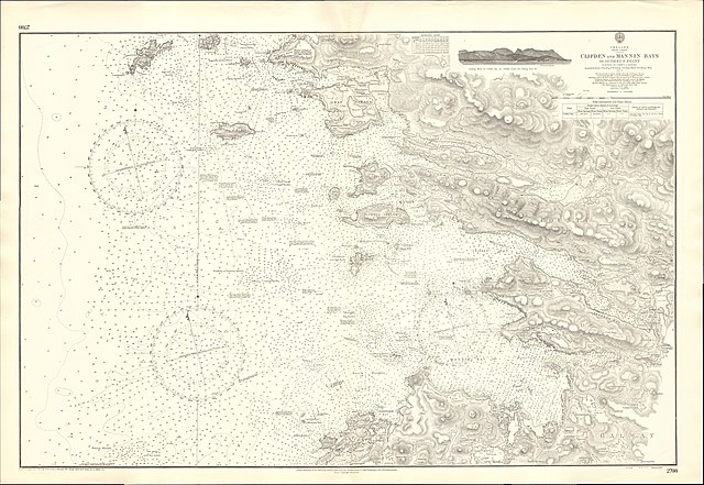
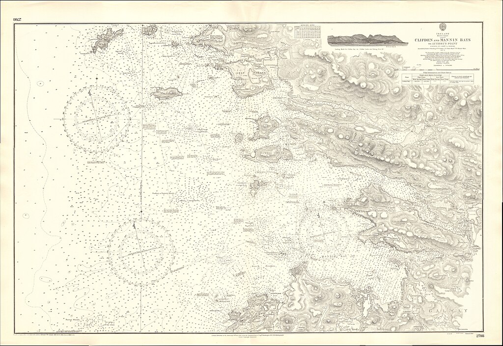
Nautical chart of Clifden and Mannin Bays
Summary
[edit]
| Warning | The original file is very high-resolution. It might not load properly or could cause your browser to freeze when opened at full size. |
|---|
| Description |
English: Nautical chart of Clifden and Mannin Bays, at a scale of 1:23,730. Surveyed by Commander G.A. Bedford assisted by Lieuts. J. Harding, F.W. Sydney, J.E. Davis, Master, T.B. Horner, Mate, 1847-8. Not current - not to be used for navigation! |
||||||||||
| Date | |||||||||||
| Source | Scan of original Admiralty Chart | ||||||||||
| Creator |
|
||||||||||
| Geotemporal data | |||||||||||
| Spatial reference system | gnomonic | ||||||||||
| Scale | 1:21,120 | ||||||||||
| Bounding box |
|
||||||||||
| Georeferencing | |||||||||||
Projection: Gnomonic
Licensing
[edit]
This work created by the United Kingdom Government is in the public domain.
This is because it is one of the following:
HMSO has declared that the expiry of Crown Copyrights applies worldwide (ref: HMSO Email Reply)
|
 |
File history
Click on a date/time to view the file as it appeared at that time.
| Date/Time | Thumbnail | Dimensions | User | Comment | |
|---|---|---|---|---|---|
| current | 11:40, 23 February 2021 | | 16,402 × 11,299 (25.4 MB) | Kognos (talk | contribs) | Uploaded a work by Capt. Washington, Hydrographer from Scan of original Admiralty Chart with UploadWizard |
You cannot overwrite this file.
File usage on Commons
There are no pages that use this file.