Category:George Augustus Bedford
Jump to navigation
Jump to search
British Royal Navy officer and surveyor | |||||
| Upload media | |||||
| Name in native language |
| ||||
|---|---|---|---|---|---|
| Date of death | 1878 | ||||
| Country of citizenship | |||||
| Occupation | |||||
| Father |
| ||||
| Sibling | |||||
| |||||
Media in category "George Augustus Bedford"
The following 26 files are in this category, out of 26 total.
-
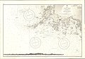
 Admiralty Chart No 1245 Horn Head to Rathlin O'Birne, Published 1860.jpg 8,099 × 11,065; 25.78 MB
-
 Admiralty Chart No 1709 Charlottetown Harbour, Published 1845.jpg 7,971 × 6,058; 8.84 MB
-
 Admiralty Chart No 1738 Hillsborough Bay, Published 1846.jpg 11,922 × 8,040; 17.53 MB
-
 Admiralty Chart No 1942 Bedeque Harbour, Published 1849.jpg 8,071 × 5,968; 7.65 MB
-
 Admiralty Chart No 1973 Murray Harbour, Published 1849.jpg 7,959 × 5,957; 8.25 MB
-
 Admiralty Chart No 1977 Caribou Harbour, Published 1850.jpg 8,721 × 6,618; 5.44 MB
-
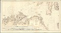
 Admiralty Chart No 1984 Ireland west coast Galway Bay, Published 1850.jpg 12,240 × 8,313; 14.38 MB
-
 Admiralty Chart No 1989 Pictou Harbour, Published 1850.jpg 8,721 × 6,618; 6.76 MB
-
 Admiralty Chart No 2000 Crapaud Road, Published 1850.jpg 9,807 × 7,570; 8.11 MB
-
 Admiralty Chart No 2015 Ireland Isles of Arran (Aran), Published 1850.jpg 7,185 × 3,938; 2.61 MB
-
 Admiralty Chart No 2036 Pugwash Harbour, Published 1850.jpg 6,628 × 8,712; 7.58 MB
-

-

-
 Admiralty Chart No 2420 Achill Head to Slyne Head, Published 1855.jpg 11,277 × 8,173; 16.96 MB
-
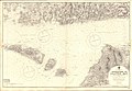
 Admiralty Chart No 2440 Rathlin O'Birne to Downpatrick Head, Published 1858.jpg 8,412 × 6,125; 17.23 MB
-
 Admiralty Chart No 2666 St Johns Newfoundland to Halifax with the Outer Banks, Published 1861.jpg 11,911 × 8,074; 12.46 MB
-
 Admiralty Chart No 2699 Sheep Haven, Published 1963.jpg 8,440 × 12,257; 31.91 MB
-
 Admiralty Chart No 2702 Donegal Bay, Published 1959.jpg 16,310 × 11,270; 26.79 MB
-
 Admiralty Chart No 2706 Ballynakill and Killary Bays, Published 1860.jpg 16,396 × 11,304; 36.28 MB
-
 Admiralty Chart No 2707 Inishbofin, Published 1860.jpg 16,419 × 11,262; 19.7 MB
-
 Admiralty Chart No 2708 Clifden and Mannin Bays, Published 1860.jpg 16,402 × 11,299; 25.4 MB
-
 Admiralty Chart No 2709 Slyne Head, Published 1860.jpg 16,377 × 11,283; 18.05 MB
-
 Admiralty Chart No 2767 Sligo and Killala Bays, Published 1860.jpg 16,283 × 11,264; 26.93 MB
-
 Admiralty Chart No 3139 Cape St. Ann to Cape Three Points, Published 1900.jpg 18,854 × 11,332; 31.56 MB
-
 Admiralty Chart No 3339 Approaches to Galway Bay, Published 1903.jpg 16,408 × 11,286; 66.02 MB
-
 Admiralty Chart No 46 Ailsa Craig to Bloody Foreland, Published 1861.jpg 20,202 × 11,078; 58.98 MB


,_Published_1850.jpg)

_Kilkieran_Greatman_and_Cashla_Bays,_Published_1852.jpg)


