File:Admiralty Chart No 1079 Van Diemens Land by M. Flinders 1798-9. South coast, sheet VI. RMG F0282, Published 1814.tiff

Original file (5,689 × 7,861 pixels, file size: 127.95 MB, MIME type: image/tiff)
Captions
Captions
Summary
[edit]| Author |
Flinders, Matthew; Hydrographic Office; Thomas Hurd |
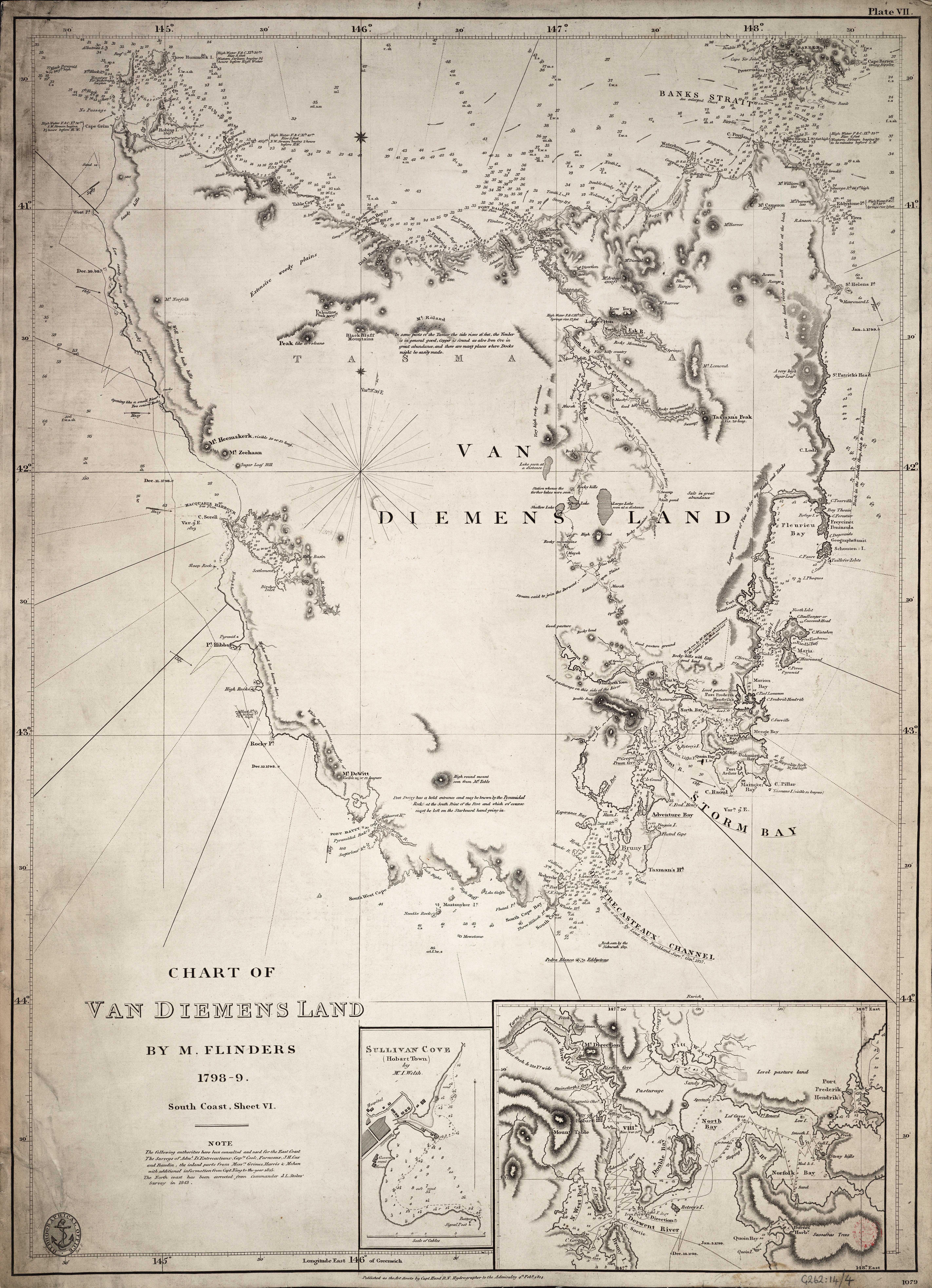
| Description |
English: Chart of Van Diemens Land by M. Flinders 1798-9. South coast, sheet VI.Single sheet. Engr. Medium: Linen backed. Scale: [ca.1:1 000 000]. Cartographic Note: Graduated chart. Variation shown. Additional Places: Tasmania. Contents Note: Inset: Sullivan Cove (Hobart Town) by Mr I Welsh [ca. 1:12 000], Inset: [North Bay and Derwent River] [ca. 1:35 000]. G262:14/4 Van Diemans Land by Flinders |
| Date | 1814; 1843 |
| Dimensions | Printed area 65 x 47cm, on sheet 67 x 48cm. |
| Source/Photographer | http://collections.rmg.co.uk/collections/objects/540614 |
| Permission (Reusing this file) |
The original artefact or artwork has been assessed as public domain by age, and faithful reproductions of the two dimensional work are also public domain. No permission is required for reuse for any purpose. The text of this image record has been derived from the Royal Museums Greenwich catalogue and image metadata. Individual data and facts such as date, author and title are not copyrightable, but reuse of longer descriptive text from the catalogue may not be considered fair use. Reuse of the text must be attributed to the "National Maritime Museum, Greenwich, London" and a Creative Commons CC-BY-NC-SA-3.0 license may apply if not rewritten. Refer to Royal Museums Greenwich copyright. |
| Identifier | Admiralty Chart Number: 1079. id number: G262:14/4 |
| Collection | Charts and maps |
Licensing
[edit]|
This is a faithful photographic reproduction of a two-dimensional, public domain work of art. The work of art itself is in the public domain for the following reason:
The official position taken by the Wikimedia Foundation is that "faithful reproductions of two-dimensional public domain works of art are public domain".
This photographic reproduction is therefore also considered to be in the public domain in the United States. In other jurisdictions, re-use of this content may be restricted; see Reuse of PD-Art photographs for details. | ||||
File history
Click on a date/time to view the file as it appeared at that time.
| Date/Time | Thumbnail | Dimensions | User | Comment | |
|---|---|---|---|---|---|
| current | 01:48, 15 August 2017 |  | 5,689 × 7,861 (127.95 MB) | Fæ (talk | contribs) | Royal Museums Greenwich Charts and maps, http://collections.rmg.co.uk/collections/objects/540614 |
You cannot overwrite this file.
File usage on Commons
The following 2 pages use this file:
File usage on other wikis
The following other wikis use this file:
- Usage on da.wikipedia.org
- Usage on en.wikipedia.org
- Usage on it.wikipedia.org