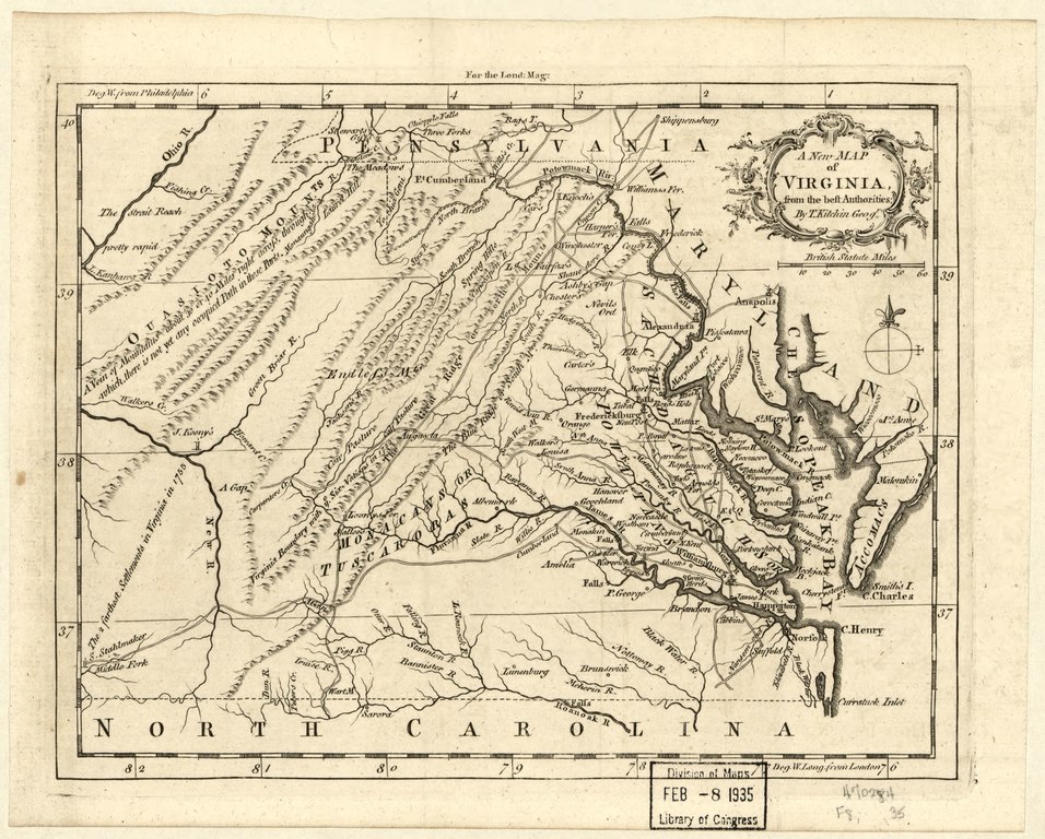
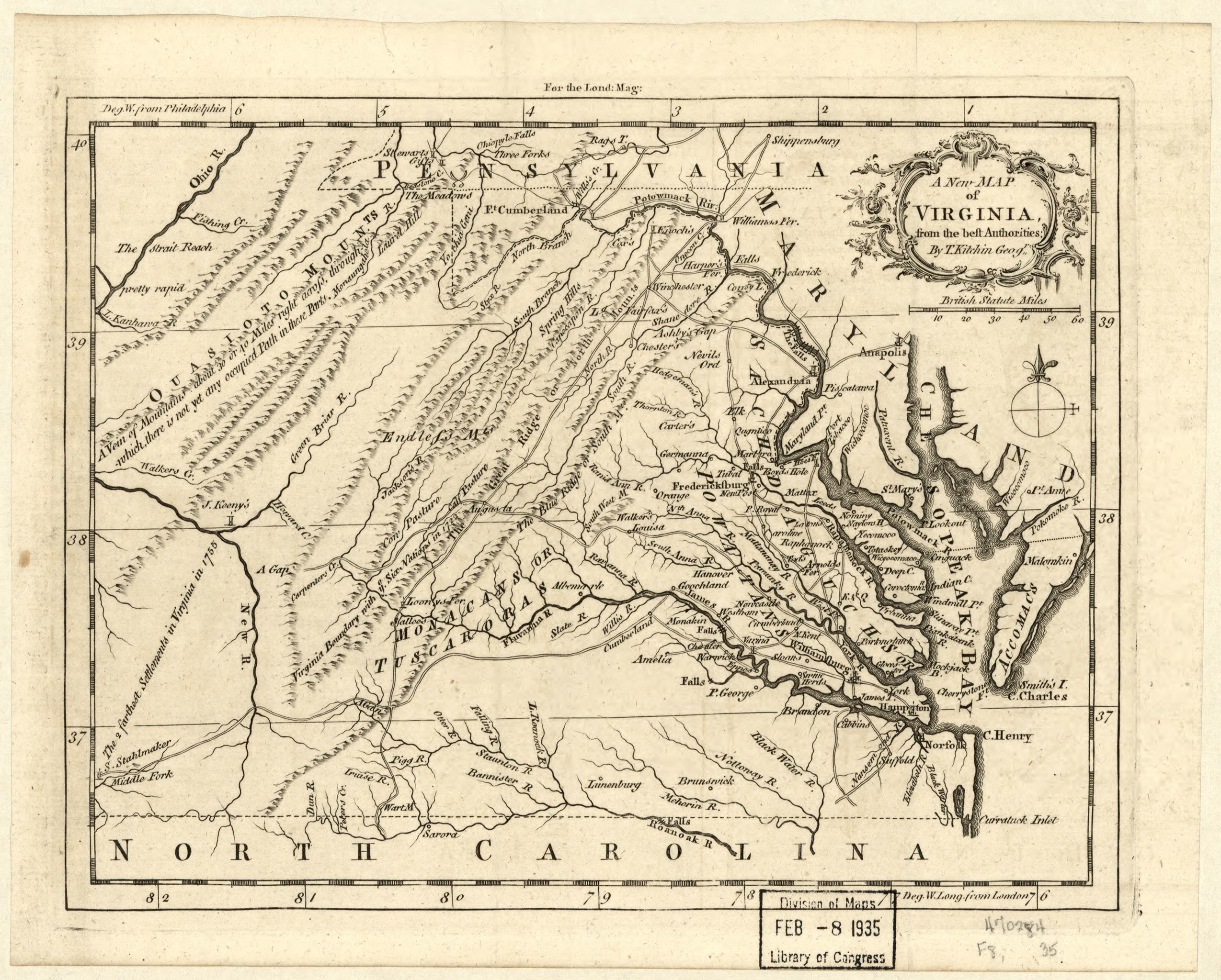
File:A new map of Virginia from the best authorities LOC 2001627679.tif
Jump to navigation
Jump to search

Size of this JPG preview of this TIF file: 746 × 600 pixels. Other resolutions: 299 × 240 pixels | 597 × 480 pixels | 956 × 768 pixels | 1,274 × 1,024 pixels | 2,549 × 2,048 pixels | 3,147 × 2,529 pixels.
Original file (3,147 × 2,529 pixels, file size: 22.77 MB, MIME type: image/tiff)
Captions
Captions
Add a one-line explanation of what this file represents
Summary
[edit]| Description |
English: From the London Magazine. November 1761, v. 30. Prime meridian: London and Philadelphia. LC Maps of North America, 1750-1789, 1436 Available also through the Library of Congress Web site as a raster image. Copy 2. Gift; From the collection of Dr. Gerald D. Aurbach, given in his memory by his wife, Hanna, and daughters, Elissa and Pamela. Acquisitions control no. 94-29 |
||
| Title | A new map of Virginia from the best authorities | ||
| Shelf ID | G3880 1761 .K5 | ||
| Date | |||
| Source | https://www.loc.gov/item/2001627679/ | ||
| Author | Kitchin, Thomas | ||
| Permission (Reusing this file) |
|
||
| Other versions |
|
||
| Location | United States · Virginia | ||
| Part of | Military Battles And Campaigns · American Memory · Catalog · Geography And Map Division · American Revolution And Its Era: Maps And Charts Of North America And The West Indies, 1750-1789 | ||
| Subject | United States · Maps · Early Works To 1800 · Virginia |


Licensing
[edit]|
This is a faithful photographic reproduction of a two-dimensional, public domain work of art. The work of art itself is in the public domain for the following reason:
The official position taken by the Wikimedia Foundation is that "faithful reproductions of two-dimensional public domain works of art are public domain".
This photographic reproduction is therefore also considered to be in the public domain in the United States. In other jurisdictions, re-use of this content may be restricted; see Reuse of PD-Art photographs for details. | ||||
File history
Click on a date/time to view the file as it appeared at that time.
| Date/Time | Thumbnail | Dimensions | User | Comment | |
|---|---|---|---|---|---|
| current | 00:44, 19 May 2018 |  | 3,147 × 2,529 (22.77 MB) | Fæ (talk | contribs) | LOC Maps https://www.loc.gov/item/2001627679/ #2083 |
You cannot overwrite this file.
File usage on Commons
The following page uses this file: