File:A map of the most inhabited part of New England, containing the provinces of Massachusets Bay and New Hampshire with the colonies of Conecticut and Rhode Island. RMG F0116.tiff

Original file (7,451 × 4,080 pixels, file size: 86.98 MB, MIME type: image/tiff)
Captions
Captions
Summary
[edit]| Author |
Jefferys, Thomas |
| Description |
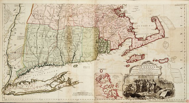
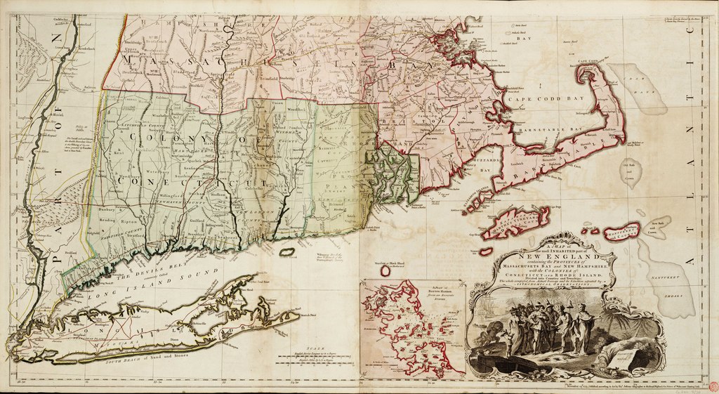
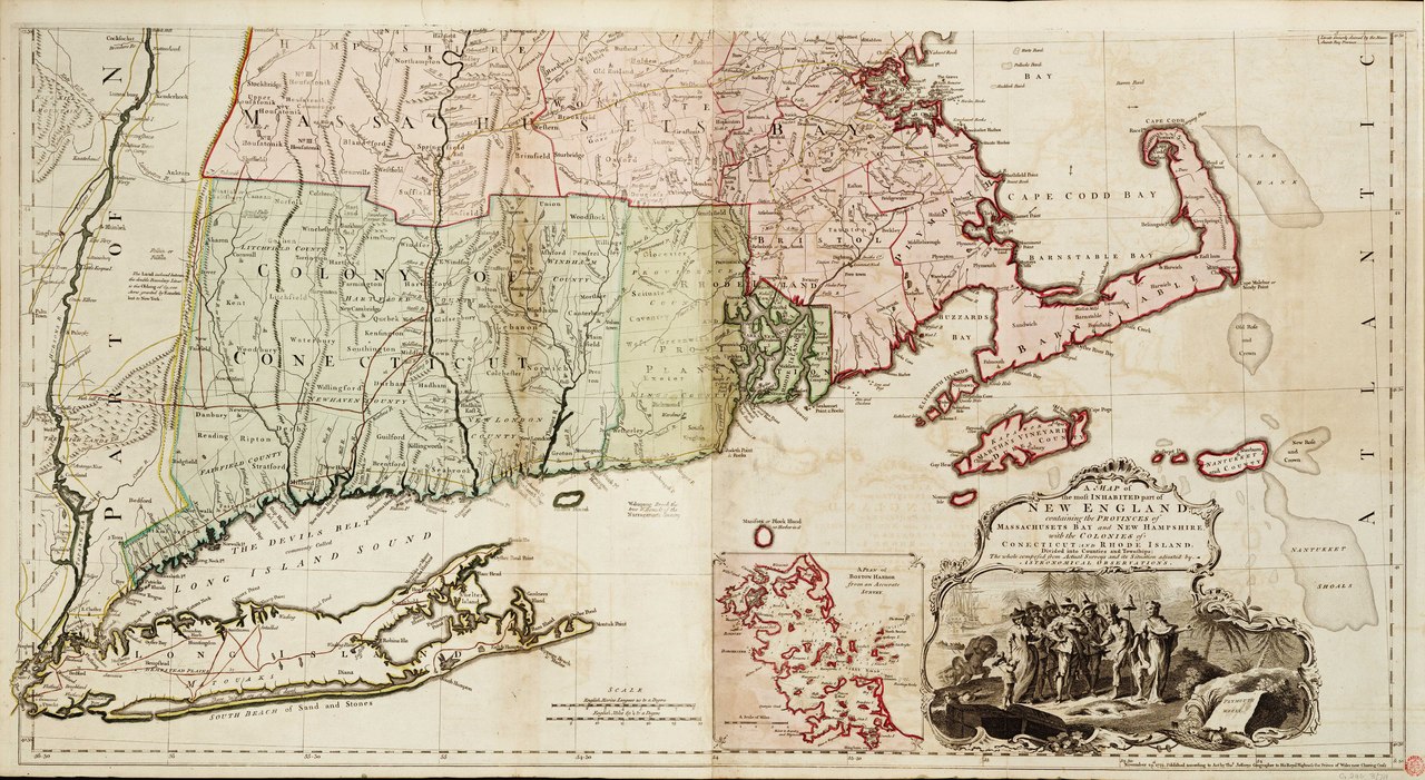
English: A map of the most inhabited part of New England, containing the provinces of Massachusets Bay and New Hampshire with the colonies of Conecticut and Rhode Island. Two sheets. Hand col. engr. Medium: Each sheet is 2 leaves joined at centreline. Scale: [ca. 1:400 000 (lat)]. Cartographic Note: Graduated. London meridian, longitude from Ferro also marked. No soundings. Shoals and sanbanks shown. Scales in English marine leagues and English miles. Additional Places: New York, Connecticut, Massachusetts, Maine. Contents Note: South sheet has title cartouche depicting the landing of the pilgrim fathers and an inset: A plan of Boston harbour (with soundings) [ca. 1:150 000 (bar)],
Maps 12 & 13 from Jefferys' American Atlas, published posthumously by Sayer & Bennett in 1776. |
| Date | 1774 |
| Dimensions | Each sheet printed area 53 x100cm, on sheet 56 x 101cm. |
| Source/Photographer | http://collections.rmg.co.uk/collections/objects/540887 |
| Permission (Reusing this file) |
The original artefact or artwork has been assessed as public domain by age, and faithful reproductions of the two dimensional work are also public domain. No permission is required for reuse for any purpose. The text of this image record has been derived from the Royal Museums Greenwich catalogue and image metadata. Individual data and facts such as date, author and title are not copyrightable, but reuse of longer descriptive text from the catalogue may not be considered fair use. Reuse of the text must be attributed to the "National Maritime Museum, Greenwich, London" and a Creative Commons CC-BY-NC-SA-3.0 license may apply if not rewritten. Refer to Royal Museums Greenwich copyright. |
| Identifier | Acquisition Number: N.9166. GGCC: 246:3 id number: G246:3/7A previous number: G246:3/7A-B |
| Collection | Charts and maps |
Licensing
[edit]|
This is a faithful photographic reproduction of a two-dimensional, public domain work of art. The work of art itself is in the public domain for the following reason:
The official position taken by the Wikimedia Foundation is that "faithful reproductions of two-dimensional public domain works of art are public domain".
This photographic reproduction is therefore also considered to be in the public domain in the United States. In other jurisdictions, re-use of this content may be restricted; see Reuse of PD-Art photographs for details. | ||||
File history
Click on a date/time to view the file as it appeared at that time.
| Date/Time | Thumbnail | Dimensions | User | Comment | |
|---|---|---|---|---|---|
| current | 00:48, 6 September 2017 |  | 7,451 × 4,080 (86.98 MB) | Fæ (talk | contribs) | Royal Museums Greenwich Charts and maps, http://collections.rmg.co.uk/collections/objects/540887 #979 |
You cannot overwrite this file.
File usage on Commons
The following page uses this file: