File:AMH-5522-NA Map of Sumatra to the western coast of Celebes.jpg
Jump to navigation
Jump to search

Size of this preview: 781 × 599 pixels. Other resolutions: 313 × 240 pixels | 626 × 480 pixels | 1,001 × 768 pixels | 1,280 × 982 pixels | 2,400 × 1,842 pixels.
Original file (2,400 × 1,842 pixels, file size: 785 KB, MIME type: image/jpeg)
Captions
Captions
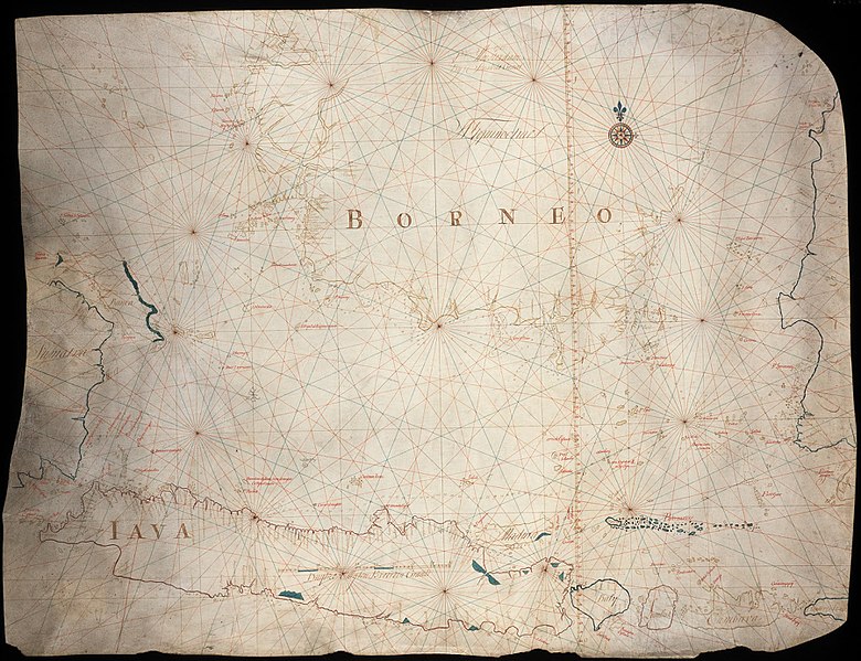
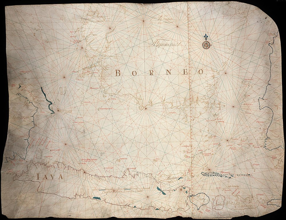
Map of Sumatra to the western coast of Celebes
Summary
[edit]| Nederlands: Kaart van Sumatra tot de westkust van Celebes
English: Map of Sumatra to the western coast of Celebes Bahasa Indonesia: Peta Sumatera sampai pantai barat Sulawesi( |
||||||||||||||||||||||||||
|---|---|---|---|---|---|---|---|---|---|---|---|---|---|---|---|---|---|---|---|---|---|---|---|---|---|---|
| Author |
Nederlands: Isaac de Graaff (uitgever)
English: Isaac de Graaff (publisher) |
|||||||||||||||||||||||||
| Title |
Nederlands: Kaart van Sumatra tot de westkust van Celebes
English: Map of Sumatra to the western coast of Celebes
Bahasa Indonesia: Peta Sumatera sampai pantai barat Sulawesi |
|||||||||||||||||||||||||
| Description |
Nederlands: Titel catalogus Leupe (NA): Kaart van een gedeelte van den Indischen Archipel, tusschen Sumatra en de Westkust van Celebes, een gedeelte van Borneo enz..
English: Title in the Leupe catalogue (NA): Kaart van een gedeelte van den Indischen Archipel, tusschen Sumatra en de Westkust van Celebes, een gedeelte van Borneo enz..
Bahasa Indonesia: Judul dalam katalog Leupe (AN): Kaart van een gedeelte van den Indischen Archipel, tusschen Sumatra en de Westkust van Celebes, een gedeelte van Borneo enz.. |
|||||||||||||||||||||||||
| Date | 1741 | |||||||||||||||||||||||||
| Medium |
Nederlands: ingekleurde tekening op perkament
English: coloured drawing on parchment
Bahasa Indonesia: gambar berwarna di atas kertas |
|||||||||||||||||||||||||
| Dimensions | height: 97 cm (38.1 in); width: 75.5 cm (29.7 in) | |||||||||||||||||||||||||
| Collection |
|
|||||||||||||||||||||||||
| Accession number |
NL-HaNA_4.VEL_346 (old number: VEL0346) |
|||||||||||||||||||||||||
| Inscriptions |
-
author: 1742 T'Amsterdam Bij Isaak de Graaf |
|||||||||||||||||||||||||
| Notes |
English: Subjects: chart / map / plan, compass / dial
Nederlands: Onderwerpen: plattegrond / kaart, kompas / windroos |
|||||||||||||||||||||||||
| Source/Photographer |
|
|||||||||||||||||||||||||
| Permission (Reusing this file) |
|
|||||||||||||||||||||||||

File history
Click on a date/time to view the file as it appeared at that time.
| Date/Time | Thumbnail | Dimensions | User | Comment | |
|---|---|---|---|---|---|
| current | 08:24, 11 June 2014 | | 2,400 × 1,842 (785 KB) | HuskyBot (talk | contribs) | == {{int:filedesc}} == {{Artwork |title = {{nl|1=Kaart van Sumatra tot de westkust van Celebes}} {{en|1=Map of Sumatra to the western coast of Celebes}} |description = {{nl|1=Titel catalogus Leupe (NA): ''Kaart... |
You cannot overwrite this file.
File usage on Commons
The following page uses this file:
File usage on other wikis
The following other wikis use this file:
- Usage on nl.wikipedia.org