Category:18th-century maps of Borneo
Jump to navigation
Jump to search
Media in category "18th-century maps of Borneo"
The following 15 files are in this category, out of 15 total.
-
AMH-5149-NA Map of the river of Banjemassin.jpg 2,400 × 1,710; 625 KB
-
Bodleian Libraries, The Java Sea by John Thornton, 1701.jpg 1,000 × 675; 120 KB
-
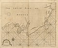
A large draught of the south part of BORNEO NYPL1640633.tiff 7,230 × 5,428; 112.28 MB
-
AMH-7230-KB Map of Borneo.jpg 2,400 × 1,957; 933 KB
-
AMH-5522-NA Map of Sumatra to the western coast of Celebes.jpg 2,400 × 1,842; 785 KB
-
AMH-4608-NA Map of the fort at Tabenjouw.jpg 2,400 × 1,442; 480 KB
-
Southsoutheast1752se.jpg 800 × 600; 133 KB
-
A large draught of the south part of Borneo - btv1b59633023.jpg 6,816 × 5,656; 5.42 MB


