File:2016-11-02-LSG Eller Forst Denkmal Tafel.jpg
Original file (2,592 × 1,944 pixels, file size: 1.44 MB, MIME type: image/jpeg)
Captions
Captions
Summary
[edit]| Description |
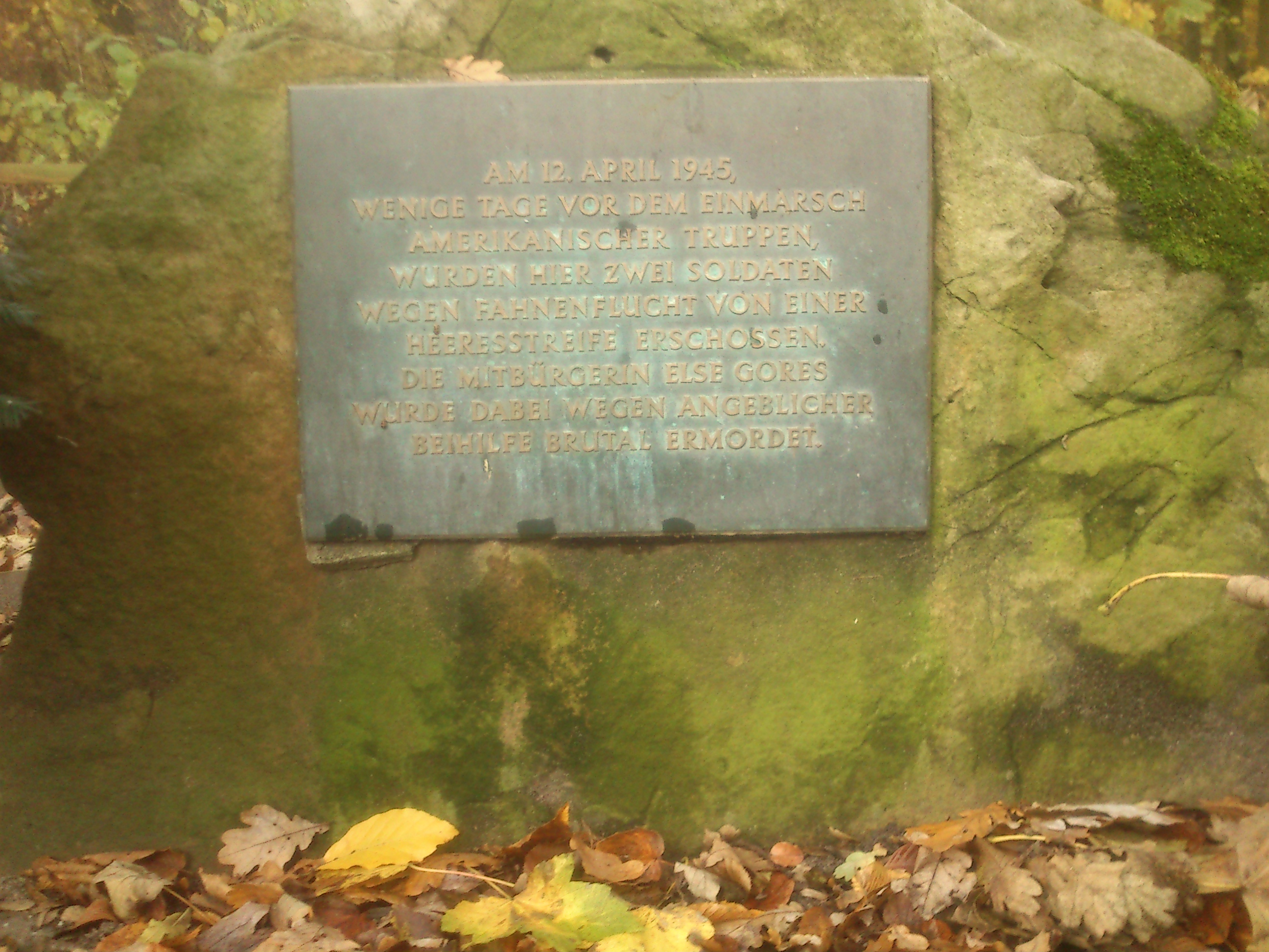
Deutsch: Gedenktafel, Denkmal im Eller Forst, Landschaftsschutzgebiet „Stadtgebiet Düsseldorf“,
Am 12. April 1945, wenige Tage vor dem Einmarsch der amerikanischer Truppen, wurden hier zwei Soldaten wegen Fahnenflucht von einer Heeresstreife erschossen. Die Mitbürgerin Else Gores wurde dabei wegen angeblicher Beihilfe brutal ermordet. Übersetzt mit deepl.com BE: On 12 April 1945, a few days before the invasion of the American troops, two soldiers were shot here by an army patrol for desertion. The fellow citizen Else Gores was brutally murdered for allegedly aiding and abetting. F: Le 12 avril 1945, quelques jours avant l'arrivée des troupes américaines, deux soldats ont été abattus par une patrouille de l'armée pour désertion. La concitoyenne Else Gores a été brutalement assassinée pour complicité présumée. NL: Op 12 april 1945, een paar dagen voor de invasie van de Amerikaanse troepen, werden hier twee soldaten door een legerpatrouille doodgeschoten wegens desertie. De medeburger Else Gores werd brutaal vermoord voor vermeende hulp en medeplichtigheid. CZ: 12. dubna 1945, několik dní před invazí amerických vojsk, zde vojenská hlídka zastřelila dva vojáky za dezerci. Spoluobčan Else Gores byl brutálně zavražděn za údajné napomáhání. SE: Den 12 april 1945, några dagar före de amerikanska truppernas invasion, sköts två soldater här av en armépatrull för desertering. Medborgaren Else Gores mördades brutalt för att han påstods ha varit medhjälpare. J: 1945年4月12日、アメリカ軍の侵攻を数日後に控えたこの地で、2人の兵士が脱走のため軍のパトロール隊に射殺された。同胞のエルゼ・ゴアズが幇助の疑いで残酷に殺害されたのだ。 |
| Date | 2 November 2016, 13:58:18 |
| Source | Own work |
| Author | Daskupa |
| Other versions |
|

| Camera location | | View this and other nearby images on: OpenStreetMap |
|---|
Licensing
[edit]
- You are free:
- to share – to copy, distribute and transmit the work
- to remix – to adapt the work
- Under the following conditions:
- attribution – You must give appropriate credit, provide a link to the license, and indicate if changes were made. You may do so in any reasonable manner, but not in any way that suggests the licensor endorses you or your use.
- share alike – If you remix, transform, or build upon the material, you must distribute your contributions under the same or compatible license as the original.
This image was uploaded as part of Wiki Loves Earth 2017.
|
 |
File history
Click on a date/time to view the file as it appeared at that time.
| Date/Time | Thumbnail | Dimensions | User | Comment | |
|---|---|---|---|---|---|
| current | 13:04, 4 May 2017 | | 2,592 × 1,944 (1.44 MB) | Daskupa (talk | contribs) | User created page with UploadWizard |
You cannot overwrite this file.
File usage on Commons
The following 2 pages use this file:
File usage on other wikis
The following other wikis use this file:
- Usage on de.wikipedia.org