Category:Images from Wiki Loves Earth 2017, DE-NW
Jump to navigation
Jump to search

Deutsch: Wettbewerbsbeiträge für Wiki Loves Earth 2017 aus Nordrhein-Westfalen. – Bitte die Bilder zusätzlich noch mit inhaltlichen/räumlichen Kategorien versehen, siehe v.a. Category:Protected areas of North Rhine-Westphalia.
Media in category "Images from Wiki Loves Earth 2017, DE-NW"
The following 200 files are in this category, out of 2,102 total.
(previous page) (next page)-
 "Pferd" von Johannes Brus im Angertal.jpg 3,600 × 2,025; 6.65 MB
-
 "Spiegelung", des Künstlers Federico Schiaffino "Möhnewandel im Bilde".jpg 3,680 × 2,580; 3.32 MB
-
 2 Rehe im Wald 2.jpg 6,000 × 4,000; 6.81 MB
-
 2 Rehe im Wald 3.jpg 6,000 × 4,000; 6.95 MB
-
 2 Rehe im Wald 4.jpg 6,000 × 4,000; 6.6 MB
-
 2 Rehe im Wald 5.jpg 6,000 × 4,000; 6.68 MB
-
 2 Rehe im Wald 6.jpg 6,000 × 4,000; 6.73 MB
-
 2 Rehe im Wald 7.jpg 6,000 × 4,000; 6.14 MB
-
 2 Rehe im Wald.jpg 6,000 × 4,000; 6.8 MB
-
 2010-04-18 ND44 Platane BochumerStr.50 01.jpg 2,594 × 3,570; 11.12 MB
-
 2011-04-17 1000j Linde in Asbeck (NRW) 01.jpg 2,594 × 3,898; 10.89 MB
-
 2011-04-17 1000j Linde in Asbeck (NRW) 02.jpg 3,898 × 2,594; 9.83 MB
-
 2012-10-29 Elmpt IMG 7829n.jpg 4,000 × 2,664; 1.13 MB
-
 2013-10-19 Elmpt IMG 8118n.jpg 4,000 × 3,000; 10.56 MB
-
 2015-05-02 Elmpt IMG 4910n.jpg 5,472 × 3,648; 15.53 MB
-
 20151101 Teiche am Homborn, Borken und Velen (04156).jpg 3,264 × 4,912; 15.58 MB
-
 20151101 Teiche am Homborn, Borken und Velen (04157).jpg 4,912 × 3,264; 20.26 MB
-
 20151101 Teiche am Homborn, Borken und Velen (04158).jpg 4,912 × 3,264; 11.5 MB
-
 20151101 Teiche am Homborn, Borken und Velen (04160).jpg 4,912 × 3,264; 10.88 MB
-
 2016-09-12-LSG Eller Forst Weg.jpg 2,560 × 1,440; 1.1 MB
-
 2016-09-12-LSG Eller Forst-untere Weggabelung an der ehem Deponie-zum Kikweg hin.jpg 2,560 × 1,440; 1.09 MB
-

-

-
 2016-09-23-LSG Eller Forst Weg.jpg 2,592 × 1,944; 1.51 MB
-
 2016-09-28-LSG Eller Forst Weg.jpg 2,592 × 1,944; 1.32 MB
-
 2016-09-28-LSG Eller Forst-Blick auf den Reitweg Richtung Rothenberg Str-Feld.jpg 2,592 × 1,944; 1.47 MB
-
 2016-10-05-Blick ins NSG Eller Forst vom Kikweg aus.jpg 2,592 × 1,944; 1.49 MB
-
 2016-10-26-LSG Eller Forst Weg II.jpg 2,592 × 1,944; 1.35 MB
-
 2016-10-26-LSG Eller Forst Weg IIa.jpg 2,592 × 1,944; 1.43 MB
-
 2016-10-26-LSG Eller Forst-Fuß- u Radweg parallel zu Am Kleinforst.jpg 2,592 × 1,944; 1.53 MB
-
 2016-10-28-Eingang ins LSG Eller Forst vom Parkplatz Rothenbergstr-Richtung ehm Deponie.jpg 2,592 × 1,944; 1.53 MB
-
 2016-10-28-LSG Eller Forst Detail nahe g Wiese.jpg 2,592 × 1,944; 1.28 MB
-
 2016-10-28-LSG Eller Forst g WieseII.jpg 1,944 × 2,592; 1.21 MB
-
 2016-10-28-LSG Eller Forst Pfad I.jpg 2,592 × 1,944; 1.54 MB
-
 2016-10-28-LSG Eller Forst Pfad II.jpg 2,592 × 1,944; 1.32 MB
-
 2016-10-28-LSG Eller Forst Pfad IX.jpg 2,592 × 1,944; 1.42 MB
-
 2016-10-28-LSG Eller Forst Pfad V.jpg 2,592 × 1,944; 1.24 MB
-
 2016-10-28-LSG Eller Forst Pfad VII.jpg 2,592 × 1,944; 1.35 MB
-
 2016-10-28-LSG Eller Forst Pfad X.jpg 2,592 × 1,944; 1.45 MB
-
 2016-10-28-LSG Eller Forst Pfad XI.jpg 2,592 × 1,944; 1.32 MB
-
 2016-10-28-LSG Eller Forst Pfad XII.jpg 1,944 × 2,592; 1.2 MB
-
 2016-10-28-LSG Eller Forst Pfad XIII.jpg 2,592 × 1,944; 1.45 MB
-
 2016-10-28-LSG Eller Forst Pfad zwischen ehem. Deponie und Forst.jpg 2,592 × 1,944; 1.29 MB
-
 2016-10-28-LSG Eller Forst Unterstand g Wiese.jpg 2,592 × 1,944; 1.67 MB
-
 2016-10-28-LSG Eller Forst Weg zur ehem. Deponie.jpg 2,592 × 1,944; 1.48 MB
-
 2016-10-28-LSG Eller Forst Weggabelung an der ehem. Deponie.jpg 2,592 × 1,944; 1.67 MB
-
 2016-10-28-LSG Eller Forst Wegweiser.jpg 1,944 × 2,592; 1.38 MB
-
 2016-10-28-LSG Eller Spielplatz nahe Pflanzenlehrpfad.jpg 2,592 × 1,944; 1.45 MB
-
 2016-11-01 Borner See, Gans (01) (freddy2001).jpg 4,168 × 2,779; 7.08 MB
-
 2016-11-01 Borner See, Gans (03) (freddy2001).jpg 5,184 × 3,456; 10.38 MB
-
 2016-11-02-Brücke Reitweg ins NSG Eller Forst.jpg 2,592 × 1,944; 1.51 MB
-
 2016-11-02-Detail Baumstumpf.jpg 2,592 × 1,944; 1.37 MB
-
 2016-11-02-LSG Eller Forst Denkmal Tafel.jpg 2,592 × 1,944; 1.44 MB
-
 2016-11-02-LSG Eller Forst Denkmal.jpg 2,592 × 1,944; 1.79 MB
-
 2016-11-02-LSG Eller Forst Pfad I.jpg 2,592 × 1,944; 1.53 MB
-
 2016-11-02-LSG Eller Forst Pfad II.jpg 2,592 × 1,944; 1.34 MB
-
 2016-11-02-LSG Eller Forst Pfad III.jpg 2,592 × 1,944; 1.39 MB
-
 2016-11-02-LSG Eller Forst Pfad IV.jpg 2,592 × 1,944; 1.42 MB
-
 2016-11-02-LSG Eller Forst Pfad IX.jpg 2,592 × 1,944; 1.69 MB
-
 2016-11-02-LSG Eller Forst Pfad V.jpg 2,592 × 1,944; 1.62 MB
-
 2016-11-02-LSG Eller Forst Pfad VI.jpg 2,592 × 1,944; 1.65 MB
-
 2016-11-02-LSG Eller Forst Pfad VII.jpg 2,592 × 1,944; 1.3 MB
-
 2016-11-02-LSG Eller Forst Pfad VIII.jpg 2,592 × 1,944; 1.53 MB
-
 2016-11-02-LSG Eller Forst Wegeinmündung Unterstand.jpg 2,592 × 1,944; 1.5 MB
-
 2016-11-02-LSG Eller Forst Wegrand Pipeline.jpg 2,592 × 1,944; 1.65 MB
-
 2016-11-04-LSG Eller Forst Blick in den Kikweg nördlich der Rothenberg Str.jpg 2,592 × 1,944; 1.25 MB
-
 2016-11-04-LSG Eller Forst Wegrand Kikweg.jpg 2,592 × 1,944; 1.74 MB
-
 2016-11-04-LSG Eller Forst.jpg 2,592 × 1,944; 1.5 MB
-
 2016-11-14-Blick ins NSG Eller Forst.jpg 2,592 × 1,944; 1.48 MB
-

-
 20160411 NSG Heidesee, Coesfeld (04683).jpg 4,912 × 3,264; 25.32 MB
-
 20160411 NSG Heidesee, Coesfeld (04684).jpg 3,264 × 4,912; 25.44 MB
-
 20160411 NSG Heidesee, Coesfeld (04688).jpg 3,264 × 4,912; 27.07 MB
-
 20160411 NSG Heidesee, Coesfeld (04690).jpg 3,264 × 4,912; 12.61 MB
-
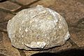
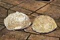 20160507 Fossiler Seeigel, Campan, Coesfelder Berg (05384).jpg 4,912 × 3,264; 6.34 MB
-
 20160507 Fossiler Seeigel, Campan, Coesfelder Berg (05385).jpg 4,912 × 3,264; 5.46 MB
-
 20160507 Fossiler Seeigel, Campan, Coesfelder Berg (05386).jpg 4,912 × 3,264; 5.31 MB
-
 20160507 Fossiler Seeigel, Campan, Coesfelder Berg (05387).jpg 4,912 × 3,264; 6.24 MB
-
 20160507 Fossiler Seeigel, Campan, Coesfelder Berg (05388).jpg 4,912 × 3,264; 6.41 MB
-
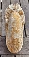
 20160521 Fossile Muschel, Campan, Coesfelder Berg (05392).jpg 4,912 × 3,264; 14.16 MB
-
 20160521 Fossile Muschel, Campan, Coesfelder Berg (05393).jpg 4,912 × 3,264; 11.28 MB
-
 20160521 Fossile Muschel, Campan, Coesfelder Berg (05394).jpg 4,912 × 3,264; 13.21 MB
-
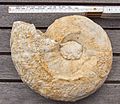
 20160527 Pachydiscus, Campan, Coesfelder Berg (DSC05395).jpg 4,912 × 3,264; 12.61 MB
-
 20160527 Pachydiscus, Campan, Coesfelder Berg (DSC05399).jpg 4,333 × 3,264; 11.34 MB
-
 20160527 Pachydiscus, Campan, Coesfelder Berg (DSC05400).jpg 2,304 × 4,573; 6.94 MB
-
 20160527 Pachydiscus, Campan, Coesfelder Berg (DSC05402).jpg 2,238 × 4,664; 7.08 MB
-
 20160527 Pachydiscus, Campan, Coesfelder Berg (DSC05410).jpg 4,912 × 3,264; 12.93 MB
-
 20160527 Pachydiscus, Campan, Coesfelder Berg (DSC05412).jpg 3,653 × 3,179; 8.14 MB
-
 20160527 Pachydiscus, Campan, Coesfelder Berg (DSC05413).jpg 4,846 × 2,891; 10.69 MB
-
 20160527 Pachydiscus, Campan, Coesfelder Berg (DSC05414).jpg 4,678 × 3,062; 10.76 MB
-
 20160527 Pachydiscus, Campan, Coesfelder Berg (DSC05415).jpg 4,546 × 3,140; 11.46 MB
-
 20160527 Pachydiscus, Campan, Coesfelder Berg (DSC05419).jpg 4,760 × 2,868; 10.41 MB
-
 2017-01-21 3 Linden Marsberg-Meerhof (NRW) 01.jpg 2,664 × 2,504; 5.46 MB
-
 2017-01-21 3 Linden Marsberg-Meerhof (NRW) 02.jpg 4,000 × 2,664; 7.43 MB
-
 2017-01-21 3 Linden Marsberg-Meerhof (NRW) 03.jpg 4,032 × 3,024; 12.03 MB
-
 2017-01-21 ND Mehrstämmige Linde Meerhof (NRW) 01.jpg 2,664 × 3,196; 7.09 MB
-
 2017-01-21 ND Mehrstämmige Linde Meerhof (NRW) 02.jpg 2,664 × 4,000; 10.03 MB
-
 2017-01-21 ND Mehrstämmige Linde Meerhof (NRW) 03.jpg 2,664 × 4,000; 10.03 MB
-
 2017-01-21 ND Mehrstämmige Linde Meerhof (NRW) 04.jpg 2,329 × 3,494; 7.97 MB
-
 2017-02-11 Blutbuche, Riemelsbeck 72 Mülheim an der Ruhr.jpg 2,664 × 4,000; 8.68 MB
-
 2017-02-11 Blutbuche, Riemelsbeck 80, Mülheim an der Ruhr.jpg 2,998 × 4,018; 11.33 MB
-
 2017-02-11 Esskastanien, Mendener Str 218 Mülheim an der Ruhr.jpg 4,000 × 2,664; 8.01 MB
-
 2017-02-11 ND27 Blutbuche Essen-Haarzopf 01.jpg 2,664 × 4,000; 7.76 MB
-
 2017-02-11 ND27 Blutbuche Essen-Haarzopf 02.jpg 2,664 × 4,000; 6.94 MB
-
 2017-02-11 Rosskastanien, Mendener Str 191 Mülheim an der Ruhr.jpg 4,000 × 2,664; 9.69 MB
-
 2017-02-12 ND68 Rotbuchen Essen-Bredeney.jpg 2,421 × 3,826; 9.92 MB
-
 2017-03-13 ND 77 Findling Essen-Kettwig.jpg 4,000 × 2,664; 4.55 MB
-
 2017-03-15 ND 34 Sumpfzypressen Essen-AltenessenSüd 01.jpg 2,664 × 4,000; 9.15 MB
-
 2017-03-15 ND 34 Sumpfzypressen Essen-AltenessenSüd 02.jpg 2,664 × 4,000; 9.52 MB
-
 2017-03-22 Bochum ND 2.10 Marone 01.jpg 2,664 × 4,000; 7.05 MB
-
 2017-03-22 Bochum ND 2.10 Marone 02.jpg 2,664 × 4,000; 9.98 MB
-
 2017-03-22 Bochum ND 2.11 Winterlinde am "Haarmanns Hof".jpg 4,000 × 2,664; 4.51 MB
-
 2017-03-22 Bochum ND 2.8 3Maroni 01.jpg 2,228 × 2,832; 5.9 MB
-
 2017-03-22 Bochum ND 2.8 3Maroni 02.jpg 2,664 × 4,000; 10.5 MB
-
 2017-03-22 Bochum ND 2.9 Edelkastanie 01.jpg 1,786 × 2,679; 7.2 MB
-
 2017-03-22 Bochum ND 2.9 Edelkastanie 02.jpg 2,099 × 3,312; 8.28 MB
-
 2017-03-23 ND Esskastanie Hof Osterfeld Mülheim an der Ruhr.jpg 2,304 × 2,664; 6.26 MB
-
 2017-03-26 ND29 Bergahorn Essen-Schönebeck.jpg 2,664 × 4,000; 8.57 MB
-
 2017-04-23 ND 85 Zeder Essen-Werden.jpg 3,272 × 2,584; 6.64 MB
-
 2017-04-23 ND44 Platane BochumerStr.50 02.jpg 1,360 × 2,048; 2.26 MB
-
 2017-04-23 ND85 Zeder Essen-Werden.jpg 1,746 × 1,360; 2.25 MB
-
 2017-04-30 2 Edelkastanien -ND14 Hamminkeln (NRW).jpg 4,000 × 2,664; 8.55 MB
-
 2017-04-30 Marone ND 15 Hamminkeln (NRW) 01.jpg 2,664 × 4,000; 11.33 MB
-
 2017-04-30 Marone ND 15 Hamminkeln (NRW) 02.jpg 2,664 × 4,000; 8.27 MB
-
 2017-05-20 Naturdenkmal-Rotbuchen-Reihe MarkusKev Muelheim-Ruhr.jpg 3,936 × 2,624; 12.07 MB
-
 2017-05-25 Elmpt IMG 4739n.jpg 5,472 × 3,648; 15 MB
-
 2017-05-Anrath-Bouton d'or.jpg 4,608 × 3,456; 5.89 MB
-
 2017-05-Anrath-Niers.jpg 3,250 × 4,338; 4.42 MB
-
 20170122 Kuhlenvenn, Hochmoor, Gescher (07605).jpg 4,912 × 3,264; 15.65 MB
-
 20170122 Kuhlenvenn, Hochmoor, Gescher (07607).jpg 4,912 × 3,264; 8.2 MB
-
 20170122 Kuhlenvenn, Hochmoor, Gescher (07609).jpg 4,912 × 3,264; 7.37 MB
-
 20170122 Kuhlenvenn, Hochmoor, Gescher (07615).jpg 3,264 × 4,912; 8.83 MB
-
 20170122 NSG Heidesee, Coesfeld (07574).jpg 4,912 × 3,264; 7.25 MB
-
 20170122 NSG Heidesee, Coesfeld (07576).jpg 4,912 × 3,264; 10.39 MB
-
 20170122 NSG Heidesee, Coesfeld (07580).jpg 4,912 × 3,264; 6.83 MB
-
 20170409 Belemnit, Campan, Coesfelder Berg (07766).jpg 4,912 × 3,264; 7.58 MB
-
 20170409 Belemnit, Campan, Coesfelder Berg (07769).jpg 4,912 × 3,264; 6.98 MB
-
 20170409 Druse, Coesfelder Berg.jpg 4,912 × 3,264; 12.14 MB
-
 20170409 Fossile Koralle, Campan, Coesfelder Berg (07751).jpg 4,912 × 3,264; 16.25 MB
-
 20170409 Fossile Koralle, Campan, Coesfelder Berg (07752).jpg 4,912 × 3,264; 17.05 MB
-
 20170409 Fossile Koralle, Campan, Coesfelder Berg (07763).jpg 3,264 × 4,912; 15.12 MB
-
 20170409 Fossile Muschel, Campan, Coesfelder Berg (07753).jpg 4,912 × 3,264; 11.1 MB
-
 20170409 Fossile Muschel, Campan, Coesfelder Berg (07754).jpg 4,912 × 3,264; 7.74 MB
-
 20170409 Fossile Muschel, Campan, Coesfelder Berg (07756).jpg 4,912 × 3,264; 10.49 MB
-
 20170409 Fossile Muschel, Campan, Coesfelder Berg (07757).jpg 4,912 × 3,264; 11.28 MB
-
 20170409 Fossile Muschel, Campan, Coesfelder Berg (07759).jpg 4,912 × 3,264; 10.51 MB
-
 20170409 Fossile Muschel, Campan, Coesfelder Berg (07764).jpg 4,912 × 3,264; 12.17 MB
-
 20170409 Fossile Muschel, Campan, Coesfelder Berg (07786).jpg 4,912 × 3,264; 10.22 MB
-
 20170409 Fossile Muschel, Campan, Coesfelder Berg (07787).jpg 4,912 × 3,264; 12.07 MB
-
 20170409 Fossiler Schwamm, Campan, Coesfelder Berg (07784).jpg 4,912 × 3,264; 11.76 MB
-
 20170409 Fossiler Schwamm, Campan, Coesfelder Berg (07788).jpg 4,912 × 3,264; 11.61 MB
-
 20170409 Fossiler Schwamm, Campan, Coesfelder Berg (07789).jpg 4,076 × 2,717; 6.36 MB
-
 20170409 Fossiler Schwamm, Campan, Coesfelder Berg (07790).jpg 4,912 × 3,264; 10.62 MB
-
 20170409 Fossiler Schwamm, Campan, Coesfelder Berg (07791).jpg 3,264 × 4,912; 13.46 MB
-
 3 Eichen Bentruperheiderweg Bielefeld- Heepen.jpg 3,264 × 4,912; 5.99 MB
-
 3Pilze.jpg 4,608 × 3,456; 7.37 MB
-
 Aachener Wald 2.jpg 4,473 × 3,355; 12.99 MB
-
 Aachener Wald.jpg 4,559 × 3,419; 14.25 MB
-
 Aachener Weiher Köln.jpg 3,264 × 2,448; 1.97 MB
-
 Abendstimmung Hinsbecker Bruch.jpg 2,000 × 1,330; 2.29 MB
-
 Abendstunden in Rosé.jpg 2,592 × 1,936; 1.23 MB
-
 Aber nicht unberührt.jpg 4,000 × 3,000; 5.59 MB
-
 Abtei Mariawald in der Eifel nahe Heimbach.jpg 3,072 × 2,304; 3.79 MB
-
 Aglais io am Stöckheimer See.png 964 × 539; 1.31 MB
-
 Alpen (Nrh) - LSG Mühlohlsley 01.jpg 4,608 × 3,456; 5.21 MB
-
 Alpen (Nrh) - LSG Mühlohlsley 02.jpg 4,608 × 3,456; 7.02 MB
-
 Alpen (Nrh) - Wiese Die Huf - Alpen.jpg 4,608 × 2,592; 2.9 MB
-
 Alpen (Nrh) - Wiese Die Huf - Bönninghardt.jpg 4,608 × 2,592; 2.75 MB
-
 Alpen (Nrh) Bönninghardt-Bönninghardter Windmühle 01.jpg 4,608 × 3,456; 4.93 MB
-
 Alpen (Nrh) Bönninghardt-Bönninghardter Windmühle 02.jpg 3,456 × 4,608; 6.09 MB
-
 Alpen (Nrh) Bönninghardt-Höhenweg 01.jpg 4,608 × 3,456; 5.38 MB
-
 Alpen (Nrh) Bönninghardt-Höhenweg 02.jpg 3,456 × 4,608; 6.9 MB
-
 Alpen (Nrh) Bönninghardt-Junggesellen Lounge am Römerlager.jpg 4,608 × 3,456; 6.64 MB
-
 Alpen (Nrh) Bönninghardt-Waldrand.jpg 4,608 × 2,592; 4.54 MB
-
 Alsmicke.jpg 2,988 × 5,312; 5.99 MB
-
 Alte Container auf dem Grubengelände.jpg 3,000 × 4,000; 4.33 MB
-
 Alte Hoflinde.jpg 3,216 × 4,288; 2.96 MB
-
 Alte Kastanie, krank,Meyer zu Bentrup, Mühlengelände in Heepen, Bielefeld, Windwehe.jpg 3,264 × 4,912; 7.51 MB
-
 Altenbeken - 2016-05-29 - Hammerlinde (01).jpg 2,800 × 4,000; 7.84 MB
-
 Altenbeken - 2016-05-29 - Hammerlinde (04).jpg 2,872 × 4,000; 7.11 MB
-
 Altenbeken - 2016-05-29 - NSG Stollen am Viadukt (1).jpg 4,000 × 2,667; 9.81 MB
-
 Altenbeken - 2016-05-29 - NSG Stollen am Viadukt (16).jpg 4,000 × 2,667; 5.21 MB
-
 Altenbeken - 2016-05-29 - NSG Stollen am Viadukt (19).jpg 4,000 × 2,667; 10.25 MB
-
 Altenbeken - 2016-05-29 - NSG Stollen am Viadukt (2).jpg 4,000 × 2,667; 10.54 MB
-
 Altenbeken - 2016-05-29 - NSG Stollen am Viadukt (22).jpg 4,000 × 2,667; 10.76 MB
-
 Altenbeken - 2016-05-29 - NSG Stollen am Viadukt (23).jpg 4,000 × 2,667; 10.5 MB
-
 Altenbeken - 2016-05-29 - NSG Stollen am Viadukt (25).jpg 4,000 × 2,667; 9.62 MB
-
 Altenbeken - 2016-05-29 - NSG Stollen am Viadukt (27).jpg 2,667 × 4,000; 9.81 MB
-
 Altenbeken - 2016-05-29 - NSG Stollen am Viadukt (4).jpg 4,000 × 2,667; 7.39 MB
-
 Altenbeken - 2016-05-29 - NSG Stollen am Viadukt (9).jpg 4,000 × 2,667; 5.22 MB
-
 Altenbeken - 2017-02-22 - NSG Stollen am Viadukt (1).jpg 2,667 × 4,000; 10.66 MB
-
 Altenbeken - 2017-02-22 - NSG Stollen am Viadukt (2).jpg 4,000 × 2,667; 9.08 MB
-
 Altenbeken - 2017-02-22 - NSG Stollen am Viadukt (6).jpg 4,000 × 2,667; 8.97 MB
-
 Altenbeken - 2017-02-22 - NSG Stollen am Viadukt (7).jpg 4,000 × 2,667; 11.28 MB
-
 Altenbeken - 2017-04-22 - LSG-4219-0002 (1).jpg 4,000 × 2,667; 10.42 MB
-
 Altenbeken - 2017-04-22 - LSG-4219-0002 (2).jpg 4,000 × 2,667; 6.45 MB
-
 Altenbeken - 2017-05-06 - Füllenberg (04).jpg 4,000 × 2,667; 11.2 MB
-
 Altenbeken - 2017-05-06 - Füllenberg (05).jpg 4,000 × 2,667; 11.01 MB
-
 Altenbeken - 2017-05-06 - Füllenberg (06).jpg 4,000 × 2,667; 11.07 MB
-
 Altenbeken - 2017-05-06 - Füllenberg (08).jpg 4,000 × 2,667; 10.48 MB


_01.jpg)
_02.jpg)


.jpg)
.jpg)
.jpg)
.jpg)


_(freddy2001).jpg)
_(freddy2001).jpg)


.jpg)
.jpg)
.jpg)
.jpg)
.jpg)
.jpg)
.jpg)
.jpg)
.jpg)
.jpg)
.jpg)
.jpg)
.jpg)
.jpg)
.jpg)
.jpg)
.jpg)
.jpg)
.jpg)
.jpg)
.jpg)
.jpg)
_01.jpg)
_02.jpg)
_03.jpg)
_01.jpg)
_02.jpg)
_03.jpg)
_04.jpg)


.jpg)
_01.jpg)
_02.jpg)


.jpg)
.jpg)
.jpg)
.jpg)
.jpg)
.jpg)
.jpg)
.jpg)
.jpg)

.jpg)
.jpg)
.jpg)
.jpg)
.jpg)
.jpg)
.jpg)
.jpg)
.jpg)
.jpg)
.jpg)
.jpg)
.jpg)
.jpg)
.jpg)
.jpg)


_-_LSG_M%C3%BChlohlsley_01.jpg)
_-_LSG_M%C3%BChlohlsley_02.jpg)
_-_Wiese_Die_Huf_-_Alpen.jpg)
_-_Wiese_Die_Huf_-_B%C3%B6nninghardt.jpg)
_B%C3%B6nninghardt-B%C3%B6nninghardter_Windm%C3%BChle_01.jpg)
_B%C3%B6nninghardt-B%C3%B6nninghardter_Windm%C3%BChle_02.jpg)
_B%C3%B6nninghardt-H%C3%B6henweg_01.jpg)
_B%C3%B6nninghardt-H%C3%B6henweg_02.jpg)
_B%C3%B6nninghardt-Junggesellen_Lounge_am_R%C3%B6merlager.jpg)
_B%C3%B6nninghardt-Waldrand.jpg)


.jpg)
.jpg)
.jpg)
.jpg)
.jpg)
.jpg)
.jpg)
.jpg)
.jpg)
.jpg)
.jpg)
.jpg)
.jpg)
.jpg)
.jpg)
.jpg)
.jpg)
.jpg)
.jpg)
.jpg)
.jpg)
.jpg)