File:1998 Ice Storm map.png
Jump to navigation
Jump to search
Size of this preview: 800 × 412 pixels. Other resolutions: 320 × 165 pixels | 640 × 329 pixels | 1,024 × 527 pixels | 1,500 × 772 pixels.
Original file (1,500 × 772 pixels, file size: 519 KB, MIME type: image/png)
Captions
Captions
Add a one-line explanation of what this file represents
Summary
[edit]
| Description |
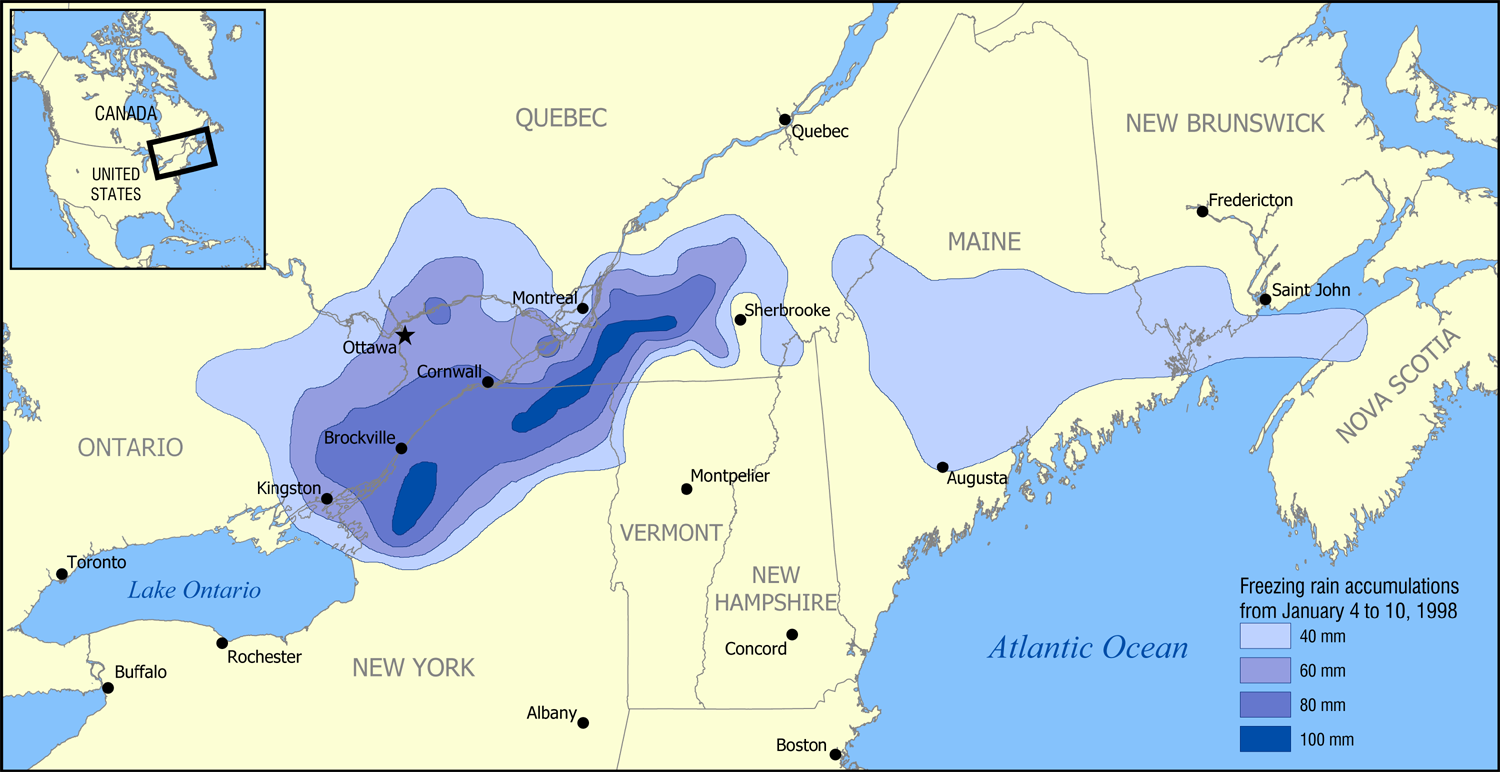
English: A map showing the extent of the January 1998 North American ice storm that affected eastern Ontario, southwest Quebec, New Brunswick, and parts of New York, Vermont, New Hampshire, and Maine. The map shows the accumulation of ice in millimetres from January 4 to January 10, 1998. Increments shown are 40 mm (1.6 in), 60 mm (2.4 in), 80 mm (3.1 in), and 100 mm (3.9 in). |
| Date | |
| Source | Based on data from Environment Canada. |
| Author | NormanEinstein |
I, the copyright holder of this work, hereby publish it under the following licenses:

|
Permission is granted to copy, distribute and/or modify this document under the terms of the GNU Free Documentation License, Version 1.2 or any later version published by the Free Software Foundation; with no Invariant Sections, no Front-Cover Texts, and no Back-Cover Texts. A copy of the license is included in the section entitled GNU Free Documentation License. |
| This file is licensed under the Creative Commons Attribution-Share Alike 3.0 Unported license. | ||
| ||
| This licensing tag was added to this file as part of the GFDL licensing update. |
You may select the license of your choice.
| Annotations | This image is annotated: View the annotations at Commons |
File history
Click on a date/time to view the file as it appeared at that time.
| Date/Time | Thumbnail | Dimensions | User | Comment | |
|---|---|---|---|---|---|
| current | 17:52, 30 January 2006 | | 1,500 × 772 (519 KB) | NormanEinstein (talk | contribs) | A map showing the extent of the 1998 Ice Storm that affected eastern Ontario, southwest Quebec, New Brunswick, and parts of New York, Vermont, New Hampshire, and Maine. The map shows the accumulation of ice in millimetres from January 4 to January 10, 19 |
You cannot overwrite this file.
File usage on Commons
The following page uses this file:
File usage on other wikis
The following other wikis use this file:
- Usage on ca.wikipedia.org
- Usage on de.wikipedia.org
- Usage on en.wikipedia.org
- Usage on es.wikipedia.org
- Usage on fr.wikipedia.org
- Usage on hr.wikipedia.org
- Usage on ja.wikipedia.org
- Usage on pl.wikipedia.org
- Usage on ru.wikipedia.org
- Usage on sh.wikipedia.org
- Usage on www.wikidata.org