File:1937 Kiev map.png
Jump to navigation
Jump to search
Size of this preview: 710 × 599 pixels. Other resolutions: 284 × 240 pixels | 569 × 480 pixels | 910 × 768 pixels | 1,213 × 1,024 pixels | 2,426 × 2,048 pixels | 3,000 × 2,533 pixels.
Original file (3,000 × 2,533 pixels, file size: 6.22 MB, MIME type: image/png)
Captions
Captions
Add a one-line explanation of what this file represents
Summary
[edit]
| Description |
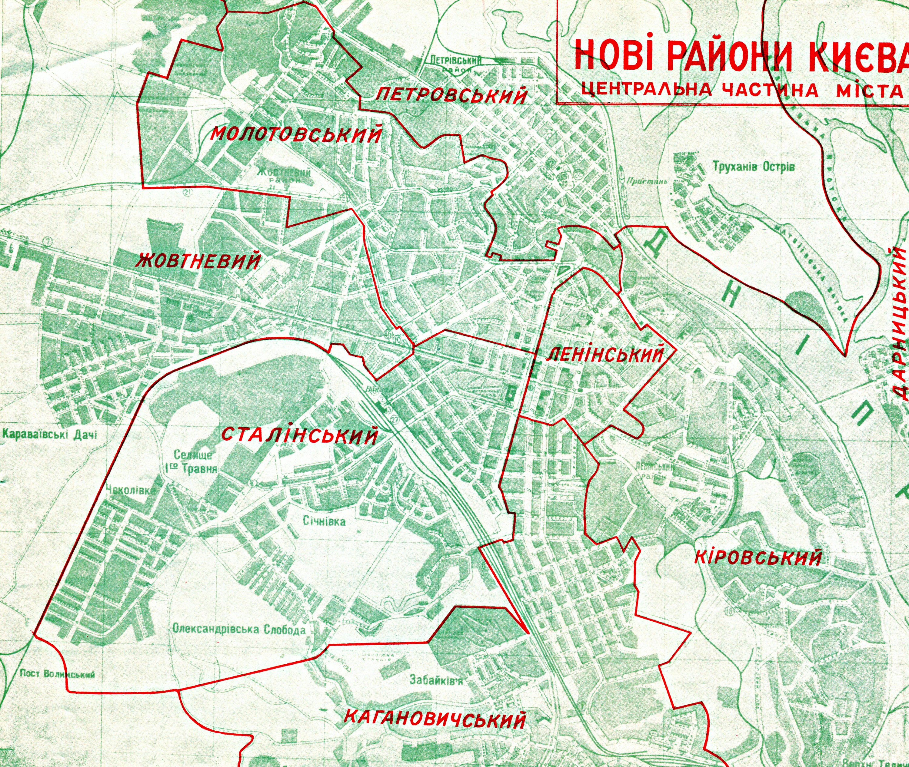
Русский: Административное-территориальное деление Киева по состоянию на 1937 год Українська: Адміністративно-територіальний поділ Києва станом на 1937 рік |
| Date | |
| Source | http://www.kievograd.org/maps/1937-rayony.png |
| Author | Unknown author |
Licensing
[edit]
|
This work is in the public domain in its country of origin and other countries and areas where the copyright term is the author's life plus 70 years or fewer. | |
| This file has been identified as being free of known restrictions under copyright law, including all related and neighboring rights. | |
File history
Click on a date/time to view the file as it appeared at that time.
| Date/Time | Thumbnail | Dimensions | User | Comment | |
|---|---|---|---|---|---|
| current | 15:50, 8 June 2015 | | 3,000 × 2,533 (6.22 MB) | AMY 81-412 (talk | contribs) | =={{int:filedesc}}== {{Information |Description={{ru|1=Административное-территориальное деление Киева по состоянию на 1937 год}}{{uk|1=Адміністративно-територіальни... |
You cannot overwrite this file.
File usage on Commons
There are no pages that use this file.
File usage on other wikis
The following other wikis use this file:
- Usage on de.wikipedia.org
- Usage on en.wikipedia.org
- Usage on fr.wikipedia.org
- Usage on uk.wikipedia.org