Category:Old maps of Kyiv
Jump to navigation
Jump to search
Subcategories
This category has the following 3 subcategories, out of 3 total.
Media in category "Old maps of Kyiv"
The following 93 files are in this category, out of 93 total.
-
 1674 План печер Гизеля (редакція Закревського).jpg 4,723 × 3,066; 13 MB
-
 1674 Храм Різдва Богородиці план Гизеля.jpg 836 × 591; 595 KB
-
 1674 Хрестовоздвижен церк план Гизеля.jpg 1,043 × 591; 797 KB
-
 1674 Хрестовоздвиженська церк план Гизеля.jpg 1,932 × 591; 1.41 MB
-
 Sandrart, Jakob von - Kiovia (Kyiv).jpg 1,525 × 904; 634 KB
-
 1780 Plan of Kyiv (Krepostey).png 4,500 × 2,518; 9.22 MB
-
 1780s map of Kyiv.jpg 3,662 × 1,890; 3.78 MB
-
 1780і План Києва.jpg 4,724 × 2,128; 5.17 MB
-
 1787 План фортець.jpg 5,906 × 2,964; 10.39 MB
-
 1800 Pechersk.jpg 1,236 × 888; 1.1 MB
-
 1833 План Києва.jpg 3,937 × 2,060; 4.48 MB
-
 1872-год-План-застройки-Щекавицы.jpg 615 × 700; 112 KB
-
 1879 План Києва.jpg 10,721 × 7,323; 29.88 MB
-
 1890-zverinec.jpg 502 × 600; 124 KB
-
 Kijew - 48-50.jpg 3,258 × 5,005; 2.65 MB
-
 Kiev-map-1894-1.jpg 2,691 × 1,846; 1.04 MB
-
 1900-map.jpg 2,500 × 1,960; 1.21 MB
-
 Map of the Kiev tram (1902).jpg 1,680 × 2,421; 901 KB
-
 Map of the Kiev tram (1918).jpg 4,096 × 2,780; 2.78 MB
-
 1913-KievTramMap.jpg 3,172 × 2,476; 1.72 MB
-
 1913 План Києва.jpg 4,134 × 3,045; 10.28 MB
-
 1937 Kiev map.png 3,000 × 2,533; 6.22 MB
-
 Basilianer klastor volswyn.jpg 881 × 647; 300 KB
-
 AFRE Kyev.jpg 4,061 × 3,594; 3.13 MB
-
 Bilychi map 1842.jpg 1,248 × 1,173; 993 KB
-
 Brockhaus and Efron Encyclopedic Dictionary b29 272-0.jpg 1,757 × 2,777; 1.46 MB
-
 Kalnofoysky Athanasius Teraturgema, 1638 Kyiv.jpg 862 × 1,221; 823 KB
-
 Kalnofoysky Athanasius Teraturgema, 1638 Lavra.jpg 831 × 1,024; 762 KB
-
 Kiovia 1687 Nuremburg by Jacob Von Sandrart.jpg 960 × 534; 112 KB
-
 Kiow map by Melenskyi (General plan) 1803 (detail, Nanny-goat bog).png 524 × 530; 247 KB
-
 Kiow map by Melenskyi (General plan) 1803.png 7,000 × 5,609; 32.48 MB
-
 Kiow, by Jan Jansson, circa 1663.jpg 608 × 512; 230 KB
-
 Kyev Zakrvsky map 01.png 3,660 × 2,322; 19.41 MB
-
 Kyev Zakrvsky map 02.png 3,703 × 2,371; 19.33 MB
-
 Kyev Zakrvsky map 03.png 3,675 × 2,314; 19.33 MB
-
 Kyev Zakrvsky map 04.png 3,761 × 2,390; 19.62 MB
-
 Kyev Zakrvsky map 05.png 2,291 × 3,325; 18.17 MB
-
 Kyiv 1919 census division.JPG 1,080 × 1,902; 317 KB
-
 Kyiv map 1842.jpg 5,445 × 4,083; 9.68 MB
-
 Kyiv Pechery Kalnofoysky Athanasius Teraturgema, 1638.jpg 1,924 × 2,429; 3.25 MB
-
 Kyiv plan 1787.png 1,423 × 762; 1.54 MB
-
 Kyiv-map-1850.jpg 2,000 × 3,058; 1.57 MB
-
 Map of the Kiev tram (1911).jpg 4,096 × 3,205; 2.47 MB
-
 Map of the Kiev tram (1914).jpg 4,096 × 3,174; 1.79 MB
-
 Near Caves (Pechersk Lavra) Plan (1638).jpg 397 × 558; 77 KB
-
 Old map of Kyiv (cropped).jpg 8,562 × 5,715; 2.58 MB
-
 Old map of Kyiv.jpg 8,585 × 6,300; 2.89 MB
-
 Pre-1811 map of Podil (Kyiv) - cropped.svg 463 × 537; 1.75 MB
-
 Pre-fire-podol.jpg 1,700 × 1,352; 1.29 MB
-

-
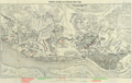
 Street map of central Kiev. LOC 79693429.jpg 12,912 × 10,463; 9.9 MB
-
 Street map of central Kiev. LOC 79693429.tif 12,912 × 10,463; 386.52 MB
-
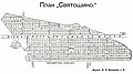 Sviatoshyn 1909.jpg 5,315 × 2,953; 9.22 MB
-
 XVIII-Kyiv.jpg 842 × 651; 229 KB
-
 Zakrvsky 's map of Kyiv during the 18th century, annotated.png 3,761 × 2,390; 22.21 MB
-
 Біличі 1842. Карта орієнтована на північ.jpg 841 × 809; 341 KB
-
 Бондаренківська 1935.jpg 481 × 272; 66 KB
-
 Генплан Києва 1936.jpg 1,413 × 1,181; 513 KB
-
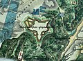
 Дача Кинь-Грусть.jpg 804 × 564; 209 KB
-
 Западинка - фрагмент мапи 1912 р.jpg 1,308 × 814; 432 KB
-
 Звіринецьке укріплення 1830.jpg 1,172 × 858; 626 KB
-
 Київ, Вишгород і Гостомель.png 439 × 658; 585 KB
-
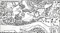
 Київська облога 1658 (Скавищизна) за І. Бабуліним.jpg 823 × 1,053; 264 KB
-
 Киевский институт благородных девиц.jpg 2,339 × 1,517; 1.96 MB
-
 Костел святого Миколая, розташування (1803).png 997 × 696; 1.2 MB
-
 Мапа Києва, 1880 р. (фрагмент з Юрковицею).png 1,489 × 833; 1.7 MB
-
 Мапа Києва, 1880 р. (Юрковиця).png 5,000 × 3,236; 22.83 MB
-
 Мапа Києва, 1880 р. 01.png 5,000 × 3,236; 13.32 MB
-
 Мапа Києва.jpg 3,529 × 2,629; 4.89 MB
-
 План города Киева (1820 г., М. Берлинский) з позначенням беремищ.png 1,800 × 1,129; 1.97 MB
-
 План города Киева (1820 г., М. Берлинский).png 1,800 × 1,129; 1.93 MB
-
 План київських печер.jpeg 718 × 960; 143 KB
-
 План Подолу Меленського 1803.jpg 1,378 × 1,227; 1.88 MB
-
 План Подолу Меленського 1812.jpg 1,378 × 798; 635 KB
-
-

-

-

-
 Почайна - река Иорданская и озеро Пичаня на карте 1890 г.jpg 3,928 × 2,506; 878 KB
-
 Провалля (фрагмент мапи 1894).jpg 851 × 591; 383 KB
-

-
 Старий Київ.jpg 1,216 × 1,088; 411 KB
-
 Старокиївська фортеця 1800 (фрагмент).jpg 984 × 939; 988 KB
-
 Схема кварталу 116 на Подолі (1836).jpg 787 × 456; 205 KB
-
 Топографічний план Києва 1925 р.jpg 2,018 × 2,362; 2.03 MB
-
 Фрагмент карти Києва 1897-1918.jpg 950 × 942; 544 KB
-

-
 Фрагмент Подола на Проектном плане по отклонению Днепра от Чертороя.png 577 × 353; 564 KB
-
 Хотівське городище - Антонович, 1879, схема 1.png 1,032 × 264; 233 KB
-
 Хотівське городище - Антонович, 1879, схема 2.png 596 × 224; 124 KB
-
 Хотівське городище - Антонович, 1879.png 1,212 × 668; 951 KB
-
 Хотівське городище, 1842.png 516 × 388; 442 KB
-
 Хрещатик план 1909.jpg 5,236 × 2,435; 5.09 MB
.jpg)


.jpg)
.png)


.jpg)
.jpg)


_1803_(detail,_Nanny-goat_bog).png)
_1803.png)


.jpg)
.jpg)
_Plan_(1638).jpg)
.jpg)

_-_cropped.svg)

_(14578809497).jpg)


_%D0%B7%D0%B0_%D0%86._%D0%91%D0%B0%D0%B1%D1%83%D0%BB%D1%96%D0%BD%D0%B8%D0%BC.jpg)

.png)
.png)
.png)


_%D0%B7_%D0%BF%D0%BE%D0%B7%D0%BD%D0%B0%D1%87%D0%B5%D0%BD%D0%BD%D1%8F%D0%BC_%D0%B1%D0%B5%D1%80%D0%B5%D0%BC%D0%B8%D1%89.png)
.png)


._%D0%92%D0%BE%D0%B5%D0%BD%D0%BD%D0%B0%D1%8F_%D1%8D%D0%BD%D1%86%D0%B8%D0%BA%D0%BB%D0%BE%D0%BF%D0%B5%D0%B4%D0%B8%D1%8F_%D0%A1%D1%8B%D1%82%D0%B8%D0%BD%D0%B0_(%D0%A1%D0%B0%D0%BD%D0%BA%D1%82-%D0%9F%D0%B5%D1%82%D0%B5%D1%80%D0%B1%D1%83%D1%80%D0%B3,_1911-1915).jpg)
.jpg)
._%D0%92%D0%BE%D0%B5%D0%BD%D0%BD%D0%B0%D1%8F_%D1%8D%D0%BD%D1%86%D0%B8%D0%BA%D0%BB%D0%BE%D0%BF%D0%B5%D0%B4%D0%B8%D1%8F_%D0%A1%D1%8B%D1%82%D0%B8%D0%BD%D0%B0_(%D0%A1%D0%B0%D0%BD%D0%BA%D1%82-%D0%9F%D0%B5%D1%82%D0%B5%D1%80%D0%B1%D1%83%D1%80%D0%B3,_1911-1915).jpg)
.jpg)

.jpg)


.jpg)
.jpg)


_%D0%B7_%D0%BF%D0%BE%D0%B7%D0%BD%D0%B0%D1%87%D0%B5%D0%BD%D0%BD%D1%8F%D0%BC_%D0%B1%D0%B5%D1%80%D0%B5%D0%BC%D0%B8%D1%89.png)


