File:18th century map of Hjo, Sweden.jpg
Jump to navigation
Jump to search
Size of this preview: 785 × 600 pixels. Other resolutions: 314 × 240 pixels | 628 × 480 pixels | 1,005 × 768 pixels | 1,280 × 978 pixels | 2,560 × 1,956 pixels | 3,922 × 2,997 pixels.
Original file (3,922 × 2,997 pixels, file size: 653 KB, MIME type: image/jpeg)
Captions
Captions
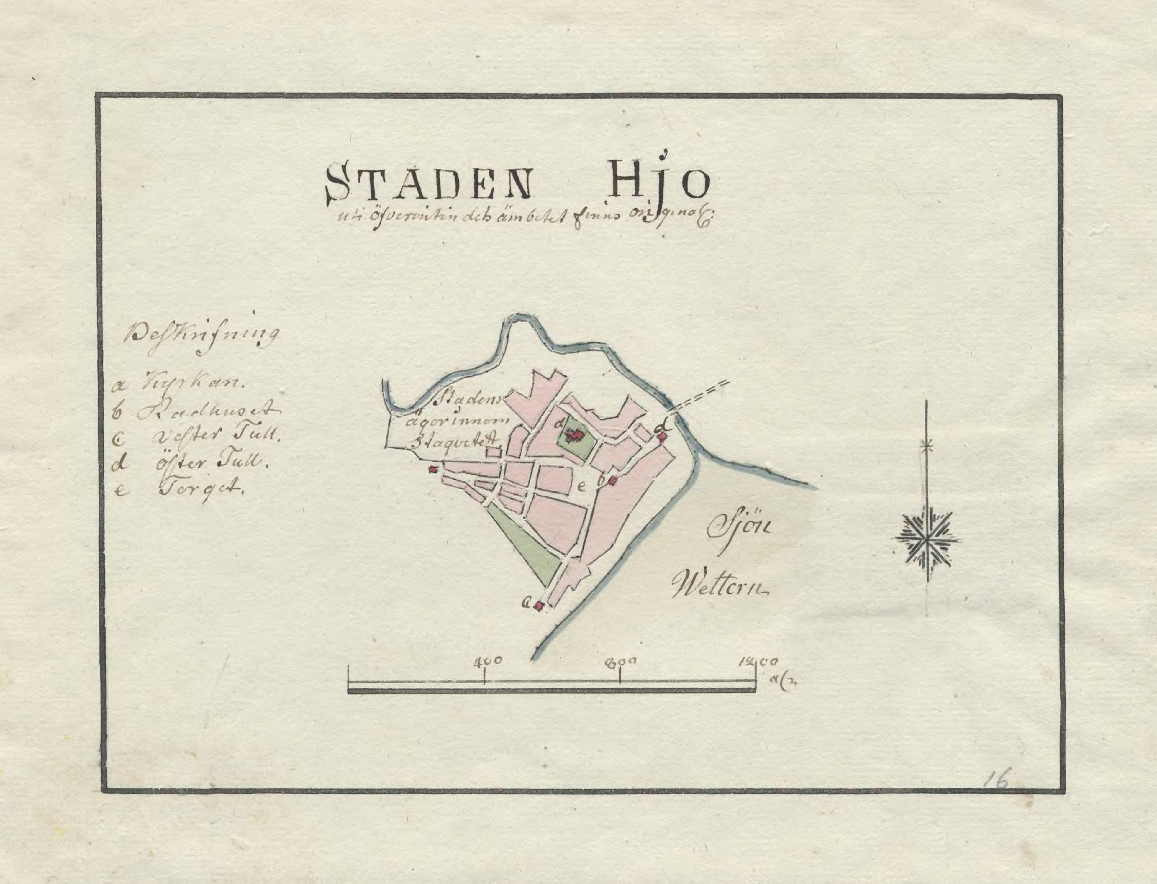
18th century map of Hjo, Sweden
Summary
[edit]| Description |
English: Hand drawn 18th century map of Hjo, Sweden
Ab: Handritad 1700-tals karta över Hjo |
||||||||||||||||||||||||||
| Date | 1790s | ||||||||||||||||||||||||||
| Source |
https://sok.riksarkivet.se/arkiv/asEtElLoSaYfiDe9Fn0Dv3
|
||||||||||||||||||||||||||
| Creator |
Wiblingen, Fredrik Adolf |
||||||||||||||||||||||||||
| Georeferencing | If inappropriate please set warp_status = skip to hide. | ||||||||||||||||||||||||||
| Archival data | |||||||||||||||||||||||||||
| Collection |
|
||||||||||||||||||||||||||


Licensing
[edit]
|
This work is in the public domain in its country of origin and other countries and areas where the copyright term is the author's life plus 70 years or fewer. | |
| This file has been identified as being free of known restrictions under copyright law, including all related and neighboring rights. | |
This work is in the public domain in the United States because it meets three requirements:
For background information, see the explanations on Non-U.S. copyrights.
Note: This tag should not be used for sound recordings. |
File history
Click on a date/time to view the file as it appeared at that time.
| Date/Time | Thumbnail | Dimensions | User | Comment | |
|---|---|---|---|---|---|
| current | 13:37, 8 June 2022 | | 3,922 × 2,997 (653 KB) | Toby Gough (Riksarkivet Sverige) (talk | contribs) | Uploaded a work by Wiblingen, Fredrik Adolf from https://sok.riksarkivet.se/arkiv/asEtElLoSaYfiDe9Fn0Dv3 with UploadWizard |
You cannot overwrite this file.
File usage on Commons
The following page uses this file:
File usage on other wikis
The following other wikis use this file:
- Usage on sv.wikipedia.org
- Usage on www.wikidata.org