File:1892 Hachette Plan or Pocket Map of Paris, France - Geographicus - Paris-hachette-1892.jpg
Jump to navigation
Jump to search

Size of this preview: 714 × 599 pixels. Other resolutions: 286 × 240 pixels | 572 × 480 pixels | 915 × 768 pixels | 1,220 × 1,024 pixels | 2,440 × 2,048 pixels | 6,000 × 5,037 pixels.
Original file (6,000 × 5,037 pixels, file size: 27.71 MB, MIME type: image/jpeg)
Captions
Captions
Add a one-line explanation of what this file represents
Summary
[edit]
| Alexandre Vuillemin: Plan de Paris
( |
|||||||||||||||||||||||
|---|---|---|---|---|---|---|---|---|---|---|---|---|---|---|---|---|---|---|---|---|---|---|---|
| Artist |
Cartographer :
Publisher : Hachette (firm) [1] |
||||||||||||||||||||||
| Title |
Plan de Paris |
||||||||||||||||||||||
| Description |
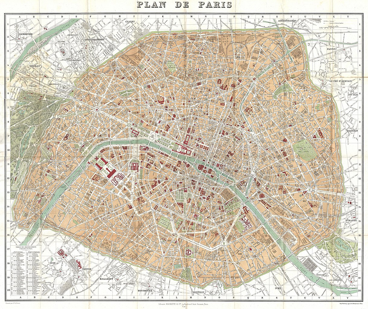
English: This is a large format folding map of Paris dating to 1892. Covers the old walled city of Paris plus surrounding areas from the Bois de Boulogne to the Bois de Vincennes. Names countless important buildings, gardens and streets, including the Eiffel Tower, the Louvre, the Hotel des Invalides, the Jardin des Tuileries, and many other Parisian landmarks. Lithograph color. Prepared by A. Vuillemin for Hachette and Co. of 79 Boulevard Saint Germain, Paris. |
||||||||||||||||||||||
| Date | 1892 (dated) | ||||||||||||||||||||||
| Dimensions | height: 25.5 in (64.7 cm); width: 31 in (78.7 cm) | ||||||||||||||||||||||
| Source/Photographer |
|
||||||||||||||||||||||
Licensing
[edit]
|
This is a faithful photographic reproduction of a two-dimensional, public domain work of art. The work of art itself is in the public domain for the following reason:
The official position taken by the Wikimedia Foundation is that "faithful reproductions of two-dimensional public domain works of art are public domain".
This photographic reproduction is therefore also considered to be in the public domain in the United States. In other jurisdictions, re-use of this content may be restricted; see Reuse of PD-Art photographs for details. | ||||
File history
Click on a date/time to view the file as it appeared at that time.
| Date/Time | Thumbnail | Dimensions | User | Comment | |
|---|---|---|---|---|---|
| current | 11:45, 29 August 2017 | | 6,000 × 5,037 (27.71 MB) | Mélomène (talk | contribs) | Clean some dirty grey areas on the map (river Seine) |
| 03:23, 23 March 2011 |  | 6,000 × 5,037 (9.66 MB) | BotMultichillT (talk | contribs) | {{subst:User:Multichill/Geographicus |link=http://www.geographicus.com/P/AntiqueMap/Paris-hachette-1892 |product_name=1892 Hachette Plan or Pocket Map of Paris, France |map_title=Plan de Paris |description=This is a large format folding map of Paris datin |
You cannot overwrite this file.
File usage on Commons
The following 2 pages use this file:
File usage on other wikis
The following other wikis use this file:
- Usage on fr.wikipedia.org