Category:Maps published by Hachette
Jump to navigation
Jump to search
Media in category "Maps published by Hachette"
The following 12 files are in this category, out of 12 total.
-
1870 Hachette Pocket Map of Paris, France - Geographicus - NouveauParis-hachette-1870.jpg 7,000 × 5,910; 10.41 MB
-
1890 Hachette Map of Antarctica - Geographicus - Antarctica-hachette-1890.jpg 3,500 × 2,711; 2.61 MB
-
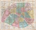
1892 Hachette Plan or Pocket Map of Paris, France - Geographicus - Paris-hachette-1892.jpg 6,000 × 5,037; 27.71 MB
-
1937-Atlantic and Indian oceans.jpg 4,208 × 3,299; 5.57 MB
-
Compassion hachette 1894 wiki.jpg 486 × 526; 369 KB
-
Découvertes maritimes.jpg 2,455 × 1,297; 927 KB
-
Plan de Paris, Hachette 1892 - Rocbo.jpg 6,300 × 5,337; 22.86 MB
-
Rue de Vouillé 1892 Hachette.jpg 979 × 610; 400 KB
-
World, 1492 vs 1904.jpg 2,454 × 895; 578 KB


