File:1886 Dripps Map of Hoboken and Jersey City, New Jersey - Geographicus - HobokenJerseyCity-dripps-1886.jpg
Jump to navigation
Jump to search
Size of this preview: 373 × 599 pixels. Other resolutions: 149 × 240 pixels | 299 × 480 pixels | 478 × 768 pixels | 637 × 1,024 pixels | 1,275 × 2,048 pixels | 3,736 × 6,000 pixels.
Original file (3,736 × 6,000 pixels, file size: 5.16 MB, MIME type: image/jpeg)
Captions
Captions
Add a one-line explanation of what this file represents
| Map of Jersey City and Hoboken Hudson County N. J. | ||||||
|---|---|---|---|---|---|---|
| Artist | ||||||
| Title |
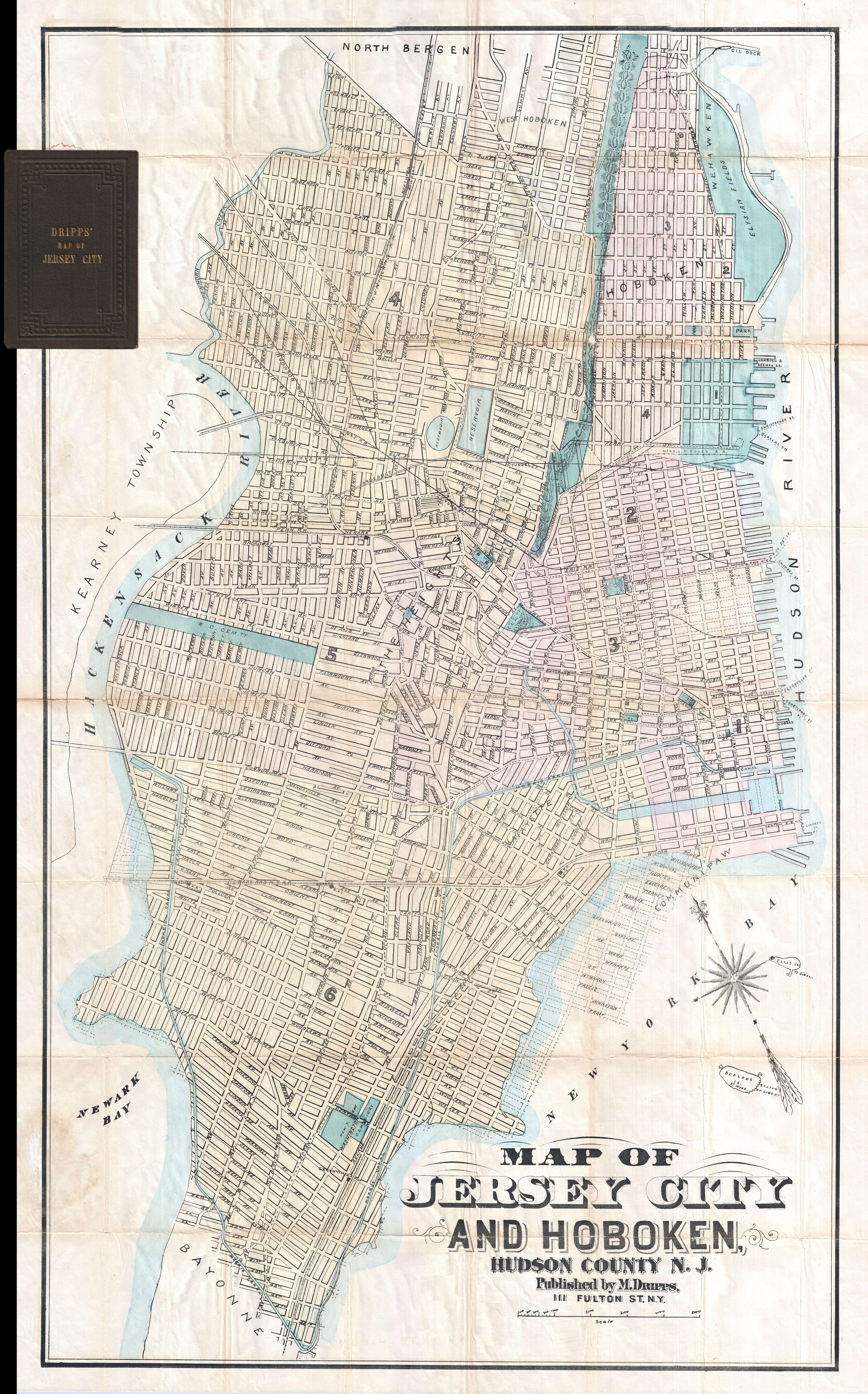
Map of Jersey City and Hoboken Hudson County N. J. |
|||||
| Description |
English: A map of exceeding rarity. This is the only known example of Matthew Dripps' pocket map of Jersey City and Hoboken. While this map is undated, the combination of the map's attribution, printing style, and the inclusion of certain geographic features such as the Statue of Liberty, firmly date it to 1885 - 1887 period. Covers Jersey City and Hoboken from North Bergen and the Elysian Fields of Weehawken south to Bayonne. Bounded on the west by the Hackensack River and on the east by New York Bay and the Hudson River. Identifies various streets, canals, parks, reservoirs, train lines, tunnels, ferry lines, and important public buildings. We have been unable to locate a single example of this map in any major collection or cartobibliography. Published by Matthew Dripps from his 111 Fulton Street office in New York City. |
|||||
| Date | 1886 (undated) | |||||
| Dimensions | height: 36 in (91.4 cm); width: 23 in (58.4 cm) | |||||
| Accession number |
Geographicus link: HobokenJerseyCity-dripps-1886 |
|||||
| Source/Photographer |
|
|||||
| Permission (Reusing this file) |
|
|||||
File history
Click on a date/time to view the file as it appeared at that time.
| Date/Time | Thumbnail | Dimensions | User | Comment | |
|---|---|---|---|---|---|
| current | 15:20, 23 March 2011 | | 3,736 × 6,000 (5.16 MB) | BotMultichillT (talk | contribs) | {{subst:User:Multichill/Geographicus |link=http://www.geographicus.com/P/AntiqueMap/HobokenJerseyCity-dripps-1886 |product_name=1886 Dripps Map of Hoboken and Jersey City, New Jersey |map_title=Map of Jersey City and Hoboken Hudson County N. J. |descript |
You cannot overwrite this file.
File usage on Commons
The following page uses this file:
File usage on other wikis
The following other wikis use this file:
- Usage on et.wikipedia.org