File:1873 U.S. Coast Survey Chart or Map of Long Island, New York - Geographicus - LongIsland-uscs-1873.jpg
Jump to navigation
Jump to search

Size of this preview: 800 × 467 pixels. Other resolutions: 320 × 187 pixels | 640 × 374 pixels | 1,024 × 598 pixels | 1,280 × 747 pixels | 2,560 × 1,494 pixels | 4,000 × 2,335 pixels.
Original file (4,000 × 2,335 pixels, file size: 1.67 MB, MIME type: image/jpeg)
Captions
Captions
Add a one-line explanation of what this file represents
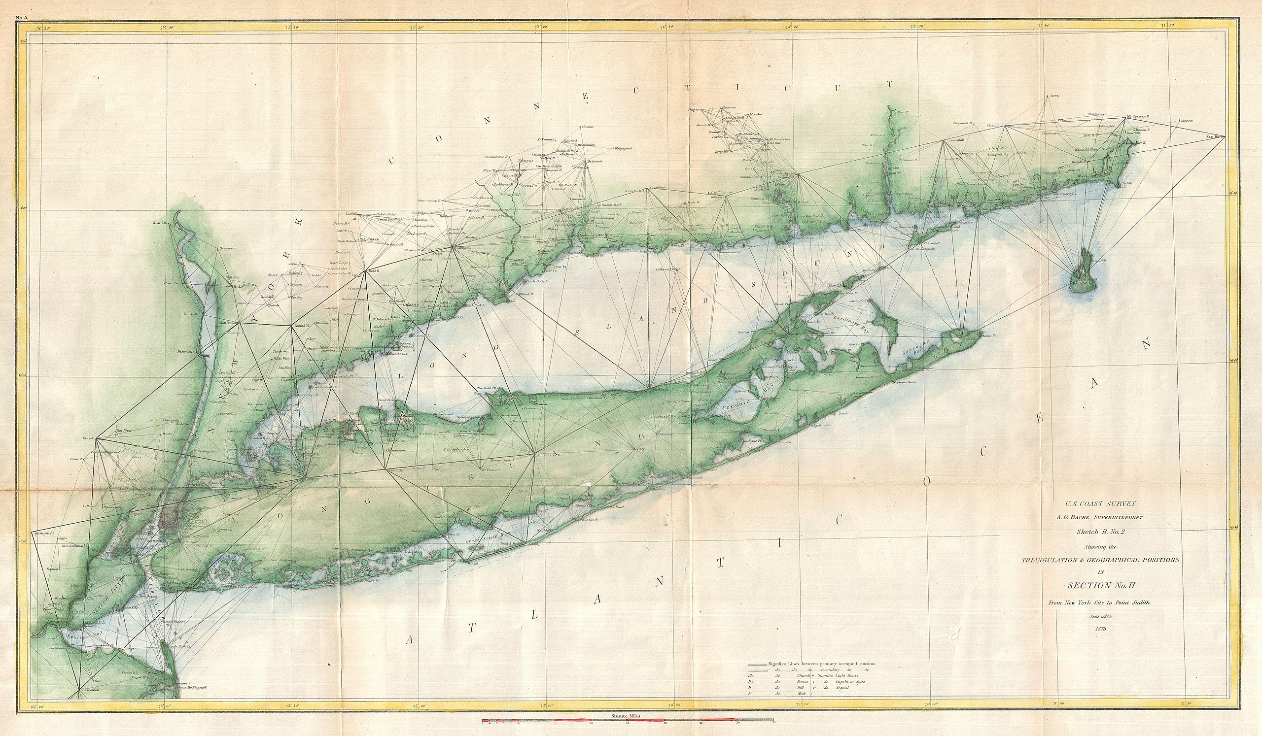
| Sketch B. No. 2 Showing the Triangulation & Geographical Positions in Section No. II From New York City to Point Judith. | ||||||
|---|---|---|---|---|---|---|
| Artist | ||||||
| Title |
Sketch B. No. 2 Showing the Triangulation & Geographical Positions in Section No. II From New York City to Point Judith. |
|||||
| Description |
English: An exceptional example of the 1873 U.S. Coast Survey's progress nautical chart for Long Island, New York. Covers from Staten Island and New York City eastward along Long Island and the coast of Connecticut to Block Island and Point Judith. Shows triangulation points throughout the regions as well as all major islands, rivers, and inlets. Lighthouses, ports, cities, beaches, and other sites noted. Prepared under the supervision of A. D. Bache and Benjamin Peirce for the 1873 Superintendent's Report . |
|||||
| Date | 1873 (dated) | |||||
| Dimensions | height: 16 in (40.6 cm); width: 27 in (68.5 cm) | |||||
| Accession number |
Geographicus link: LongIsland-uscs-1873 |
|||||
| Source/Photographer |
Report of the Superintendant of the United States Coast Survey, Washington, (1873 edition).
|
|||||
| Permission (Reusing this file) |
|
|||||
File history
Click on a date/time to view the file as it appeared at that time.
| Date/Time | Thumbnail | Dimensions | User | Comment | |
|---|---|---|---|---|---|
| current | 14:54, 24 March 2011 | | 4,000 × 2,335 (1.67 MB) | BotMultichillT (talk | contribs) | {{subst:User:Multichill/Geographicus |link=http://www.geographicus.com/P/AntiqueMap/LongIsland-uscs-1873 |product_name=1873 U.S. Coast Survey Chart or Map of Long Island, New York |map_title=Sketch B. No. 2 Showing the Triangulation & Geographical Positio |
You cannot overwrite this file.
File usage on Commons
The following page uses this file: