File:1855 Colton Map of Argentina, Chile, Paraguay and Uruguay - Geographicus - ArgentinaChile-colton-1855.jpg
Jump to navigation
Jump to search

Size of this preview: 491 × 600 pixels. Other resolutions: 196 × 240 pixels | 393 × 480 pixels | 629 × 768 pixels | 839 × 1,024 pixels | 1,677 × 2,048 pixels | 3,276 × 4,000 pixels.
Original file (3,276 × 4,000 pixels, file size: 3.69 MB, MIME type: image/jpeg)
Captions
Captions
Add a one-line explanation of what this file represents
| J. H. Colton: Argentine Republic, Chili, Uruguay and Paraguay.
( |
|||||||||||||||||||||
|---|---|---|---|---|---|---|---|---|---|---|---|---|---|---|---|---|---|---|---|---|---|
| Artist |
|
||||||||||||||||||||
| Title |
Argentine Republic, Chili, Uruguay and Paraguay. |
||||||||||||||||||||
| Description |
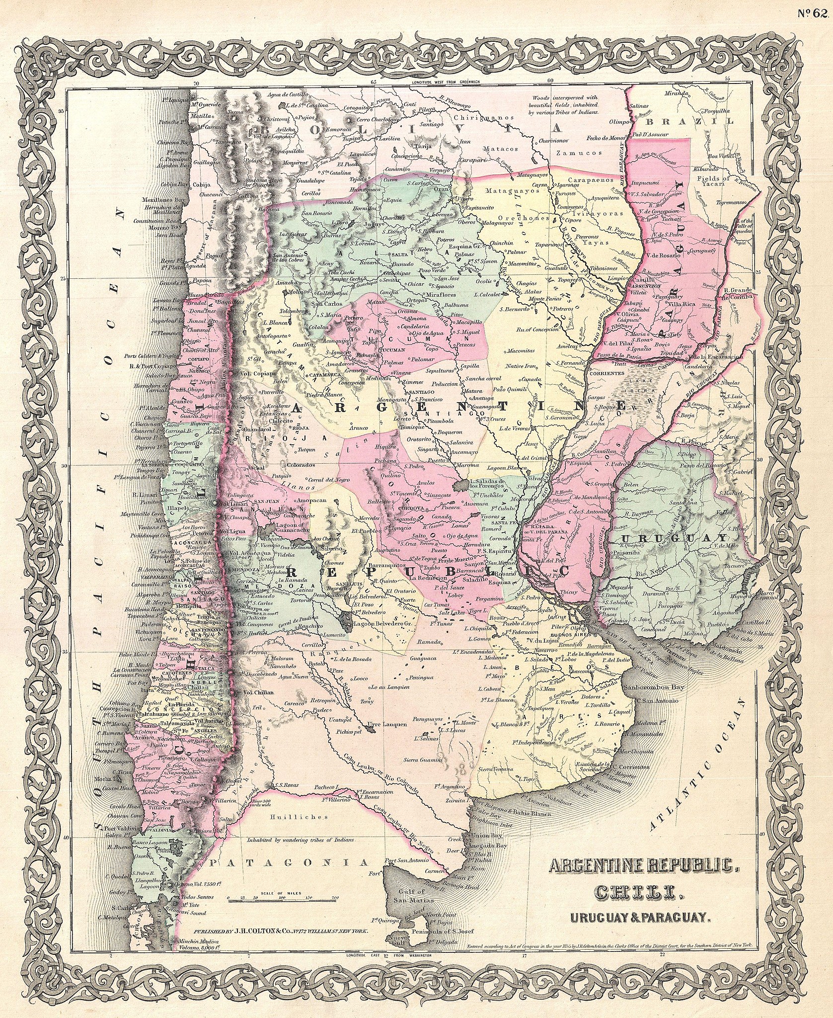
English: An excellent first edition example of Colton's rare 1855 map Chile, Argentina, Paraguay and Uruguay. Covers from Bolivia to Patagonia and from the Pacific to the Atlantic. Shows Bolivia's claims to the Atacama Desert which is today part of Chile. Indentifies a number of important mountains including Aconcagua, the highest elevation in South America. Throughout the map Colton identifies various cities, towns, forts, rivers, rapids, fords, and an assortment of additional topographical details. Map is hand colored in pink, green, yellow and blue pastels to define national and regional boundaries. Surrounded by Colton's typical spiral motif border. Dated and copyrighted to J. H. Colton, 1855. Published as page no. 62 in volume 1 of the first edition of George Washington Colton's 1855 Atlas of the World . |
||||||||||||||||||||
| Date | 1855 (dated) | ||||||||||||||||||||
| Dimensions | height: 16 in (40.6 cm); width: 13 in (33 cm) | ||||||||||||||||||||
| Accession number |
Geographicus link: ArgentinaChile-colton-1855 |
||||||||||||||||||||
| Source/Photographer |
Colton, G. W., Colton's Atlas of the World Illustrating Physical and Political Geography, Vol 1, New York, 1855 (First Edition).
|
||||||||||||||||||||
| Permission (Reusing this file) |
|
||||||||||||||||||||

File history
Click on a date/time to view the file as it appeared at that time.
| Date/Time | Thumbnail | Dimensions | User | Comment | |
|---|---|---|---|---|---|
| current | 12:52, 23 March 2011 | | 3,276 × 4,000 (3.69 MB) | BotMultichillT (talk | contribs) | {{subst:User:Multichill/Geographicus |link=http://www.geographicus.com/P/AntiqueMap/ArgentinaChile-colton-1855 |product_name=1855 Colton Map of Argentina, Chile, Paraguay and Uruguay |map_title=Argentine Republic, Chili, Uruguay and Paraguay. |description |
You cannot overwrite this file.
File usage on Commons
The following page uses this file:
File usage on other wikis
The following other wikis use this file:
- Usage on ast.wikipedia.org
- Usage on ca.wikipedia.org
- Usage on es.wikipedia.org