Category:Maps of the Argentine Confederation
Jump to navigation
Jump to search
Media in category "Maps of the Argentine Confederation"
The following 11 files are in this category, out of 11 total.
-
-

-
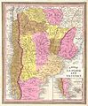
 Argentine Confederation and BuenosAires 1858.jpg 308 × 317; 43 KB
-
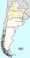
 Conf. Argentina.png 764 × 1,206; 24 KB
-
 Confederación Argentina (1848).png 300 × 580; 89 KB
-
 Confederación Argentina y Estado de Buenos Aires (1858).png 300 × 580; 87 KB
-
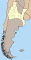
 Estado de Buenos Aires.png 363 × 599; 62 KB
-
 Flag map of Argentine Confederation (1831-1861).png 391 × 418; 35 KB
-
 Mapa ARGENTINA 1858.jpg 310 × 599; 89 KB
-
 Mapa Argentina vs BuenosAires 1858.jpg 310 × 599; 88 KB
-
 Mapa de Argentina (1848, sin texto).png 300 × 580; 69 KB


.png)
.png)

.png)


.png)