File:1827 Finley Map of Holland or the Netherlands - Geographicus - Holland-finley-1827.jpg
Jump to navigation
Jump to search
Size of this preview: 755 × 600 pixels. Other resolutions: 302 × 240 pixels | 604 × 480 pixels | 967 × 768 pixels | 1,280 × 1,017 pixels | 2,560 × 2,033 pixels | 3,000 × 2,383 pixels.
Original file (3,000 × 2,383 pixels, file size: 1.89 MB, MIME type: image/jpeg)
Captions
Captions
Add a one-line explanation of what this file represents
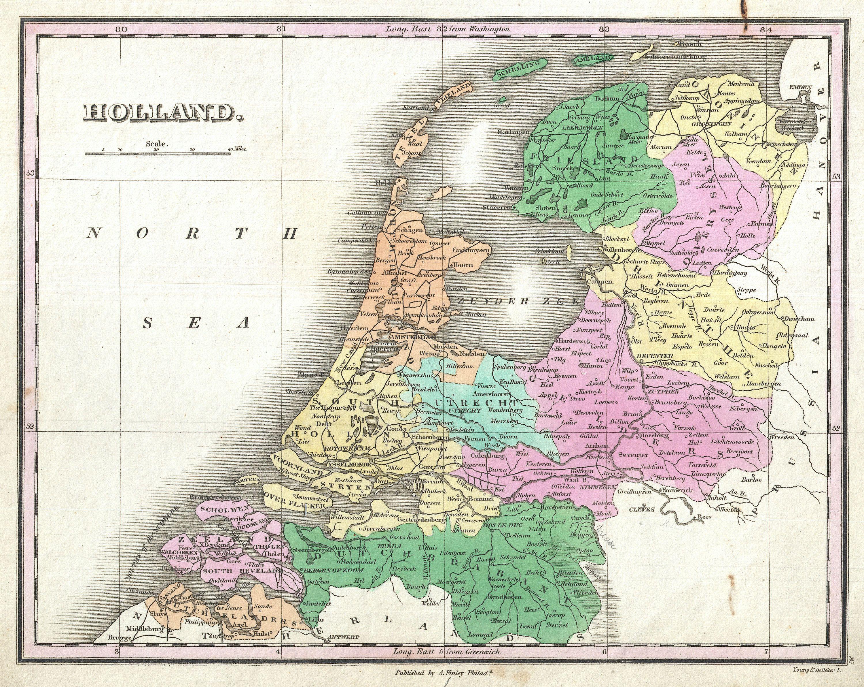
| Anthony Finley: Holland.
( |
||||||||||||||
|---|---|---|---|---|---|---|---|---|---|---|---|---|---|---|
| Artist |
|
|||||||||||||
| Title |
Holland. |
|||||||||||||
| Description |
English: A beautiful example of Finley's important 1827 map of Holland or the Netherlands. Covers the region Friesland south to Dutch Flanders and Brabant. Identifies numerous cities, river systems, swamps and canals. Title and scale in upper left quadrant. Engraved by Young and Delleker for the 1827 edition of Anthony Finley's General Atlas . |
|||||||||||||
| Date | 1827 (undated) | |||||||||||||
| Dimensions | height: 9 in (22.8 cm); width: 11.5 in (29.2 cm) | |||||||||||||
| Accession number |
Geographicus link: Holland-finley-1827 |
|||||||||||||
| Source/Photographer |
Finley, Anthony, A New General Altas, Comprising a Complete Set of Maps, representing the Grand Divisions of the Globe, Together with the several Empires, Kingdoms and States in the World; Compiled from the Best Authorities, and corrected by the Most Recent Discoveries, Philadelphia, 1827.
|
|||||||||||||
| Permission (Reusing this file) |
|
|||||||||||||
File history
Click on a date/time to view the file as it appeared at that time.
| Date/Time | Thumbnail | Dimensions | User | Comment | |
|---|---|---|---|---|---|
| current | 10:04, 23 March 2011 | | 3,000 × 2,383 (1.89 MB) | BotMultichillT (talk | contribs) | {{subst:User:Multichill/Geographicus |link=http://www.geographicus.com/P/AntiqueMap/Holland-finley-1827 |product_name=1827 Finley Map of Holland or the Netherlands |map_title=Holland. |description=A beautiful example of Finley's important 1827 map of Holl |
You cannot overwrite this file.
File usage on Commons
The following page uses this file: