File:1801 Cary Map of Portugal - Geographicus - Portugal-cary-1801.jpg
Jump to navigation
Jump to search
Size of this preview: 666 × 599 pixels. Other resolutions: 267 × 240 pixels | 533 × 480 pixels | 853 × 768 pixels | 1,138 × 1,024 pixels | 2,276 × 2,048 pixels | 5,000 × 4,500 pixels.
Original file (5,000 × 4,500 pixels, file size: 6.49 MB, MIME type: image/jpeg)
Captions
Captions
Add a one-line explanation of what this file represents
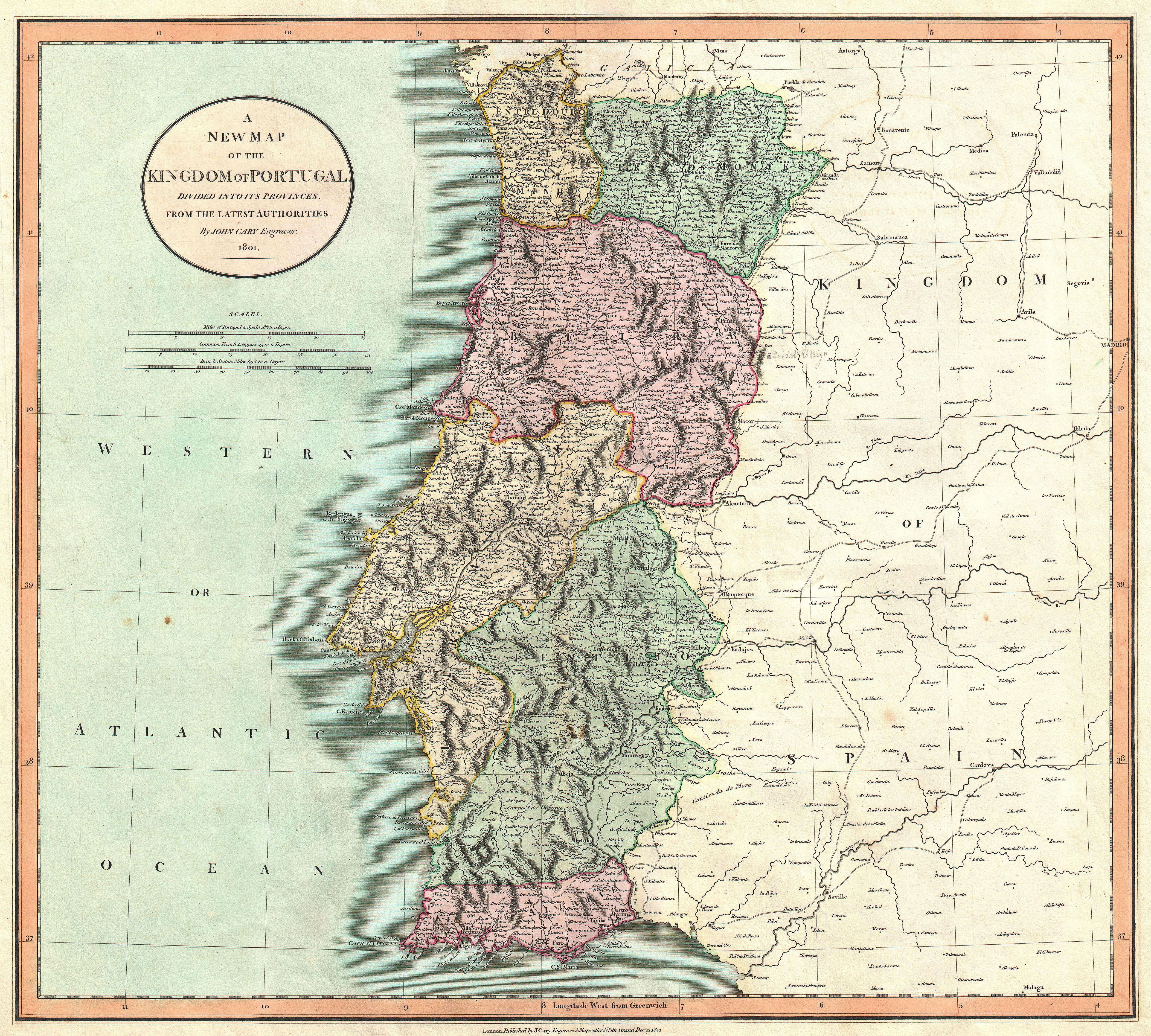
| John Cary: A New Map of the Kingdom of Portugal, Divided into its Provinces, from the Latest Authorities.
( |
||||||||||||||||||||||||||
|---|---|---|---|---|---|---|---|---|---|---|---|---|---|---|---|---|---|---|---|---|---|---|---|---|---|---|
| Artist |
|
|||||||||||||||||||||||||
| Title |
A New Map of the Kingdom of Portugal, Divided into its Provinces, from the Latest Authorities. |
|||||||||||||||||||||||||
| Description |
English: An extremely attractive example of John Cary’s 1801 map of Portugal. Highly detailed and color coded according to region. All in all, one of the most interesting and attractive atlas maps Portugal to appear in first years of the 19th century. Prepared in 1801 by John Cary for issue in his magnificent 1808 New Universal Atlas . |
|||||||||||||||||||||||||
| Date | 1801 (dated) | |||||||||||||||||||||||||
| Dimensions | height: 18.5 in (46.9 cm); width: 20.5 in (52 cm) | |||||||||||||||||||||||||
| Accession number |
Geographicus link: Protugal-cary-1801 |
|||||||||||||||||||||||||
| Source/Photographer |
Cary, John, Cary's New Universal Atlas, containing distinct maps of all the principal states and kingdoms throughout the World. From the latest and best authorities extant. London: Printed for J. Cary, Engraver and Map-seller, No. 181, near Norfolk Street, Strand, 1808.
|
|||||||||||||||||||||||||
| Permission (Reusing this file) |
|
|||||||||||||||||||||||||
File history
Click on a date/time to view the file as it appeared at that time.
| Date/Time | Thumbnail | Dimensions | User | Comment | |
|---|---|---|---|---|---|
| current | 11:54, 22 March 2011 | | 5,000 × 4,500 (6.49 MB) | BotMultichillT (talk | contribs) | {{subst:User:Multichill/Geographicus |link=http://www.geographicus.com/P/AntiqueMap/Protugal-cary-1801 |product_name=1801 Cary Map of Portugal |map_title=A New Map of the Kingdom of Portugal, Divided into its Provinces, from the Latest Authorities. |desc |
You cannot overwrite this file.
File usage on Commons
The following 2 pages use this file:
File usage on other wikis
The following other wikis use this file: