Category:Maps by John Cary
Jump to navigation
Jump to search
Subcategories
This category has only the following subcategory.
1
Media in category "Maps by John Cary"
The following 88 files are in this category, out of 88 total.
-

-
 1796 Cary Folding Case Map of England ^ Wales - Geographicus - EnglandWales-cary-1793.jpg 5,000 × 6,048; 7.78 MB
-

-
 1799 Cary Map of Franconia, Germany ( Nuremburg ) - Geographicus - Franconia-cary-1799.jpg 5,000 × 4,443; 7.44 MB
-
 1799 Cary Map of Hungary, Croatia and Transylvania - Geographicus - Hungary-cary-1799.jpg 5,000 × 4,506; 7.85 MB
-
 1799 Cary Map of Ireland - Geographicus - Ireland-cary-1799.jpg 5,000 × 4,379; 6.57 MB
-
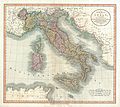 1799 Cary Map of Italy - Geographicus - Italy-cary-1799.jpg 5,000 × 4,460; 6.47 MB
-
 1799 Cary Map of Mantua, Venice and Tyrol, Italy - Geographicus - Venice-cary-1799.jpg 5,000 × 4,513; 8.31 MB
-
 1799 Cary Map of Piedmont, Italy ( Milan, Genoa ) - Geographicus - Piedmont-cary-1799.jpg 5,000 × 4,441; 8.17 MB
-
 1799 Cary Map of Poland, Prussia and Lithuania - Geographicus - Poland-cary-1799.jpg 5,000 × 4,416; 7.6 MB
-
 1799 Cary Map of Prussia and Lithuania - Geographicus - Prussia-cary-1799.jpg 5,000 × 4,364; 6.48 MB
-
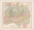
 1799 Cary Map of Swabia, Germany - Geographicus - Swabia-cary-1799.jpg 5,000 × 4,449; 8.31 MB
-
 1799 Cary Map of the Netherlands - Geographicus - Netherlands-cary-1799.jpg 5,000 × 4,472; 7.88 MB
-
 1799 Cary Map of the Russian Empire - Geographicus - Russia-cary-1799.jpg 7,000 × 3,100; 6.91 MB
-
 1799 Cary Map of the Upper and Lower Rhine - Geographicus - Rhine-cary-1799.jpg 5,000 × 4,458; 8.23 MB
-

-
 1799 Cary Map of Tyrol - Geographicus - Venice-cary-1799.jpg 4,883 × 3,253; 15.16 MB
-
 1799 map of Swabia by John Cary.jpg 13,999 × 12,380; 33.21 MB
-
 1801 Cary Map of Austria - Geographicus - Austria-cary-1801.jpg 5,000 × 4,488; 7.86 MB
-

-
 1801 Cary Map of China and Korea - Geographicus - China-cary-1801.jpg 5,000 × 4,587; 8.39 MB
-
 1801 Cary Map of Denmark - Geographicus - Denmark-cary-1801.jpg 5,000 × 4,488; 7.31 MB
-
-

-
 1801 Cary Map of Portugal - Geographicus - Portugal-cary-1801.jpg 5,000 × 4,500; 6.49 MB
-
 1801 Cary Map of Scotland (4 Sheets) - Geographicus - Scotland-cary-1801.jpg 7,000 × 6,322; 13.91 MB
-
 1801 Cary Map of Spain and Portugal - Geographicus - SpainPortugal-cary-1801.jpg 5,000 × 4,503; 8.56 MB
-

-
 1801 Cary Map of the East Indies and Southeast Asia signifying Champa.png 790 × 721; 1.47 MB
-

-
 1801 Cary Map of the World on Mercator Projection - Geographicus - WorldMerc-cary-1801.jpg 5,000 × 4,451; 7.15 MB
-

-

-
 1801 Cary Map of Westphalia, Germany - Geographicus - Westphalia-cary-1799.jpg 5,000 × 4,434; 7.5 MB
-
 1801 map of Turkey in Asia by John Cary.jpg 13,895 × 12,545; 25.59 MB
-
 1802 A new map of Europe.jpg 2,448 × 3,264; 1.67 MB
-

-
 1804 Cary Map of Belgium and Luxembourg - Geographicus - Belgium-cary-1804.jpg 5,000 × 4,523; 7.6 MB
-
 1805 Cary Map of Egypt - Geographicus - Egypt-cary-1805 (crop).jpg 1,935 × 1,739; 2.4 MB
-
 1805 Cary Map of Egypt - Geographicus - Egypt-cary-1805.jpg 5,000 × 4,455; 6.45 MB
-
-
 1806 Cary Map of Asia, Polynesia, and Australia - Geographicus - Asia-cary-1806.jpg 4,000 × 3,546; 4.13 MB
-
-
 1806 Cary Map of India or Hindoostan - Geographicus - India-cary-1806.jpg 5,000 × 4,054; 5.77 MB
-

-
 1806 Cary Map of Tartary or Central Asia - Geographicus - Tartary-cary-1806.jpg 5,000 × 4,569; 8.57 MB
-

-
-
 1806 map of India by John Cary.jpg 13,208 × 11,911; 31.13 MB
-

-
 1807 Cary Map of South America - Geographicus - SouthAmerica-cary-1807.jpg 3,400 × 6,000; 6.19 MB
-

-
 1811 Cary Map of Arabia, Egypt ^ Abyssinia - Geographicus - Arabia-cary-1811.jpg 4,000 × 3,540; 2.84 MB
-
 1811 Cary Map of the Kingdom of Portugal - Geographicus - Portugal-cary-1811.jpg 3,000 × 2,669; 1.69 MB
-

-
 1819 Cary Map of Arabia, Egypt ^ Abyssinia - Arabia.jpg 2,000 × 1,789; 1,008 KB
-

-
 1836 Cary Map of Greece and the Balkans - Geographicus - TurkeyinEurope-cary-1836.jpg 3,063 × 3,777; 2.02 MB
-
 A chart of the Coast of France from l'Orient to St Gilles (BM 1871,1209.91).jpg 2,500 × 2,029; 1.11 MB
-

-

-
 A map of France from the best Authorities (BM 1871,1209.100).jpg 2,500 × 1,993; 1.2 MB
-

-
 A map of Surinam, Barbutius * Cayenne in South America (BM 1871,1209.123).jpg 2,026 × 2,500; 1.09 MB
-

-

-
 A new Map of Staffordshire divided into hundreds... - by John Cary, 1806 - btv1b84431896.jpg 8,921 × 10,158; 12.64 MB
-
 A new map of the circle of Austria 1801.jpg 15,570 × 12,516; 26.05 MB
-
-
 Ambracian Gulf, John Cary 1801.jpg 368 × 355; 64 KB
-
 Carymap.jpg 709 × 617; 125 KB
-
 East and West Florida 1803 Cary Map.png 846 × 635; 1.37 MB
-
 Europe map 1804 Cary (cropped).jpg 3,822 × 3,432; 2.98 MB
-
 Europe map 1804 Cary.jpg 5,677 × 4,185; 4.15 MB
-
 Fontenoy Battle (BM 1871,1209.113).jpg 2,130 × 1,680; 786 KB
-
 Fort Orleans abandoned 1805.jpg 656 × 558; 140 KB
-
 Fragment of Cary's map, 1795, showing location of Whitechapel Mount.png 2,229 × 1,543; 7.83 MB
-
 John Cary - Map of Derbyshire - 1787 - 001.jpg 1,378 × 1,743; 1.66 MB
-
 John Cary - Map of Hertfordshire - 001.jpg 3,000 × 2,448; 4.79 MB
-
 John Cary 1799 map of the territory of Bergamo.jpg 740 × 1,353; 420 KB
-
-
 Map of Watford and Cassiobury Park by John Cary.jpg 789 × 406; 302 KB
-
 Prussian-Polish border in the 18th century.png 1,755 × 1,253; 6.29 MB
-
 The engagement off Belle-Isle Novr 20, 1759 (BM 1871,1209.96).jpg 2,500 × 1,996; 1,015 KB
-
 The West Indies and Gulf of Mexico (BM 1871,1209.109).jpg 2,500 × 1,654; 1,019 KB
-
 Tollgates London 1801.jpg 1,400 × 1,029; 308 KB
-
 Turky - in - Europe, - from the best - authorities (BM 1875,0710.5414).jpg 2,500 × 1,962; 1.21 MB
-
 Vienna - Cary's Pocket Globe - 6744.jpg 4,289 × 2,817; 3.03 MB
_1806_map_detail,_from-_1806_Cary_Map_of_Tartary_or_Central_Asia_-_Geographicus_-_Tartary-cary-1806_(cropped).jpg)

_-_Geographicus_-_Bavaria-cary-1799.jpg)
_-_Geographicus_-_Franconia-cary-1799.jpg)


_-_Geographicus_-_Piedmont-cary-1799.jpg)


_-_Geographicus_-_WesternHemisphere-cary-1799.jpg)


_-_Geographicus_-_Bohemia-cary-1801.jpg)


_-_Geographicus_-_LowerSaxony-cary-1801.jpg)
_-_Geographicus_-_Persia-cary-1801.jpg)

_-_Geographicus_-_Scotland-cary-1801.jpg)

_-_Geographicus_-_EastIndies-cary-1801.jpg)

_-_Geographicus_-_EasternHemisphere-cary-1801.jpg)


_-_Geographicus_-_UpperSaxony-cary-1799.jpg)


.jpg)

_-_Geographicus_-_WesternTerritory-cary-1805.jpg)


_-_Geographicus_-_America-cary-1806.jpg)


.jpg)


.jpg)


.jpg)
.jpg)
.jpg)
.jpg)
.jpg)
.jpg)


.jpg)

.jpg)


.jpg)
.jpg)

.jpg)

_by_John_Cary._Original_from_The_Beinecke_Rare_Book_%26_Manuscript_Library._Digitally_enhanced_by_rawpixel._(50622865008).jpg)