File:1771 Bonne Map of Persia ( Iran, Iraq, Afghanistan ) - Geographicus - Persia-bonne-1771.jpg
Jump to navigation
Jump to search

Size of this preview: 800 × 591 pixels. Other resolutions: 320 × 236 pixels | 640 × 473 pixels | 1,024 × 756 pixels | 1,280 × 945 pixels | 2,560 × 1,891 pixels | 4,000 × 2,954 pixels.
Original file (4,000 × 2,954 pixels, file size: 3.38 MB, MIME type: image/jpeg)
Captions
Captions
Add a one-line explanation of what this file represents
«»== Summary ==
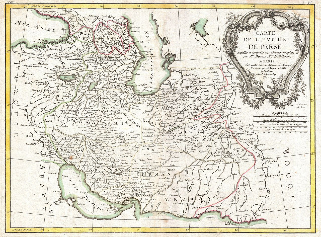
| Rigobert Bonne: Carte de L'Empire de Perse.
( |
|||||||||||||||||||||||
|---|---|---|---|---|---|---|---|---|---|---|---|---|---|---|---|---|---|---|---|---|---|---|---|
| Artist |
|
||||||||||||||||||||||
| Title |
Carte de L'Empire de Perse. |
||||||||||||||||||||||
| Description |
English: A beautiful example of Rigobert Bonne's 1771 decorative map of the Persia. Covers from the Black Sea south to the Persian Gulf and east past the Caspian Sa to the Indus Valley. Includes the modern day nations of Iran, Iraq, Kuwait, Afghanistan, Georgia, Armenia, Azerbaijan, with parts of adjacent Turkey, Saudi Arabia, and Pakistan. Names numerous tribal areas, villages, cities, deserts, caravan routes, and river systems. A large decorative title cartouche bearing garlands appears in the upper right hand quadrant. A fine map of the region. Drawn by R. Bonne in 1771 for issue as plate no. B 25 in Jean Lattre's 1776 issue of the Atlas Moderne. |
||||||||||||||||||||||
| Date | Paris / 1771 (dated) | ||||||||||||||||||||||
| Dimensions | height: 12.7 in (32.3 cm); width: 17.5 in (44.4 cm) | ||||||||||||||||||||||
| Accession number |
Geographicus link: Persia-bonne-1771 |
||||||||||||||||||||||
| Source/Photographer |
Lattre, Jean, Atlas Moderne ou Collection de Cartes sur Toutes les Parties du Globe Terrestre, c. 1775.
|
||||||||||||||||||||||
| Permission (Reusing this file) |
|
||||||||||||||||||||||
| Other versions | Barry Lawrence Ruderman Antique Maps Inc. | ||||||||||||||||||||||
Licensing
[edit]_-_Geographicus_-_Persia-bonne-1771.jpg&action=edit§ion=1)
|
This is a faithful photographic reproduction of a two-dimensional, public domain work of art. The work of art itself is in the public domain for the following reason:
The official position taken by the Wikimedia Foundation is that "faithful reproductions of two-dimensional public domain works of art are public domain".
This photographic reproduction is therefore also considered to be in the public domain in the United States. In other jurisdictions, re-use of this content may be restricted; see Reuse of PD-Art photographs for details. | ||||
File history
Click on a date/time to view the file as it appeared at that time.
| Date/Time | Thumbnail | Dimensions | User | Comment | |
|---|---|---|---|---|---|
| current | 03:03, 23 March 2011 | | 4,000 × 2,954 (3.38 MB) | BotMultichillT (talk | contribs) | {{subst:User:Multichill/Geographicus |link=http://www.geographicus.com/P/AntiqueMap/Persia-bonne-1771 |product_name=1771 Bonne Map of Persia ( Iran, Iraq, Afghanistan ) |map_title=Carte de L'Empire de Perse. |description=A beautiful example of Rigobert Bo |
You cannot overwrite this file.
File usage on Commons
The following page uses this file:
_-_Geographicus_-_Persia-bonne-1771.jpg)
File usage on other wikis
The following other wikis use this file:
- Usage on et.wikipedia.org
- Usage on fa.wikipedia.org
_-_Geographicus_-_Persia-bonne-1771.jpg&oldid=879559010)