File:1764 Ukraine.png
Jump to navigation
Jump to search

Size of this preview: 785 × 600 pixels. Other resolutions: 314 × 240 pixels | 629 × 480 pixels | 1,006 × 768 pixels | 1,280 × 978 pixels | 2,151 × 1,643 pixels.
Original file (2,151 × 1,643 pixels, file size: 1.99 MB, MIME type: image/png)
Captions
Captions
Add a one-line explanation of what this file represents
Summary
[edit]
| Description |
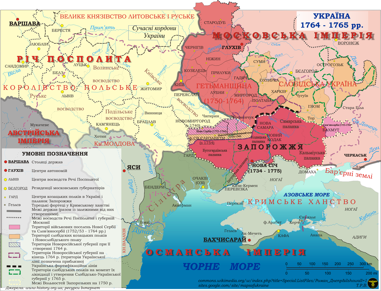
Українська: Землі України у 1764-1765 рр. Утворення Новоросійської губернії
English: Earth Ukraine in 1764-1765 years. The formation of Novorossiysk province |
| Date | |
| Source | Own work |
| Author | Роман Днепр |
Licensing
[edit]
I, the copyright holder of this work, hereby publish it under the following license:
This file is licensed under the Creative Commons Attribution-Share Alike 4.0 International license.
- You are free:
- to share – to copy, distribute and transmit the work
- to remix – to adapt the work
- Under the following conditions:
- attribution – You must give appropriate credit, provide a link to the license, and indicate if changes were made. You may do so in any reasonable manner, but not in any way that suggests the licensor endorses you or your use.
- share alike – If you remix, transform, or build upon the material, you must distribute your contributions under the same or compatible license as the original.
File history
Click on a date/time to view the file as it appeared at that time.
| Date/Time | Thumbnail | Dimensions | User | Comment | |
|---|---|---|---|---|---|
| current | 18:08, 15 June 2016 | | 2,151 × 1,643 (1.99 MB) | Роман Днепр (talk | contribs) | User created page with UploadWizard |
You cannot overwrite this file.
File usage on Commons
The following page uses this file:
File usage on other wikis
The following other wikis use this file:
- Usage on be-tarask.wikipedia.org
- Usage on es.wikipedia.org
- Usage on uk.wikipedia.org
Metadata
Categories:
- Maps of Cossack Hetmanate
- Maps of the history of Ukraine in the early modern period
- Maps of Novorossia Governorate
- Maps of the Polish-Lithuanian Commonwealth
- Volhynian Voivodeship (1569–1795)
- Podolian Voivodeship
- Bracław Voivodeship
- Maps of Kiev Voivodeship (1471-1793)
- Maps of Ruthenian Voivodeship
- Maps of New Serbia and Slavo-Serbia