Category:Maps of Ruthenian Voivodeship
Jump to navigation
Jump to search
Wikimedia category | |||||
| Upload media | |||||
| Instance of | |||||
|---|---|---|---|---|---|
| Category combines topics | |||||
| Vilnius Voivodeship | |||||
one of the historic voivodeships of the Grand Duchy of Lithuania, established in 1413 | |||||
| Instance of | |||||
| Location | Grand Duchy of Lithuania | ||||
| Capital | |||||
| Inception |
| ||||
| Dissolved, abolished or demolished date |
| ||||
| Area |
| ||||
| Follows |
| ||||
| Replaces |
| ||||
| Replaced by | |||||
| Different from | |||||
 | |||||
Media in category "Maps of Ruthenian Voivodeship"
The following 26 files are in this category, out of 26 total.
-
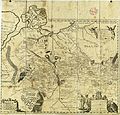
1750 Homann Heirs Map of Poland - Geographicus - Poloniae-homannheirs-1750.jpg 4,000 × 3,552; 3.07 MB
-
1764 Ukraine.png 2,151 × 1,643; 1.99 MB
-
1907 rzeczpospolita yr.jpg 1,167 × 906; 329 KB
-
Atlas Van der Hagen-KW1049B10 041-UKRAINAE PARS QVA POKUTIA Vulgo dictur.jpg 5,500 × 4,615; 3.72 MB
-
Austrian Galicia compared to pre-1772 Voivodeships.png 1,176 × 952; 143 KB
-
Eastern Europe - Antonio Zatta (1781).jpg 1,024 × 742; 211 KB
-
Eastern Europe by Antonio Zatta.jpg 1,500 × 1,171; 1.57 MB
-
Heraclid Despot's invasion in northern Moldavia, 1561.svg 1,115 × 789; 341 KB
-
Jagiellon countries 1490.PNG 2,916 × 2,992; 1.68 MB
-
Karta Ukrainy. Beauplan. B-Kamenskyj.jpg 4,278 × 4,093; 7.68 MB
-
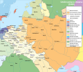
Królestwo Polskie i Wielkie Księstwo Litewskie w 1466 r-es.svg 1,406 × 1,228; 1.22 MB
-
Królestwo Polskie i Wielkie Księstwo Litewskie w 1466 r..svg 1,502 × 1,310; 3.2 MB
-
Kyivstar vkraina 1580.jpg 2,500 × 1,890; 2.62 MB
-
Kyivstar vkraina 1670 4.jpg 2,500 × 2,108; 2.77 MB
-
Map of the partition of the Kingdom of Poland and the Grand Duchy of Lithuania from 1799.jpg 6,330 × 5,677; 6.83 MB
-
RON województwo ruskie map.svg 1,000 × 875; 212 KB
-
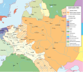
Ruskie bełskie (II RP).png 2,110 × 2,364; 679 KB
-
Ruskie bełskie.png 3,155 × 2,831; 581 KB
-
RuskieIRP1-ru.PNG 2,000 × 1,564; 944 KB
-
Russie Rouge, 1701.jpg 2,337 × 1,877; 2.2 MB
-
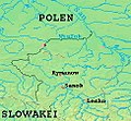
SanokerLand.jpg 244 × 225; 63 KB
-
Ziemia Przemyska.png 1,647 × 2,031; 217 KB
-
Ziemia Sanocka.png 3,744 × 4,805; 13 MB
-
МВ1 001.jpg 4,656 × 3,391; 1.56 MB
-
Перша Новоросійська губернія.png 1,985 × 1,517; 1.88 MB


