File:1749LarcherDAubencourt6.jpg
Jump to navigation
Jump to search
Size of this preview: 742 × 599 pixels. Other resolutions: 297 × 240 pixels | 594 × 480 pixels | 951 × 768 pixels | 1,268 × 1,024 pixels | 1,331 × 1,075 pixels.
Original file (1,331 × 1,075 pixels, file size: 737 KB, MIME type: image/jpeg)
Captions
Captions
Add a one-line explanation of what this file represents
Summary
[edit]
| Description |
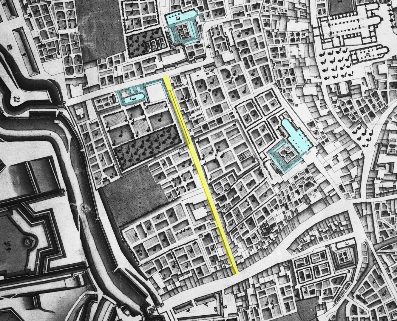
English: Detail of a map of Maastricht, Netherlands, showing the western part of the city in 1749. The map by French military engineer Jean-Baptiste Larcher d'Aubencourt was used to build the Maquette of Maastricht (1752), now in the Musée de Beaux Arts in Lille, France. Here the area around Abtstraat (marked in yellow). Top right: Vrijthof square. Marked in blue: Calvary Monastery, Crozier Monastery and Second Minorite Monastery. |
| Date | |
| Source | http://beeldbank.cultureelerfgoed.nl/alle-afbeeldingen/weergave/search/layout/result/indeling/detail/start/2?searchfield=Larcher+d%5C%5C%5C%27Aubancourt |
| Author | Jean-Baptiste Larcher d'Aubencourt, 1749 |
Licensing
[edit]
|
This work is in the public domain in its country of origin and other countries and areas where the copyright term is the author's life plus 100 years or fewer. | |
| This file has been identified as being free of known restrictions under copyright law, including all related and neighboring rights. | |
File history
Click on a date/time to view the file as it appeared at that time.
| Date/Time | Thumbnail | Dimensions | User | Comment | |
|---|---|---|---|---|---|
| current | 23:35, 5 December 2018 | | 1,331 × 1,075 (737 KB) | Kleon3 (talk | contribs) | blue marked areas expanded |
| 23:19, 5 December 2018 |  | 1,331 × 1,075 (732 KB) | Kleon3 (talk | contribs) | User created page with UploadWizard |
You cannot overwrite this file.
File usage on Commons
There are no pages that use this file.
File usage on other wikis
The following other wikis use this file:
- Usage on nl.wikipedia.org