File:1749LarcherDAubencourt, Kommel.jpg
Jump to navigation
Jump to search
Size of this preview: 800 × 415 pixels. Other resolutions: 320 × 166 pixels | 640 × 332 pixels | 1,367 × 709 pixels.
Original file (1,367 × 709 pixels, file size: 526 KB, MIME type: image/jpeg)
Captions
Captions
Add a one-line explanation of what this file represents
Summary
[edit]
| Description |
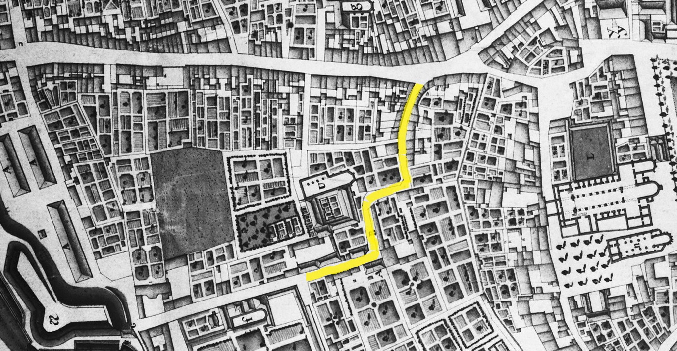
English: Maastricht, Netherlands. Detail of a map showing the western part of the city in 1749. The map by French military engineer Jean-Baptiste Larcher d'Aubencourt was used to built the Maquette of Maastricht (1752), now in the Musée de Beaux Arts in Lille, France. Here the area around Kommel (marked in yellow). At the top: Brusselsestraat. Right: Vrijthof square. Bottom left: Kat Brandenburg, a cavelier or elevation behind the second Medieval wall near Calvariestraat. |
| Date | |
| Source | http://beeldbank.cultureelerfgoed.nl/alle-afbeeldingen/weergave/search/layout/result/indeling/detail/start/2?searchfield=Larcher+d%5C%5C%5C%27Aubancourt |
| Author | Jean-Baptiste Larcher d'Aubencourt, 1749 |
Licensing
[edit]
|
This work is in the public domain in its country of origin and other countries and areas where the copyright term is the author's life plus 100 years or fewer. | |
| This file has been identified as being free of known restrictions under copyright law, including all related and neighboring rights. | |
File history
Click on a date/time to view the file as it appeared at that time.
| Date/Time | Thumbnail | Dimensions | User | Comment | |
|---|---|---|---|---|---|
| current | 18:46, 28 August 2017 | | 1,367 × 709 (526 KB) | Kleon3 (talk | contribs) | correction yellow marking |
| 16:41, 28 August 2017 |  | 1,367 × 709 (505 KB) | Kleon3 (talk | contribs) | User created page with UploadWizard |
You cannot overwrite this file.
File usage on Commons
There are no pages that use this file.
File usage on other wikis
The following other wikis use this file:
- Usage on nl.wikipedia.org