File:08 elect13.svg
Jump to navigation
Jump to search

Size of this PNG preview of this SVG file: 783 × 599 pixels. Other resolutions: 314 × 240 pixels | 627 × 480 pixels | 1,003 × 768 pixels | 1,280 × 980 pixels | 2,560 × 1,960 pixels | 1,019 × 780 pixels.
Original file (SVG file, nominally 1,019 × 780 pixels, file size: 1.72 MB)
Captions
Captions
Add a one-line explanation of what this file represents
| U.S. presidential election maps from the National Atlas of the United States |
| See also: SVG maps |
| 1789 · 1792 · 1796 · 1800 · 1804 · 1808 · 1812 · 1816 · 1820 · 1824 · 1828 · 1832 · 1836 · 1840 · 1844 · 1848 · 1852 · 1856 · 1860 · 1864 · 1868 · 1872 · 1876 · 1880 · 1884 · 1888 · 1892 · 1896 · 1900 · 1904 · 1908 · 1912 · 1916 · 1920 · 1924 · 1928 · 1932 · 1936 · 1940 · 1944 · 1948 · 1952 · 1956 · 1960 · 1964 · 1968 · 1972 · 1976 · 1980 · 1984 · 1988 · 1992 · 1996 · 2000 · 2004 · 2008 · 2012 |
.png)
Summary
[edit]
| Description |
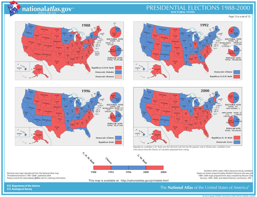
English: Electoral college map SVGs, 1988-2000 presidential elections. |
| Date | circa 1997-2014 |
| Source | National Atlas U.S. presidential election results |
| Author | United States Geological Survey |
Licensing
[edit]
This map was obtained from an edition of the National Atlas of the United States. Like almost all works of the U.S. federal government, works from the National Atlas are in the public domain in the United States.
Online access: NationalAtlas.gov | 1970 print edition: Library of Congress, Perry-Castañeda Library
|
File history
Click on a date/time to view the file as it appeared at that time.
| Date/Time | Thumbnail | Dimensions | User | Comment | |
|---|---|---|---|---|---|
| current | 16:25, 27 June 2023 | | 1,019 × 780 (1.72 MB) | Born Isopod (talk | contribs) | Uploaded a work by United States Geological Survey from [http://web.archive.org/web/20161223041040/https://nationalmap.gov/small_scale/printable/images/pdf/elections/08_elect13.pdf National Atlas U.S. presidential election results] with UploadWizard |
You cannot overwrite this file.
File usage on Commons
The following page uses this file: