File:0009 Planta De La Ciudad De Xeres De Los Cavalleros.jpg
Jump to navigation
Jump to search

Size of this preview: 800 × 539 pixels. Other resolutions: 320 × 215 pixels | 640 × 431 pixels | 1,024 × 689 pixels | 1,280 × 862 pixels | 2,560 × 1,723 pixels | 10,359 × 6,973 pixels.
Original file (10,359 × 6,973 pixels, file size: 4.99 MB, MIME type: image/jpeg)
Captions
Captions
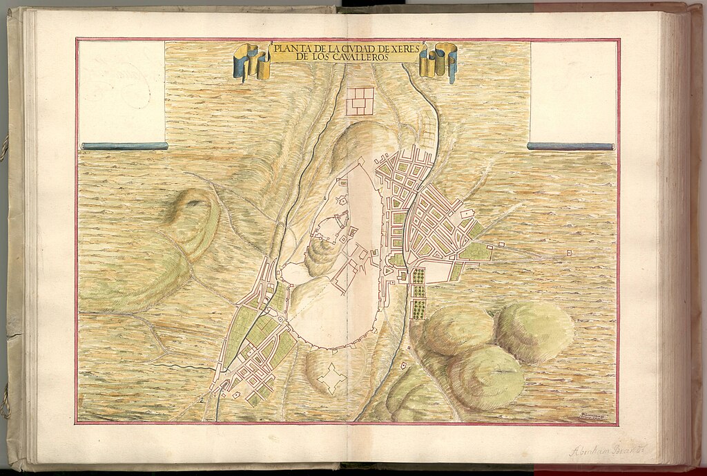
Hand drawn map of Jerez de los Caballeros, Spain
Summary
[edit]| Description |
Svenska: Handritad karta över Jerez de los Caballeros, Spanien. Akvarellmålning på paper.
English: Hand drawn map from the 17th century of Jerez de los Caballeros, Spain. Watercolor painting on paper. |
||||||||||||||||||||||||||
| Date | |||||||||||||||||||||||||||
| Source |
|
||||||||||||||||||||||||||
| Creator |
Leonardus de Ferrarys |
||||||||||||||||||||||||||
| Permission (Reusing this file) |
|
||||||||||||||||||||||||||
| Georeferencing | If inappropriate please set warp_status = skip to hide. | ||||||||||||||||||||||||||


Licensing
[edit]
|
This work is in the public domain in its country of origin and other countries and areas where the copyright term is the author's life plus 70 years or fewer. | |
| This file has been identified as being free of known restrictions under copyright law, including all related and neighboring rights. | |
This work is in the public domain in the United States because it meets three requirements:
For background information, see the explanations on Non-U.S. copyrights.
Note: This tag should not be used for sound recordings. |
File history
Click on a date/time to view the file as it appeared at that time.
| Date/Time | Thumbnail | Dimensions | User | Comment | |
|---|---|---|---|---|---|
| current | 09:05, 26 April 2024 | | 10,359 × 6,973 (4.99 MB) | Helene Holmberg (Riksarkivet Sverige) (talk | contribs) | Uploaded a work by Leonardus de Ferrarys from https://sok.riksarkivet.se/arkiv/vh1rHC2BUqw5gDuYx96k52 with UploadWizard |
You cannot overwrite this file.
File usage on Commons
The following page uses this file: