File:(North western Canada). (IA bp 33088).pdf
Jump to navigation
Jump to search

Size of this JPG preview of this PDF file: 459 × 599 pixels. Other resolutions: 184 × 240 pixels | 368 × 480 pixels | 588 × 768 pixels | 784 × 1,024 pixels | 1,643 × 2,145 pixels.

Original file (1,643 × 2,145 pixels, file size: 2.46 MB, MIME type: application/pdf, 2 pages)
Captions
Captions
Add a one-line explanation of what this file represents
Summary
[edit]| [North western Canada].
( |
|
|---|---|
| Title |
[North western Canada]. |
| Publisher |
J. H. Colton, [Great Britain] |
| Description |
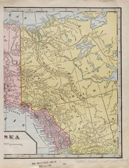
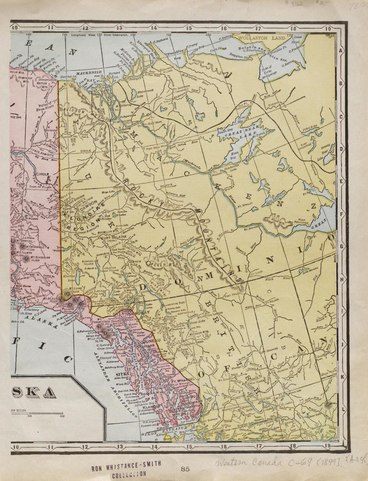
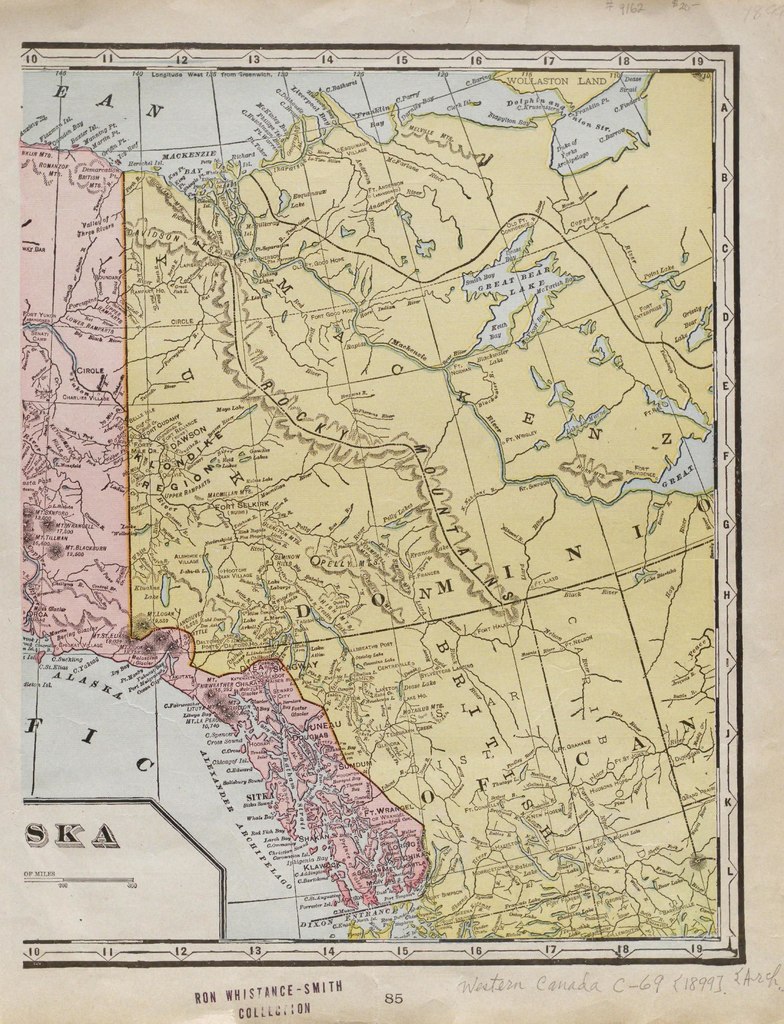
From the Whistance-Smith Collection.;Col., 31 x 25 cm. on atlas sheet.;[Plate] '85.';Includes Yukon, portion of NWT and northern British Columbia and Alberta, and Alaskan Panhandle.;On verso: [plate] 86; portion of Cuba.;Map is eastern half of a double page map entitled Alaska. Subjects: Western Canada--Physical sciences |
| Language | English |
| Publication date | [1899] |
| Current location |
IA Collections: wcw_gale; wcw; university_of_alberta_libraries; toronto |
| Accession number |
bp_33088 |
| Notes | Scale: Ca. 1:6,336,000 |
| Source | |
Licensing
[edit]|
This work is in the public domain in its country of origin and other countries and areas where the copyright term is the author's life plus 70 years or fewer. | |
| This file has been identified as being free of known restrictions under copyright law, including all related and neighboring rights. | |
File history
Click on a date/time to view the file as it appeared at that time.
| Date/Time | Thumbnail | Dimensions | User | Comment | |
|---|---|---|---|---|---|
| current | 13:01, 27 August 2021 |  | 1,643 × 2,145, 2 pages (2.46 MB) | Fæ (talk | contribs) | IA Query "collection:(wcw) date:[1000 TO 1899]" bp_33088 Category:William C. Wonders Map Collection (COM:IA books#query) (1899 #297) |
You cannot overwrite this file.
File usage on Commons
The following page uses this file: