File:(Map of Central Europe). (IA bp 15139).pdf
Jump to navigation
Jump to search

Size of this JPG preview of this PDF file: 800 × 550 pixels. Other resolutions: 320 × 220 pixels | 640 × 440 pixels | 1,024 × 704 pixels | 1,280 × 880 pixels | 2,560 × 1,760 pixels | 3,512 × 2,414 pixels.
Original file (3,512 × 2,414 pixels, file size: 3.7 MB, MIME type: application/pdf)
Captions
Captions
Add a one-line explanation of what this file represents
Summary
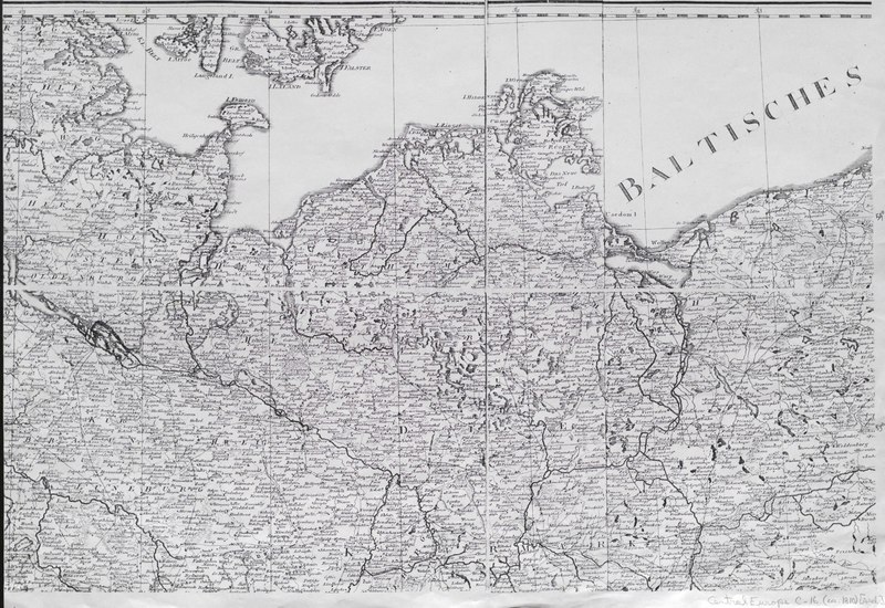
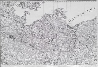
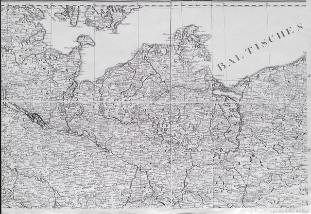
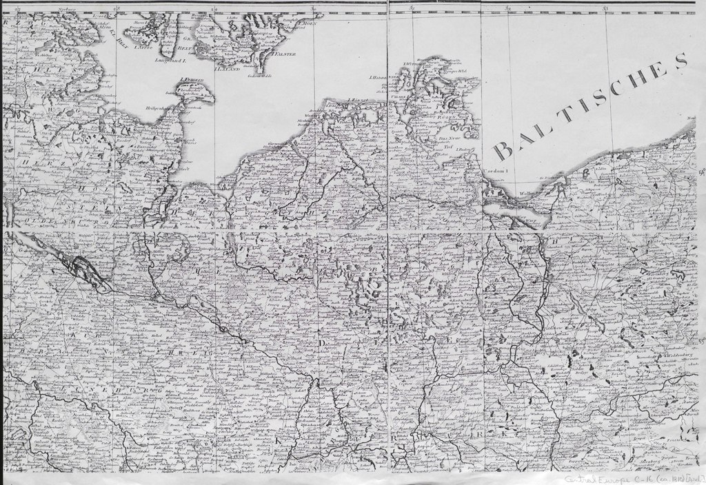
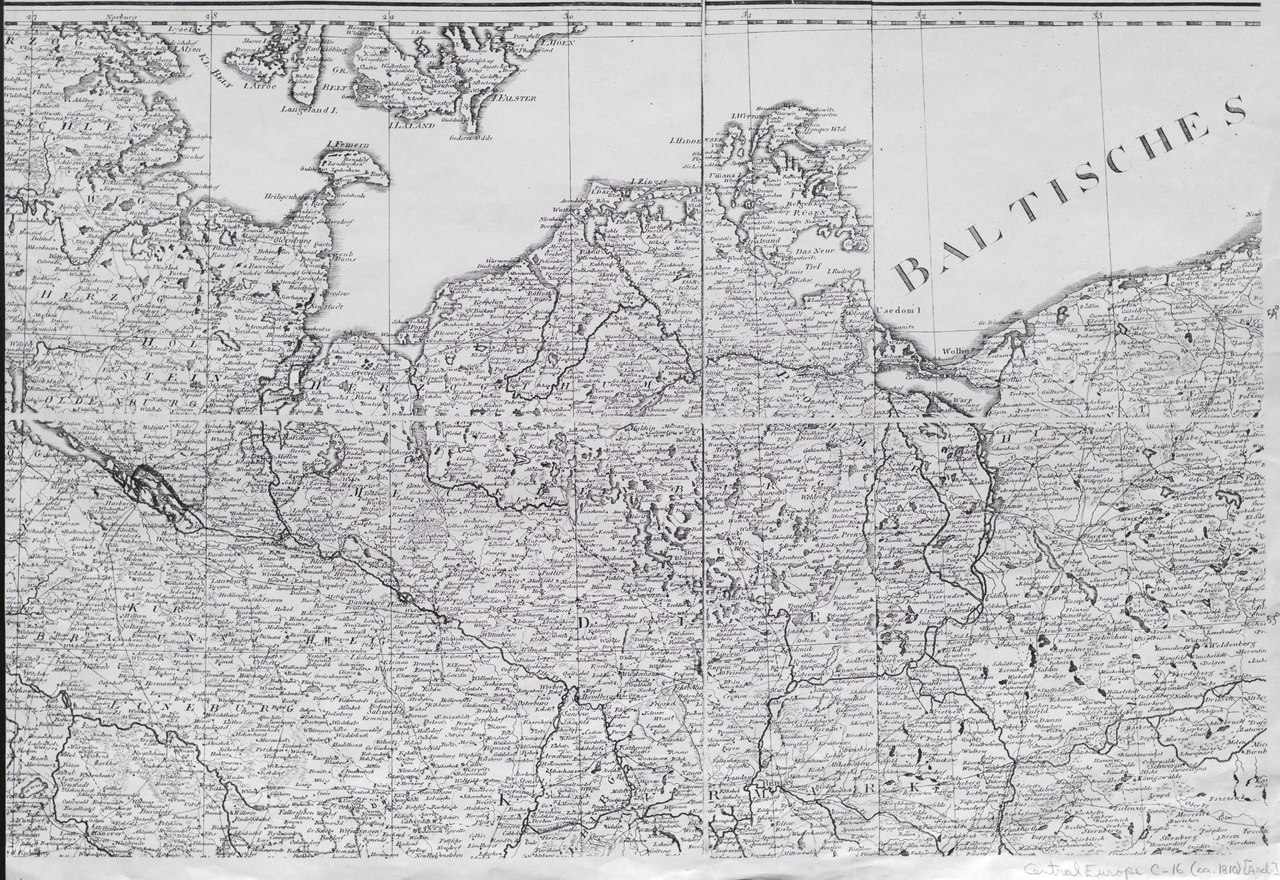
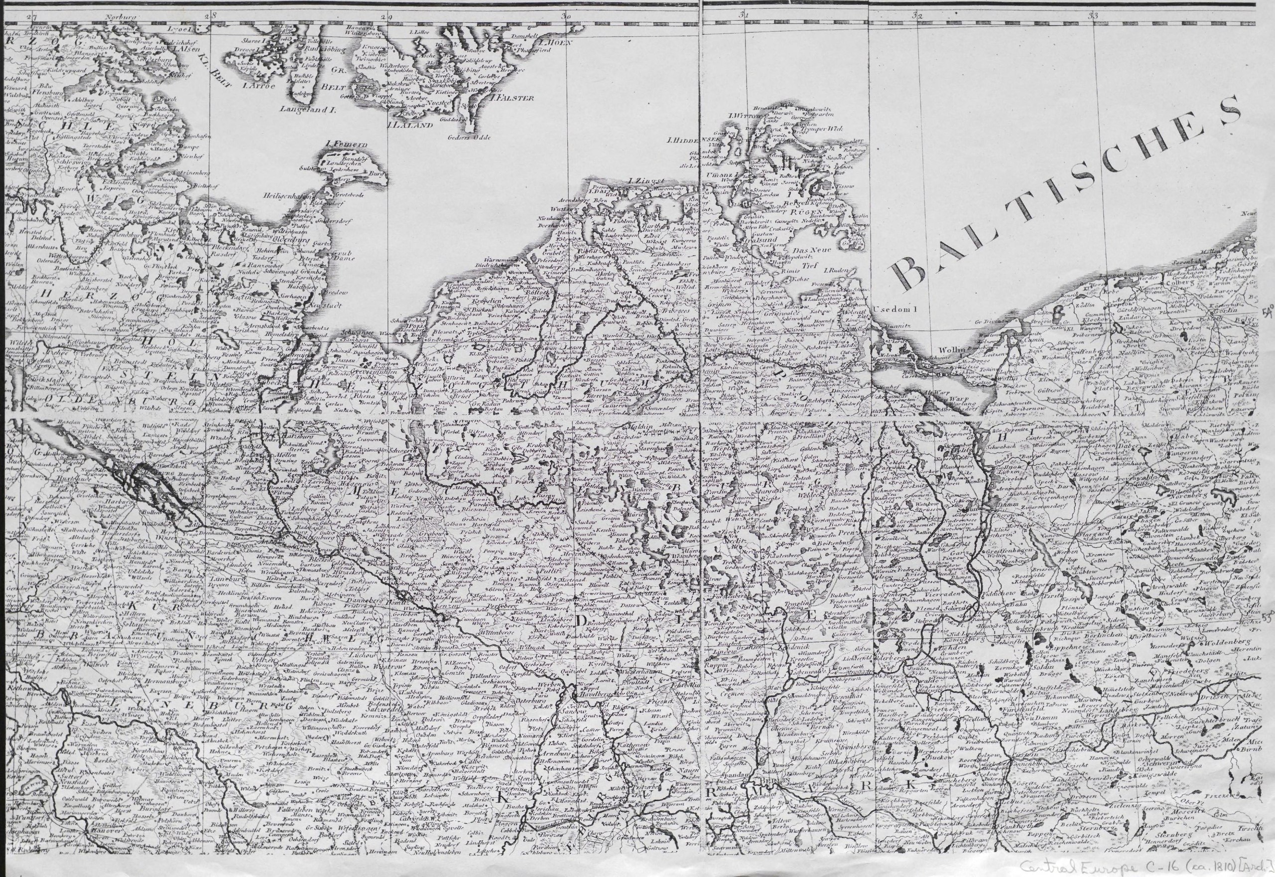
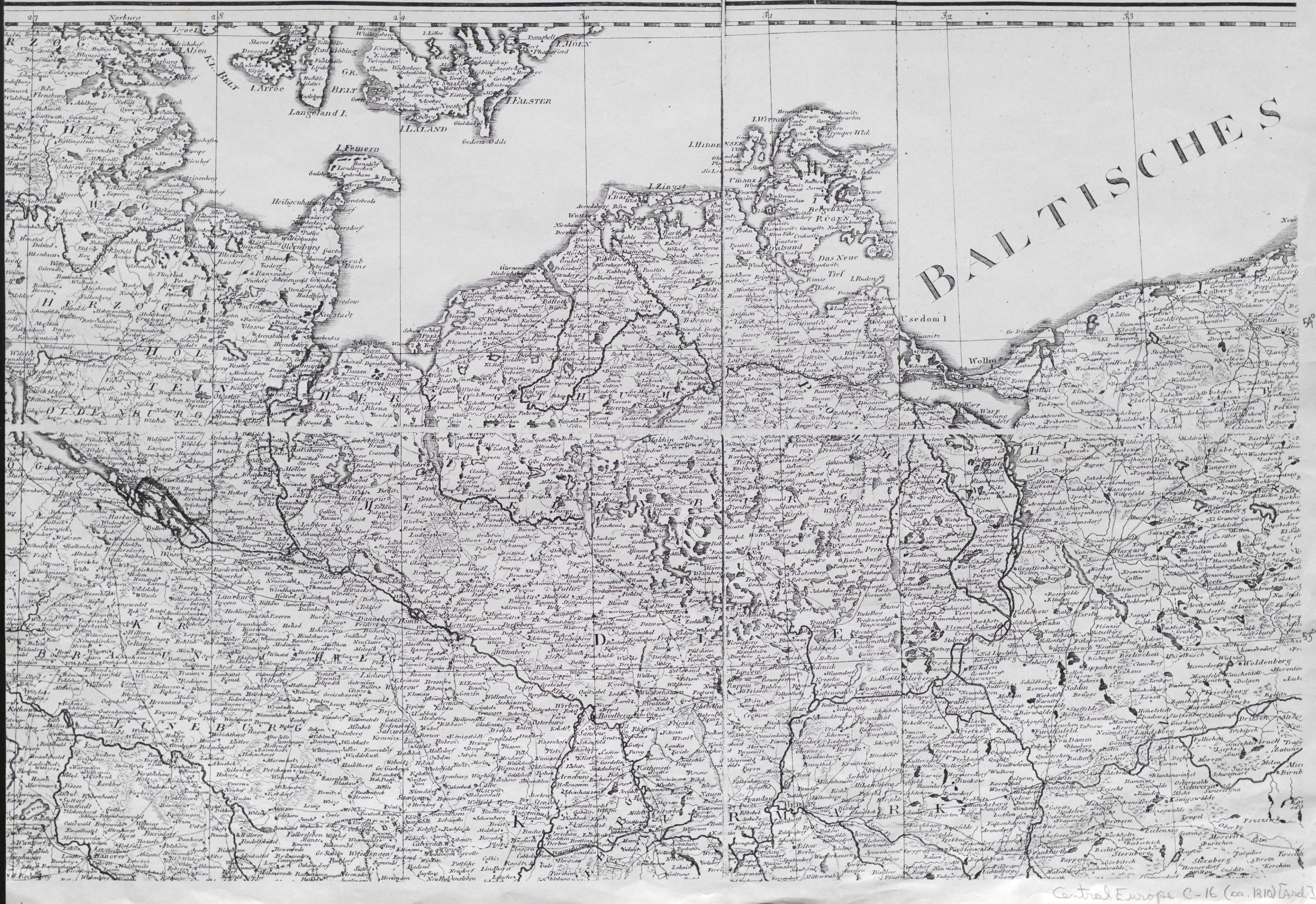
[edit]| [Map of Central Europe].
( |
|
|---|---|
| Title |
[Map of Central Europe]. |
| Publisher |
s.n.], [S.l.] |
| Description |
2 sheets.;Extent of portions held: 45°-50°35'N, 30°40'-36°30'E Ferro, and 52°15'-55°N, 27°-34°E Ferro.;Dated on the basis of the lettering styles.;Incomplete map assembled from photocopies thrown out by the National Library in Vienna. Subjects: Europe, Central--Physical sciences |
| Language | English |
| Publication date | ca 1810 |
| Current location |
IA Collections: wcw_gale; wcw; university_of_alberta_libraries; toronto |
| Accession number |
bp_15139 |
| Notes | Scale: Ca. 1:765,000. |
| Source | |
Licensing
[edit]|
This work is in the public domain in its country of origin and other countries and areas where the copyright term is the author's life plus 70 years or fewer. | |
| This file has been identified as being free of known restrictions under copyright law, including all related and neighboring rights. | |
File history
Click on a date/time to view the file as it appeared at that time.
| Date/Time | Thumbnail | Dimensions | User | Comment | |
|---|---|---|---|---|---|
| current | 12:23, 27 August 2021 |  | 3,512 × 2,414 (3.7 MB) | Fæ (talk | contribs) | IA Query "collection:(wcw) date:[1000 TO 1899]" bp_15139 Category:William C. Wonders Map Collection (COM:IA books#query) (1810 #183) |
You cannot overwrite this file.
File usage on Commons
The following page uses this file: