File:ПОСЛЕ ДОЖДЯ.jpg
Original file (3,000 × 2,000 pixels, file size: 6.06 MB, MIME type: image/jpeg)
Captions
Summary
[edit]DescriptionПОСЛЕ ДОЖДЯ.jpg |
Русский: Автомобильная дорога в степи после дождя недалеко от посёлка Казыбек-бека. Жамбыльский район, Алматинская область, Казахстан. English: 
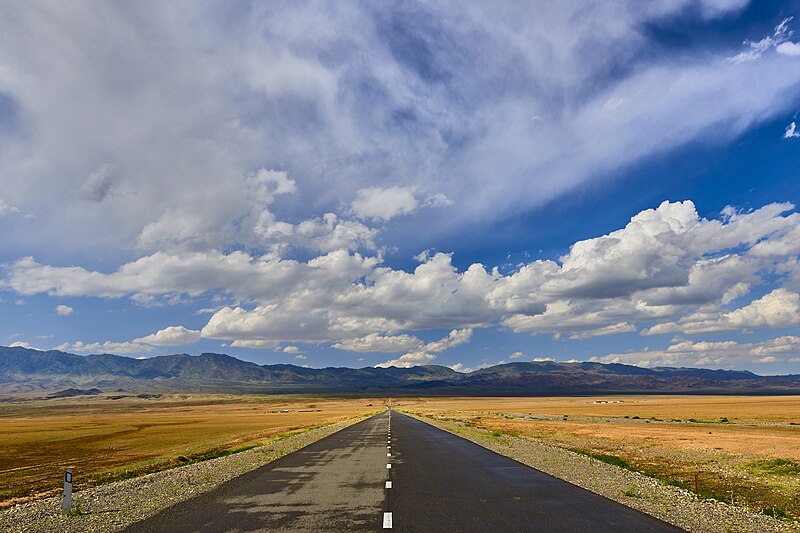
Automobile road after rain not far from Kazybek-bek station. Jambyl District, Almaty Region, Kazakhstan. |
Date | |
Source | Own work |
Author | RS128 |
Camera location | 43° 40′ 27.85″ N, 76° 23′ 26.9″ E | View this and other nearby images on: OpenStreetMap | 43.674403; 76.390806 |
---|
Licensing
[edit]- You are free:
- to share – to copy, distribute and transmit the work
- to remix – to adapt the work
- Under the following conditions:
- attribution – You must give appropriate credit, provide a link to the license, and indicate if changes were made. You may do so in any reasonable manner, but not in any way that suggests the licensor endorses you or your use.
- share alike – If you remix, transform, or build upon the material, you must distribute your contributions under the same or compatible license as the original.
This image was uploaded as part of Wiki Loves Earth 2024.
aragonés ∙ asturianu ∙ azərbaycanca ∙ Bahasa Indonesia ∙ Bahasa Melayu ∙ brezhoneg ∙ català ∙ čeština ∙ Cymraeg ∙ dagbanli ∙ Deutsch ∙ eesti ∙ English ∙ español ∙ euskara ∙ français ∙ galego ∙ hrvatski ∙ italiano ∙ latviešu ∙ Nederlands ∙ norsk ∙ norsk bokmål ∙ português ∙ polski ∙ português do Brasil ∙ qaraqalpaqsha ∙ română ∙ shqip ∙ sicilianu ∙ slovenščina ∙ svenska ∙ Tagalog ∙ Türkçe ∙ Ελληνικά ∙ беларуская (тарашкевіца) ∙ български ∙ кыргызча ∙ македонски ∙ русский ∙ српски / srpski ∙ українська ∙ ქართული ∙ հայերեն ∙ नेपाली ∙ मराठी ∙ বাংলা ∙ മലയാളം ∙ ไทย ∙ 한국어 ∙ 日本語 ∙ 中文 ∙ 中文(台灣) ∙ 中文(简体) ∙ 中文(繁體) ∙ עברית ∙ اردو ∙ العربية ∙ فارسی ∙ +/− |
This image has been assessed using the Quality image guidelines and is considered a Quality image.
العربية ∙ جازايرية ∙ беларуская ∙ беларуская (тарашкевіца) ∙ български ∙ বাংলা ∙ català ∙ čeština ∙ Cymraeg ∙ Deutsch ∙ Schweizer Hochdeutsch ∙ Zazaki ∙ Ελληνικά ∙ English ∙ Esperanto ∙ español ∙ eesti ∙ euskara ∙ فارسی ∙ suomi ∙ français ∙ galego ∙ עברית ∙ हिन्दी ∙ hrvatski ∙ magyar ∙ հայերեն ∙ Bahasa Indonesia ∙ italiano ∙ 日本語 ∙ Jawa ∙ ქართული ∙ 한국어 ∙ kurdî ∙ Lëtzebuergesch ∙ lietuvių ∙ македонски ∙ മലയാളം ∙ मराठी ∙ Bahasa Melayu ∙ Nederlands ∙ Norfuk / Pitkern ∙ polski ∙ português ∙ português do Brasil ∙ rumantsch ∙ română ∙ русский ∙ sicilianu ∙ slovenčina ∙ slovenščina ∙ shqip ∙ српски / srpski ∙ svenska ∙ தமிழ் ∙ తెలుగు ∙ ไทย ∙ Tagalog ∙ toki pona ∙ Türkçe ∙ українська ∙ vèneto ∙ Tiếng Việt ∙ 中文 ∙ 中文(简体) ∙ 中文(繁體) ∙ +/− |
File history
Click on a date/time to view the file as it appeared at that time.
Date/Time | Thumbnail | Dimensions | User | Comment | |
---|---|---|---|---|---|
current | 08:01, 25 June 2024 | 3,000 × 2,000 (6.06 MB) | RS128 (talk | contribs) | Uploaded own work with UploadWizard |
You cannot overwrite this file.
File usage on Commons
The following 3 pages use this file:
Metadata
This file contains additional information such as Exif metadata which may have been added by the digital camera, scanner, or software program used to create or digitize it. If the file has been modified from its original state, some details such as the timestamp may not fully reflect those of the original file. The timestamp is only as accurate as the clock in the camera, and it may be completely wrong.
Camera manufacturer | NIKON CORPORATION |
---|---|
Camera model | NIKON D800 |
Author | SPRychkov |
Copyright holder |
|
Exposure time | 1/320 sec (0.003125) |
F-number | f/9 |
ISO speed rating | 250 |
Date and time of data generation | 16:04, 6 July 2014 |
Lens focal length | 24 mm |
Latitude | 43° 40′ 27.85″ N |
Longitude | 76° 23′ 26.9″ E |
Altitude | 1,588 meters above sea level |
Orientation | Normal |
Horizontal resolution | 72 dpi |
Vertical resolution | 72 dpi |
Software used | Capture One 12 Macintosh |
File change date and time | 16:04, 6 July 2014 |
Y and C positioning | Centered |
Exposure Program | Aperture priority |
Exif version | 2.3 |
Date and time of digitizing | 16:04, 6 July 2014 |
Meaning of each component |
|
APEX shutter speed | 8.3219279976198 |
APEX aperture | 6.3398499938522 |
APEX exposure bias | 0 |
Maximum land aperture | 3 APEX (f/2.83) |
Subject distance | 6.6666666666667 meters |
Metering mode | Pattern |
Light source | Unknown |
Flash | Flash did not fire, compulsory flash suppression |
DateTime subseconds | 050 |
DateTimeOriginal subseconds | 050 |
DateTimeDigitized subseconds | 050 |
Supported Flashpix version | 1 |
Color space | sRGB |
Sensing method | One-chip color area sensor |
File source | Digital still camera |
Scene type | A directly photographed image |
Custom image processing | Normal process |
Exposure mode | Auto exposure |
White balance | Auto white balance |
Digital zoom ratio | 1 |
Focal length in 35 mm film | 24 mm |
Scene capture type | Standard |
Scene control | None |
Contrast | Normal |
Saturation | Normal |
Sharpness | Normal |
Subject distance range | Unknown |
Speed unit | Kilometers per hour |
Speed of GPS receiver | 0 |
Reference for direction of image | True direction |
Direction of image | 0 |
Lens used | Nikon AF-S NIKKOR 24-70mm f/2.8G ED |
Serial number of camera | 6028092 |
IIM version | 2 |
Structured data
Items portrayed in this file
depicts
6 July 2014
43°40'27.851"N, 76°23'26.902"E
0.003125 second
24 millimetre
250
image/jpeg
- Files with coordinates missing SDC location of creation
- CC-BY-SA-4.0
- Self-published work
- Images from Wiki Loves Earth 2024
- Images from Wiki Loves Earth 2024 in Kazakhstan
- Images from Wiki Loves Earth missing SDC depicts
- Images from Wiki Loves Earth missing SDC location of creation
- Uploaded via Campaign:wle-kz
- Quality images from Wiki Loves Earth 2024 in Kazakhstan
- Quality images of roads
- Quality images
- Quality images missing SDC depicts