File:Área de Villena en 1750.jpg
Jump to navigation
Jump to search

Size of this preview: 776 × 600 pixels. Other resolutions: 311 × 240 pixels | 621 × 480 pixels | 933 × 721 pixels.
Original file (933 × 721 pixels, file size: 141 KB, MIME type: image/jpeg)
Captions
Captions
Add a one-line explanation of what this file represents
Summary
[edit]
| Description |
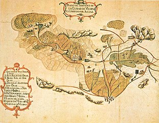
Español: Plano del Término de la Ciudad de Villena y curso de sus aguas |
| Date | |
| Source | Grabado del siglo XVIII |
| Author | Unknown author |
| Permission (Reusing this file) |
Credit information
This work was created by Enrique Íñiguez Rodríguez (Qoan). You are free to use it for any purpose as long as you credit me properly (e.g. © Enrique Íñiguez Rodríguez (CC-BY-SA); other variants are acceptable, let me know if in doubt). Reuse:
|
| Camera location | | View this and other nearby images on: OpenStreetMap |
|---|
Licensing
[edit]
|
This work is in the public domain in its country of origin and other countries and areas where the copyright term is the author's life plus 100 years or fewer. | |
| This file has been identified as being free of known restrictions under copyright law, including all related and neighboring rights. | |
File history
Click on a date/time to view the file as it appeared at that time.
| Date/Time | Thumbnail | Dimensions | User | Comment | |
|---|---|---|---|---|---|
| current | 21:34, 30 July 2009 | | 933 × 721 (141 KB) | Qoan (talk | contribs) | {{Information |Description={{es|1=Plano del Término de la Ciudad de Villena y curso de sus aguas}} |Source=Grabado del siglo XVIII |Author=Desconocido |Date=1750 |Permission= |other_versions= }} Category:Villena |
You cannot overwrite this file.
File usage on Commons
The following page uses this file:
File usage on other wikis
The following other wikis use this file:
- Usage on ca.wikipedia.org
- Usage on es.wikipedia.org
- Usage on gl.wikipedia.org