Ebenthal
Jump to navigation
Jump to search
Deutsch: Ebenthal ist eine Gemeinde im österreichischen Bundesland Kärnten und befindet sich in der Nähe der Landeshauptstadt Klagenfurt.
municipality in Klagenfurt-Land District, Carinthia, Austria   | |||||
| Upload media | |||||
| Instance of |
| ||||
|---|---|---|---|---|---|
| Location | Klagenfurt-Land District, Carinthia, Austria | ||||
| Population |
| ||||
| Area |
| ||||
| Elevation above sea level |
| ||||
| official website | |||||
 | |||||
Aich an der Straße
[edit]Berg
[edit]-
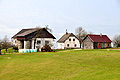
 Number 2, farmstead - Nummer 2, Gehöft
 -
 Number 3, farmstead - Nummer 3, Gehöft
 -
 Number 5, farmstead - Nummer 5, Gehöft
 -
 Wayside shrine, dedicated by home-coming Mr. Rudolf Socher “vulgo Raunjak - Heimkehrerkreuz, errichtet von Rudolf Socher „vulgo Raunjak“
 -
 Number 11, farmstead "vulgo Raunjak" - Nummer 11, Gehöft „vulgo Raunjak“
 -
 Number 13, farmstead "vulgo Stippich" - Nummer 13, Gehöft „vulgo Stippich“
 -
 Number 15, casual cider tavern "Moertl" - Nummer 15, Buschenschenke „Mörtl“
 -
 Number 15, casual cider tavern "Moertl" - Nummer 15, Buschenschenke „Mörtl“
 -
 Number 16, casual cider tavern "Schmautzer" - Nummer 16, Buschenschenke „Schmautzer“
 -
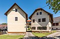
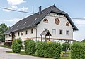
 Number 17, apartment house - Nummer 17, Wohnhaus
 -
 Stand and browsing goat - Hochsitz und äsende Ziege


Ebenthal
[edit]Views | Ansichten
[edit]-
 View from the Predigtstuhl mountain - Blick vom Predigtstuhl-Berg
 -
 View from the Predigtstuhl mountain at the fields - Blick vom Predigtstuhl-Berg auf die Felder


Friedrich-Gagern-Straße
[edit]-
 English:
Castle Rosenegg, western viewDeutsch:
Schloss Rosenegg, West-Ansicht -
 English:
 Castle Rosenegg, southeastern viewDeutsch: Schloss Rosenegg, SO-Ansicht
 -
 English: Stack of firewoodDeutsch: Brennholzstapel


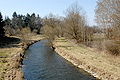
Glanfurtstrasse
[edit]-
 English:
#7: River Glanfurt at Ebenthal MillDeutsch:
Nr. 7: Glanfurt an der Ebemthaler Mühle

Goessstrasse | Goessstraße
[edit]Parish church Saint Mary of Help | Pfarrkirche Maria Hilf
[edit]-
 English:
Western viewDeutsch:
West-Ansicht -
 English: Western viewDeutsch: West-Ansicht
 -
 English:
Western viewDeutsch:
West-Ansicht -
 English:
Bell towersDeutsch:
Glockentürme -
 English:
Western viewDeutsch:
West-Ansicht -
 English: Southwestern viewDeutsch: SW-Ansicht
 -
 English:
Southwestern viewDeutsch:
SW-Ansicht -
 English:
PortalDeutsch:
Portal -
 English: PortalDeutsch: Portal
 -
 English:
Southern viewDeutsch:
Süd-Ansicht -
 English:
Southern viewDeutsch:
Süd-Ansicht -
 English: Southeastern viewDeutsch: SO-Ansicht
 -
 English:
Southeastern viewDeutsch:
SO-Ansicht -
 English: Eastern viewDeutsch: Ost-Ansicht
 -
 English: ApseDeutsch: Chorschluss
 -
 English:
Eastern viewDeutsch:
Ost-Ansicht


#1: Roman Catholic rectory | Nr. 1: Röm.-kath. Pfarrhaus
[edit]-
 English:
Southeastern viewDeutsch:
SO-Ansicht -
 English:
Southeastern viewDeutsch:
SO-Ansicht


Gurnitzer Street | Gurnitzer Straße
[edit]-
 Farmstead "vulgo Pongraz" on the Gurnitzer Strasse #14 - Bauernhof „vulgo Pongraz“ in der Gurnitzer Straße 14
 -
 Number 16, vulgo Fasser - Nummer 16, vulgo Fasser


Miegerer Strasse | Miegerer Straße
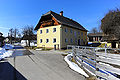
[edit]#30: Municipal office | Nr. 30: Marktgemeindeamt
[edit]-
 English:
Northwestern viewDeutsch:
NW-Ansicht -
 English:
DetailDeutsch:
Detail


Oremus Street | Oremusstraße
[edit]-
 English:
# 2: Mansion “Oremus house”, "vulgo Wirt"Deutsch:
Nr. 2: Villa „Oremushaus“, „vulgo Wirt“ -
 English:
# 2: Mansion “Oremus house”, "vulgo Wirt"Deutsch:
Nr. 2: Villa „Oremushaus“, „vulgo Wirt“ -
 English:
# 2: Concert room on the first floor of the mansion “Oremus house"Deutsch:
Nr. 2: Konzertraum im ersten Stock der Villa „Oremushaus“ -
 Mag. Attila Szabó, violinist and musical director of the Szabó string quartet - Mag. Attila Szabó, Violinist und Leiter des Szabó-Streichquartetts
 -
 Number 2, detail of the mansion “Oremus house”, "vulgo Wirt" - Nummer 2, Ausschnitt der Villa „Oremushaus“, „vulgo Wirt“
 -
 Inscription on the gravestone of Johann Oremus, former owner of “vulgo Wirt” mansion on the Oremus Street #2 - Grabstein-Inschrift für Johann Oremus, ehemaliger Besitzer der Villa „Oremushaus“, „vulgo Wirt“ in der Oremusstraße 2
 -
 English:
# 2: Southern view at the mansion “Oremus house”, "vulgo Wirt"Deutsch:
Nr. 2: Süd-Ansicht der Villa „Oremushaus“, „vulgo Wirt“ -
 English:
# 6: Farmstead “vulgo Krumpl”Deutsch:
Nr. 6: Bauernhof „vulgo Krumpl“ -
 English:
# 8: Farmstead “vulgo Matschnig”Deutsch:
Nr. 8: „Matschnig-Hube“ -
 English: # 8: Farmstead “vulgo Matschnig”Deutsch: Nr. 8: „Matschnig-Hube“
 -
 English:
# 8: Barnyard “vulgo Matschnig”Deutsch:
Nr. 8: Wirtschaftsgebäude der „Matschnig-Hube“ -
 English:
# 3: Ehart mill "vulgo Ambrusch" at the river GlanfurtDeutsch:
Nr. 3: Ehart-Mühle „vulgo Ambrusch“ an der Glanfurt -
 English: # 3: Ehart mill "vulgo Ambrusch" at the river GlanfurtDeutsch: Nr. 3: Ehart-Mühle „vulgo Ambrusch“ an der Glanfurt
 -
 English:
# 3: Ehart mill "vulgo Ambrusch" at the river GlanfurtDeutsch:
Nr. 3: Ehart-Mühle „vulgo Ambrusch“ an der Glanfurt -
 English: # 3: Ehart mill and number 8, “vulgo Matschnig”Deutsch: Nr. 3: Ehart-Mühle und Nr. 8 „vulgo Matschnig“
 -
 English:
# 3: Weir of the river Glanfurt at the Ehart mill and bread shop "vulgo Ambrusch"Deutsch:
Nr. 3: Glanfurt-Wehr an der Ehart-Mühle und Bäckerei „vulgo Ambrusch“ -
 English: # 3: Weir of the river Glanfurt at the Ehart mill and bread shop "vulgo Ambrusch"Deutsch: Nr. 3: Glanfurt-Wehr an der Ehart-Mühle und Bäckerei „vulgo Ambrusch“
 -
 English:
# 3: Ehart mill and number 8, “vulgo Matschnig”Deutsch:
Nr. 3: Ehart-Mühle und Nr. 8 „vulgo Matschnig“ -
 English:
# 3: Ehart mill "vulgo Ambrusch"Deutsch:
Nr. 3: Ehart-Mühle „vulgo Ambrusch“ -
 English:
# 3: Ehart mill "vulgo Ambrusch"Deutsch:
Nr. 3: Ehart-Mühle „vulgo Ambrusch“ -
 English: # 3: Ehart mill "vulgo Ambrusch"Deutsch: Nr. 3: Ehart-Mühle „vulgo Ambrusch“
 -
 English:
# 3: Ehart mill "vulgo Ambrusch"Deutsch:
Nr. 3: Ehart-Mühle „vulgo Ambrusch“


Schlossstrasse | Schlossstraße
[edit]Castle Ebenthal | Schloss Ebenthal
[edit]-
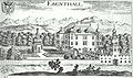 Valvasor´s copper engraving from 1688 A.D. - Valvasors Kupferstich aus dem Jahre 1688
 -
 English:
Southeastern viewDeutsch:
SO-Ansicht -
 English:
Eastern viewDeutsch:
Ost-Ansicht -
 English:
CutoutDeutsch:
Ausschnitt -
 Detail - Detail


#26: Schlosswirt | Nr. 26: Schlosswirt
[edit]-
 English:
Northwestern view (2006)Deutsch:
NW-Ansicht (2006) -
 English:
Northeastern view (2010)Deutsch:
NO-Ansicht (2010) -
 English:
Southeastern view (2010Deutsch:
SO-Ansicht (2010)


Castle ruin Greifenfels | Burgruine Greifenfels
[edit]-
 Valvasor A.D. 1688 - Valvasor im Jahr 1688
 -
 Scarse rests of the stereobate - Spärliche Überbleibsel der Grundmauern
 -
 Scarse rests of the stereobate - Kärgliche Mauerreste der Burgruine
 -
 Rock with rests - Felskuppe mit Anlageresten


Miscellaneous | Verschiedenes
[edit]-
 “Lampl” bridge across the Glanfurt with memorial plaque - „Lampl“-Brücke über die Glanfurt mit Gedenkstein
 -
 Memorial plaque in the middle of the bridge across the Glanfurt - Erinnerungstafel in der Brückenmitte über der Glanfurt
 -
 Glanfurt river (line of demarcation in the years 1919 to 1920) near the restaurant "Lamplwirt" - Glanfurt (Demarkationslinie in den Jahren 1919/1920) nahe dem Restaurant Lamplwirt
 -
 Restaurant “Lamplwirt” - Restaurant „Lamplwirt“
 -
 Glanfurt Street #12, “Hansl-Bauer” - Glanfurtstraße 2, „Hansl-Bauer“
 -
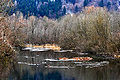
 Glanfurt, Mischiz and Gorianz - Glanfurt, Mischiz und Gorianz
 -
 Kalmus bath - Kalmusbad
 -
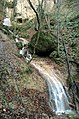 Waterfall - Wasserfall
 -
 Weir on the eastern part of the river Glanfurt, splitting off the Ebenthal canal - Wehr am östlíchen Lauf der Glanfurt, den Ebentaler Kanal absondernd
 -
 Wayside shrine on the Quellenstrasse - Heimkehrer-Bildstock an der Quellenstraße
 -
 Fetching water at the well on the Quellenstrasse - Wasserfassen an der Quellenstrasse


Goritschach
[edit]-
 English:
Number 9: vulgo BrodnikDeutsch:
Nummer 0: vulgo Brodnik -
 English:
Number 9: vulgo BrodnikDeutsch:
Nummer 0: vulgo Brodnik -
 English:
“Kossiach Rock”Deutsch:
„Kossiacher Felsen“ -
 English:
Number 25 and Rottenstein in the backgroundDeutsch:
Nummer 25 mit Rottenstein im Hintergrund -
 English:
Vernal acre with tractorDeutsch:
Frühlingsfeld mit Traktor -
 English:
Bridge across the DravaDeutsch:
Brücke über die Drau -
 English:
Number 6, vulgo IllitschDeutsch:
Nummer 6, vulgo Illitsch -
 English:
Number 6, vulgo IllitschDeutsch:
Nummer 6, vulgo Illitsch -
 English:
Number 6, vulgo IllitschDeutsch:
Nummer 6, vulgo Illitsch -
 English:
Memorial at the site of the Pilatus Porter`s aircraft crashDeutsch:
Gedenkstätte an der Absturzstelle des Bundesheer-Transport-Flugzeugs Pilatus Porter -
 English:
Memorial at the site of the Pilatus Porter`s aircraft crashDeutsch:
Gedenkstätte an der Absturzstelle des Bundesheer-Transport-Flugzeugs Pilatus Porter


Gradnitz
[edit]-
 Old elementary school in the year 1931 - Alte Volksschule im Jahre 1931
 -
 Farmhouse "Archerhof" on the Sankt Jakober Strasse - Archerhof an der Sankt Jakober Straße
 -
 Restaurant Sporn on the Sankt Jakober Strasse - Gasthaus Sporn an der Sankt Jakober Straße
 -
 Restaurant Kutsche on the Sankt Jakober Strasse - Gasthof Kutsche an der Sankt Jakober Straße
 -
 Sankt Jakober Strasse number 20 - Sankt Jakober Straße 20
 -
 Sankt Jakober Strasse number 14 - Sankt Jakober Straße 14
 -
 Sankt Jakober Strasse number 16 - Sankt Jakober Straße 16
 -
 Farmhouse on the Sankt Jakober Strasse - Gehöft an der Sankt Jakober Straße
 -
 Farmhouse on the Sankt Jakober Strasse - Gehöft an der Sankt Jakober Straße


Gurnitz
[edit]Castle | Burg
[edit]-
 Markus Pernhart: Gurnitz
 -
 Valvasor´s copper engraving from 1688 A.D. - Valvasors Kupferstich von 1688
 -
 English:
Fortification relics of the castle ruins "Old Gurnitz"Deutsch:
Reste der Befestigungs-Anlage der Burgruine Alt-Gurnitz


Miscellaneous | Diverses
[edit]-
 English:
War memorialDeutsch:
Kriegerdenkmal -
 English:
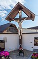
Wayside cross on KirchenstrasseDeutsch:
Wegkreuz an der Kirchenstraße -
 English:
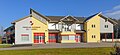
Fire stationDeutsch:
Freiwillige Feuerwehr -
 English:
Demarcation line in the years 1918 to 1920 on the bridge across the Glan river in KirchenstrasseDeutsch:
Demarkationslinie in den Jahren 1918 bis 1920 auf der Brücke über die Glan in der Kirchenstraße -
 English:
Demarcation line in the years 1918 to 1920 on the bridge across the Glan river in KirchenstrasseDeutsch:
Demarkationslinie in den Jahren 1918 bis 1920 auf der Brücke über die Glan in der Kirchenstraße -
 English:
Former elementary school on Kirchenstrasse #31-33Deutsch:
Frühere Volksschule in der Kirchenstraße 31-33


Kirchenstrasse | Kirchenstraße
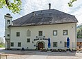
[edit]#30: Old Brewhouse (Castle Landlord) | Nr. 30: Altes Bräuhaus (Schlosswirt)
[edit]-
 English: Northeastern viewDeutsch: NO-Ansicht
 -
 English:
Northwestern viewDeutsch:
NW-Ansicht -
 English:
Northwestern viewDeutsch:
NW-Ansicht -
 English: Western viewDeutsch: West-Ansicht
 -
 English:
Western viewDeutsch:
West-Ansicht -
 English:
Northwestern viewDeutsch:
NW-Ansicht -
 English:
BayDeutsch:
Eckerker -
 English: BayDeutsch: Eckerker
 -
 English:
Northwestern bayDeutsch:
NW-Eckerker -
 English: Northern viewDeutsch: Nord-Ansicht
 -
 English:
Northeastern viewDeutsch:
NO-Ansicht -
 English:
Northeastern viewDeutsch:
NO-Ansicht -
 English:
Northeastern viewDeutsch:
NO-Ansicht -
 English:
Northeastern viewDeutsch:
NO-Ansicht -
 English:
Eastern viewDeutsch:
Ost-Ansicht -
 English:
Eastern viewDeutsch:
Ost-Ansicht -
 English: Southeastern viewDeutsch: SO-Ansicht
 -
 English:
Southern viewDeutsch:
Süd-Ansicht -
 English: Southern viewDeutsch: Süd-Ansicht
 -
 English:
Southern viewDeutsch:
Süd-Ansicht -
 English:
Latin inscription on the orielDeutsch:
Lateinische Erker-Inschrift


Grotto of Lourdes | Lourdes-Grotte
[edit]-
 English: Memorial plaqueDeutsch: Gedenktafel
 -
 English: General viewDeutsch: Gesamt-Ansicht
 -
 English:
General viewDeutsch:
Gesamt-Ansicht


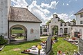
Priory, parish church and cemetery | Propstei, Pfarrkirche und Friedhof
[edit]-
 English:
Mountain range SattnitzDeutsch:
Sattnitz-Rücken -
 English:
Collegiate church Saint Martin and prioryDeutsch:
Pfarrkirche hl. Martin und Propstei -
 English:
Collegiate church Saint Martin and prioryDeutsch:
Pfarrkirche hl. Martin und Propstei -
 English: Collegiate church Saint Martin and prioryDeutsch: Pfarrkirche hl. Martin und Propstei
 -
 English:
Collegiate church Saint Martin and prioryDeutsch:
Pfarrkirche hl. Martin und Propstei -
 English: Priory and rectoryDeutsch: Propstei und Pfarrhof
 -
 English:
Northern staircase of the prriory and rectoryDeutsch:
Nördliche Außentreppe von Propstei und Pfarrhof -
 English:
Northern staircase of the priory and rectoryDeutsch:
Nördliche Außentreppe von Propstei und Pfarrhof -
 English:
Priory and rectoryDeutsch:
Propstei und Pfarrhof -
 English:
Collegiate church Saint Martin and cemeteryDeutsch:
Pfarrkirche hl. Martin und Friedhof -
 English:
Collegiate church Saint Martin and prioryDeutsch:
Pfarrkirche hl. Martin und Propstei -
 English:
Collegiate church Saint Martin and prioryDeutsch:
Pfarrkirche hl. Martin und Propstei -
 English: Collegiate church Saint Martin and prioryDeutsch: Pfarrkirche hl. Martin und Propstei
 -
 English:
Collegiate church Saint Martin and prioryDeutsch:
Pfarrkirche Heiliger Martin und Propstei -
 English:
Collegiate church Saint Martin and cemeteryDeutsch:
Pfarrkirche hl. Martin und Friedhof -
 English:
Interior of the parish church Saint MartinDeutsch:
Innenraum der Pfarrkirche hl. Martin -
 English:
Stone relief and memorial plaque for the noble family von Neuhaus from the year 1604 inside the parish church Holy MartinDeutsch:
Reliefstein für die Adelsfamilie von Neuhaus aus dem Jahr 1604 in der Pfarrkirche Heiliger Martin -
 Stone relief and memorial plaque for John Joseph Count of Inzaghi inside the parish church Holy Martin - Relief- und Inschriftstein für Johannes Josef Graf von Inzaghi in der Pfarrkirche Heiliger Martin
 -
 English:
Stone relief and memorial plaque for the provost Joseph Aichwalder inside the parish church Saint MartinDeutsch:
Relief- und Inschriftstein für den Propst Josef Aichwalder in der Pfarrkirche hl. Martin -
 English:
Madonna mit Kind über dem Eingang zum PfarrhofDeutsch:
Madonna with child above the entrance of the rectory -
 English:
Foundation stone with relief and memorial plaque on the eastern outside wall of the parish church Saint MartinDeutsch:
Gründungsstein mit Relief und Inschrift an der äußeren Ostwand der Pfarrkirche hl. Martin -
 English:
Foundation stone with relief and memorial plaque on the eastern outside wall of the parish church Saint MartinDeutsch:
Gründungsstein mit Relief und Inschrift an der äußeren Ostwand der Pfarrkirche hl. Martin -
 English:
Stone sculpture of a lion at the north wall of the provost house and rectoryDeutsch:
Steinskulptur eines Löwen an der Nord-Wand von Propstei und Pfarrhof -
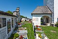
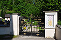 Entrance gate to the cemetery - Eingang zum Gurnitz am Friedhof
 -
 Burial vaults for three provosts of Gurnitz on the cemetery - Gruftgrabstätte für drei Pröpste von Gurnitz am Friedhof
 -
 Memorial plaque for the provost Jakop Wang (1848-1904) on the burial vault for three provosts of Gurnitz on the cemetery - Grabstein für den Propst Jakop Wang (1848-1904) auf dem Gruftgrab für drei Pröpste von Gurnitz am Friedhof
 -
 Memorial plaque for the provost Janez Sirnik (1852-1929) on the burial vault for three provosts of Gurnitz on the cemetery - Grabstein für den Propst Janez Sirnik (1852-1929) auf dem Gruftgrab für drei Pröpste von Gurnitz am Friedhof
 -
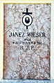 Memorial plaque for the provost Janez Wieser (1844-1922) on the burial vault for three provosts of Gurnitz on the cemetery - Grabstein für den Propst Janez Wieser (1844-1922) auf dem Gruftgrab für drei Pröpste von Gurnitz am Friedhof
 -
 English:
Neo-classical cemetery chapel with burial vault for the provosts of GurnitzDeutsch:
Klassizistische Gruftkapelle der Pröpste von Gurnitz -
 English:
Neo-classical cemetery chapel with burial vault for the provosts of GurnitzDeutsch:
Klassizistische Gruftkapelle der Pröpste von Gurnitz -
 English:
Crucifixion group inside the neo-classical cemetery chapelDeutsch:
Kreuzigungsgruppe in der klassizistischen Gruftkapelle -
 English:
Crucifixion group inside the neo-classical cemetery chapelDeutsch:
Kreuzigungsgruppe in der klassizistischen Gruftkapelle -
 English:
Memorial plaque for the provost Josephus Udalricus Aichwalder (1722-1794) inside the cemetery chapelDeutsch:
Gedenkstein für den Propst Josef Ulrich Aichwalder (1722-1794) in der Gruftkapelle der Pröpste am Friedhof


Haber
[edit]-
 English:
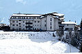
Hibernal village with fire departmentDeutsch:
Winterliche Ortschaft mit Feuerwehr -
 English:
Vernal village with fire departmentDeutsch:
Frühlingshafte Ortschaft mit Feuerwehr -
 English:
Elementary school and wayside chapelDeutsch:
Volksschule und Wegkapelle


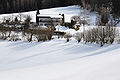
Hinterberg
[edit]-
 Hibernal village - Winterliche Ortschaft
 -
 Road to Unterkreuth, in the background on the left the mountain “Hochobir” and on the right the mountain “Schwarzer Gupf” - Straße nach Unterkreuth, links hinten der Hochobir und rechts hinten Schwarzer Gupf


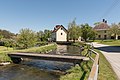
Kohldorf
[edit]-
 English:
View from the village Saager on the Sattnitz mountainDeutsch:
Blick von der Ortschaft Saager auf dem Sattnitz-Rücken -
 English:
Eastern viewDeutsch:
Ost-Ansicht -
 English:
FarmhouseDeutsch:
Bauernhof -
 English:
FarmsteadDeutsch:
Bauernhof -
 English:
Former Drava bed with lidoDeutsch:
Altes Drau-Bett mit Freizeitanlage -
 English:
Former Drava bed with lidoDeutsch:
Alte Drau-Schleife mit Freizeitanlage -
 Deutsch:
Aulandschaft an der Drau -
 Deutsch:
Aulandschaft an der Drau -

-

-

-

-

-
 English:
LidoDeutsch:
Freizeitanlage mit Strandbad -
 English:
View at the SattnitzDeutsch:
Blick über den Linsendorfer See auf die Sattnitz


Kosasmojach
[edit]-
 Farmhouse - Bauernhof
 -
 Farmhouse - Bauernhof


Kossiach
[edit]-
 Winter: view from north-west - Winter: Nordwest-Ansicht
 -
 Spring: view from north-west - Frühling: Nordwest-Ansicht
 -
 English:
Southeastern view of the “Kossiach Rock”Deutsch:
SO-Ansicht des „Kossiacher Felsen“ -
 English:
Southeastern view of the “Kossiach Rock”Deutsch:
SO-Ansicht des „Kossiacher Felsen“ -
 English:
“Kossiach Rock”Deutsch:
„Kossiacher Felsen“ -
 English:
“Kossiach Rock”Deutsch:
„Kossiacher Felsen“ -
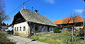
 Vulgo Kropiunig - Kropiunigkeusche


Lipizach
[edit]-
 “Salan” wayside chapel - „Salan“-Wegkapelle
 -
 Number 1, "vulgo Salan" - Nummer 1, „vulgo Salan“
 -
 Rural landscape - Bäuerliche Landschaft
 -
 Number 8, “vulgo Pongratz” - Nummer 8 „Vulgo Pongratz“
 -
 Number 9, “vulgo Hanusch” - Nummer 9 „Vulgo Hanusch“
 -
 Number 10, “vulgo ___” - Nummer 10 „Vulgo ___“
 -
 Farmhouse - Bauernhof
 -
 Farmhouse - Bauernhof
 -
 Farmhouse - Bauernhof
 -
 Apartment house - Wohnhaus


Mieger
[edit]Moosberg
[edit]-
 English:
FarmsteadDeutsch:
Gehöft -
 English:
Farmstead "vulgo Ruter"Deutsch:
Gehöft „vulgo Ruter“ -
 English:
Apartment houseDeutsch:
Wohnhaus


Niederdorf
[edit]-
 “Raba” brook - Raba-Bach
 -
 River Gurk with the old railroad bridge - Gurk-Fluss mit der alten Eisenbahnbrücke
 -
 Koralm railway line close to the industrial park - Koralmbahn neben dem Gewerbepark
 -
 Koralm railway line in front of the industrial park - Koralmbahn vor dem Gewerbepark


Oberkreuth
[edit]-
 English:
Rustic snack bar “Mickl”Deutsch:
Jausenstation „Mickl“ -
 English:
View across the Rosental at the HochobirDeutsch:
Blick über das Rosental auf den Hochobir -
 English:
View across the Rosental at the HochobirDeutsch:
Blick über das Rosental auf den Hochobir -
 English:
View across the Rosental at the HochobirDeutsch:
Blick über das Rosental auf den Hochobir -
 English:
Number 15, old mill, at present sculptor Hartwig Kernmayrs` studioDeutsch:
Nummer 15, alte Mühle, jetzt Atelier des bildenden Künstlers Hartwig Kernmayr -
 English:
Number 15, old mill, at present sculptor Hartwig Kernmayrs` studioDeutsch:
Nummer 15, alte Mühle, jetzt Atelier des bildenden Künstlers Hartwig Kernmayr -
 English:
Number 15, old mill, at present sculptor Hartwig Kernmayrs` studioDeutsch:
Nummer 15, alte Mühle, jetzt Atelier des bildenden Künstlers Hartwig Kernmayr -
 English:
Number 15, old mill, at present sculptor Hartwig Kernmayrs` studioDeutsch:
Nummer 15, alte Mühle, jetzt Atelier des bildenden Künstlers Hartwig Kernmayr -
 English:
Number 16, farmstead "vulgo Schubernig"Deutsch:
Nummer 16 - Anwesen „vulgo Schubernig“


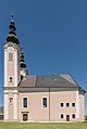
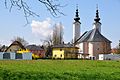
Obermieger
[edit]-
 Southwest view - Südwest-Ansicht
 -
 View from Berg - Blick von Berg
 -
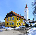
 Parish church Saint Bartholomeus - Pfarrkirche Heiliger Bartholomäus
 -
 Parish church Saint Bartholomeus - Pfarrkirche Heiliger Bartholomäus


Obitschach
[edit]-
 English:
LandscapeDeutsch:
Landschaft -
 English:
Farmstead (with the Hochobir mountain in the background)Deutsch:
Bäuerliches Anwesen (mit Hochobir-Massiv im Hintergrund) -
 English:
Southern view of the “Käfer” smallholdingDeutsch:
Süd-Ansicht der Käfer-Keusche -
 English:
Northern view of the “Käfer” smallholdingDeutsch:
Nord-Ansicht der Käfer-Keusche


Pfaffendorf
[edit]-
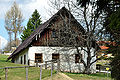
 Old farmhouse on the Miegerer Street #76 - Alte Keusche in der Miegerer Straße 76
 -
 Old barn on the Miegerer Street #76 - Alter Stadel in der Miegerer Straße 76
 -
 "School on a farm" on the Miegerer Street #121 - „Schule am Bauernhof“ in der Miegerer Straße 121
 -
 Farmstead "School on a farm" on the Miegerer Street #121 - Stadel der „Schule am Bauernhof“ in der Miegerer Straße 121


Priedl
[edit]-
 Miegerer Street #95 - Miegerer Straße 95
 -
 Markhof on the Miegerer Street #97 - Markhof an der Miegerer Straße 97
 -
 Markhof on the Miegerer Street #97 - Markhof an der Miegerer Straße 97


Radsberg - Radiše
[edit]- Radsberg is a village in the municipality Ebenthal in Kärnten
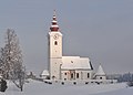
Parish church Saint Lambertus | Pfarrkirche hl. Lambert
[edit]-
 English:
Southeastern viewDeutsch:
SO-Ansicht -
 English:
Southsouthwestern viewDeutsch:
SSW-Ansicht -
 English:
Southsouthwestern viewDeutsch:
SSW-Ansicht -
 English:
Southsouthwestern viewDeutsch:
SSW-Ansicht -
 English:
Southsouthwestern viewDeutsch:
SSW-Ansicht -
 English:
Southsouthwestern viewDeutsch:
SSW-Ansicht -
 English:
Southsouthwestern viewDeutsch:
SSW-Ansicht -
 English: Southsouthwestern viewDeutsch: SSW-Ansicht
 -
 English:
Southwestern viewDeutsch:
SW-Ansicht -
 English:
Southern viewDeutsch:
Süd-Ansicht -
 English:
Rectory and parish churchDeutsch:
Pfarrhaus und Pfarrkirche -
 English:
Southwestern viewDeutsch:
SW-Ansicht -
 English:
Southwestern viewDeutsch:
SW-Ansicht -
 English: Southwestern viewDeutsch: SW-Ansicht
 -
 English:
Village hall, mortuary, rectory and parish churchDeutsch:
Kulturhaus, Aufbahrungshalle, Pfarrhof und Pfarrkirche -
 English:
Cemetery portalDeutsch:
Friedhofseingang -
 English:
Cemetery portalDeutsch:
Friedhofseingang -
 English: Cemetery portalDeutsch: Friedhofseingang
 -
 English:
  Cemetery portalDeutsch: Friedhofseingang
 -
 English:
Cemetery portalDeutsch:
Friedhofseingang -
 English:
Sacristy and fresco of Saint Christopher on the north sideDeutsch:
Sakristei und Fresko des hl. Christophorus an der N-Seite -
 English:
Sacristy and fresco of Saint Christopher on the north sideDeutsch:
Sakristei und Fresko des hl. Christophorus an der N-Seite -
 English:
Porch and cemetery portalDeutsch:
Vorhalle und Friedhofseingang -
 English:
PorchDeutsch:
Vorhalle -
 English:
Porch and cemeteryDeutsch:
Vorhalle und Friedhof -
 English:
Porch and cemeteryDeutsch:
Vorhalle und Friedhof -
 English:
Porch and crucifixDeutsch:
Vorhalle und Kruzifix -
 English:
PorchDeutsch:
Vorhalle -
 English:
PorchDeutsch:
Vorhalle -
 English:
PorchDeutsch:
Vorhalle -
 English:
PortalDeutsch:
Portal -
 English:
Alcove fresco, showing the revived Redeemer on top of the entrance to the parish churchDeutsch:
Nischen-Fresko mit der Darstellung des auferstandenen Erlösers über dem Eingang zur Pfarrkirche -
 English:
Fresco of Saint Christopher at the northern wallDeutsch:
Christopherus-Fresko an der N-Wand -
 English:
Fresco of Saint Christopher at the northern wallDeutsch:
Christopherus-Fresko an der N-Wand -
 English:
Fresco of Saint Christopher at the southern wallDeutsch:
Christopherus-Fresko an der S-Wand -
 English:
Fresco of Saint Christopher at the southern wallDeutsch:
Christopherus-Fresko an der S-Wand -
 English:
Fresco of Saint Christopher and apseDeutsch:
Christopherus-Fresko und Chorschluss -
 English:
Fresco of Saint Christopher at the southern wallDeutsch:
Christopherus-Fresko an der S-Wand -
 English:
Fresco of Saint Christopher at the southern wallDeutsch:
Christopherus-Fresko an der S-Wand -
 English:
Western Gothic church portal at the porchDeutsch:
Westliches gotisches Kirchenportal in der Vorhalle -
 English:
Gravestone at the porchDeutsch:
Grabstein in der Vorhalle -
 English:
Gothic vault of the organ gallery inside the parish church Saint LambertusDeutsch:
Gotisches Gewölbe der Orgelgalerie in der Pfarrkirche Heiliger Lambert


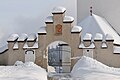
Romanesque charnel house Saint Michael | Romanischer Rundkarner hl. Michael
[edit]-
 English:
Western viewDeutsch:
West-Ansicht -
 English:
Western viewDeutsch:
West-Ansicht -
 English: Western viewDeutsch: West-Ansicht
 -
 English:
Western viewDeutsch:
West-Ansicht -
 English:
Western viewDeutsch:
West-Ansicht -
 English:
Western viewDeutsch:
West-Ansicht -
 English:
Southwestern viewDeutsch:
SW-Ansicht -
 English:
Southwestern viewDeutsch:
SW-Ansicht -
 English:
Southeastern viewDeutsch:
SO-Ansicht -
 English:
Eastern viewDeutsch:
Ost-Ansicht -
 English:
Eastern viewDeutsch:
Ost-Ansicht -
 English:
Northeastern viewDeutsch:
NO-Ansicht -
 English:
Northwestern viewDeutsch:
NW-Ansicht -
 English:
Southwestern viewDeutsch:
SW-Ansicht


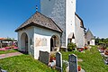
Cemetery | Friedhof
[edit]-
 English:
Gravestone of family OraschDeutsch:
Grabstein Familie Orasch -
 English:
Gravestone of Paula OraschDeutsch:
Grabstein Paula Orasch


Roman Catholic rectory | Röm.-kath. Pfarrhof
[edit]-
 English:
Western viewDeutsch:
West-Ansicht -
 English:
Western viewDeutsch:
West-Ansicht -
 English:
Southwestern viewDeutsch:
SW-Ansicht -
 English:
Southern viewDeutsch:
Süd-Ansicht -
 English:
Southeastern viewDeutsch:
SO-Ansicht -
 English:
Southeastern viewDeutsch:
SO-Ansicht -
 English:
Southeastern viewDeutsch:
SO-Ansicht -
 English:
Southern viewDeutsch:
Süd-Ansicht -
 English:
Eastern viewDeutsch:
Ost-Ansicht -
 English:
Eastern viewDeutsch:
Ost-Ansicht -
 English:
Eastern viewDeutsch:
Ost-Ansicht -
 English:
Relief stone on top of the rectory's entranceDeutsch:
Wappenstein über dem Pfarrhof-Eingang


Mortuary | Aufbahrungshalle
[edit]-
 English:
Northern viewDeutsch:
Nord-Ansicht -
 English:
Northern viewDeutsch:
Nord-Ansicht -
 English:
Mortuary and rectoryDeutsch:
Aufbahrungshalle und Pfarrhof -
 English:
Mortuary and rectoryDeutsch:
Aufbahrungshalle und Pfarrhof -
 English:
Mortuary and wayside chapelDeutsch:
Aufbahrungshalle und Wegkapelle


House of culture | Kulturhaus
[edit]-
 English:
Western viewDeutsch:
West-Ansicht -
 English:
Western viewDeutsch:
West-Ansicht -
 English:
Southern viewDeutsch:
Süd-Ansicht -
 English:
Southeastern viewDeutsch:
SO-Ansicht -
 English:
Southeastern viewDeutsch:
SO-Ansicht -
 English:
Southeastern viewDeutsch:
SO-Ansicht -
 English:
Northeastern viewDeutsch:
NO-Ansicht -
 English:
Plaques at the western wallDeutsch:
Inschrifttafeln an der Westwand -
 English: Plaques at the western wallDeutsch: Inschrifttafeln an der Westwand


Historical site to remember the forced relocation of Carinthians of Slovenian descent by the Nazis in the years 1942-1945 | Mahnmal der Vertreibung slowenischstämmiger Kärntner durch die Nazis in den Jahren 1942-1945
[edit]-
 English:
Southern viewDeutsch:
Süd-Ansicht -
 English:
Southern viewDeutsch:
Süd-Ansicht -
 English:
Southern viewDeutsch:
Süd-Ansicht -
 English:
Eastern viewDeutsch:
Ost-Ansicht -
 English:
German inscriptionDeutsch:
Inschrift auf Deutsch


Wayside chapel | Wegkapelle
[edit]-
 English:
Northwestern viewDeutsch:
NW-Ansicht -
 English:
Northeastern viewDeutsch:
NO-Ansicht -
 English:
Northeastern viewDeutsch:
NO-Ansicht -
 English:
Northeastern viewDeutsch:
NO-Ansicht


Miscellaneous | Verschiedenes
[edit]-
 English:
Vernal landscapeDeutsch:
Sommerlandschaft -
 English:
Hibernal landscapeDeutsch:
Winterlandschaft -
 English:
Hibernal landscapeDeutsch:
Winterlandschaft -
 English:
Hibernal landscapeDeutsch:
Winterlandschaft -
 English:
  Fence post in hibernal landscapeDeutsch: Zaunpfahl in Winterlandschaft
 -
 English:
Wayside shrine south of the parish churchDeutsch:
Bildstock südlich der Pfarrkirche -
 English:
Cemetery cross (created by Werner Hofmeister)Deutsch:
Friedhofskreuz (geschaffen von Werner Hofmeister) -
 Number 5 "VULGO MESSNER" - Nummer 5 "MESSNER-HOF"
 -
 Number 6 "VULGO TAURER" - Nummer 6 "TAURER-HOF"


Reichersdorf
[edit]-
 Grimmgasse number 5 - Grimmgasse 5
 -
 Grimmgasse number 5 - Grimmgasse 5
 -
 Grimmgasse number 5, cutout - Grimmgasse 5, Ausschnitt
 -
 Grimmgasse number 5 - Grimmgasse 5
 -
 Grimmgasse number 5 - Grimmgasse 5
 -
 Grimmgasse number 5, cutout - Grimmgasse 5, Ausschnitt
 -
 Fields beneath clouds in a blue Carinthian sky - Felder unter Kärntner Wolkenhimmel


Rosenegg
[edit]-
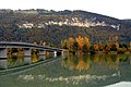
 Mouth of the river Glanfurt to the Glan - Mündung der Glanfurt in die Glan

Schloss Rosenegg
[edit]-
 Castle Rosenegg on the Friedrich-Gagern-Street #1 in Ebenthal - Schloss Rosenegg an der Friedrich-Gagern-Strasse 1
 -
 Castle Rosenegg on the Friedrich-Gagern-Street #1 in Ebenthal - Schloss Rosenegg an der Friedrich-Gagern-Strasse 1
 -
Castle Rosenegg - Schloss Rosenegg
-
 Renaissance portal of castle Rosenegg - Renaissanceportal von Schloss Rosenegg


Rottenstein
[edit]Parish church Saint Magdalena and cemetery | Pfarrkirche hl. Magdalena und Friedhof
[edit]-
 English:
Northeastern viewDeutsch:
NO-Ansicht -
 English:
Northeastern viewDeutsch:
NO-Ansicht -
 English:
Northwestern viewDeutsch:
NW-Ansicht -
 English:
Eastern viewDeutsch:
Ost-Ansicht -
 English:
Southern viewDeutsch:
Süd-Ansicht -
 English:
Southeastern viewDeutsch:
SO-Ansicht -
 English:
Eastern viewDeutsch:
Ost-Ansicht -
 English:
Eastern view with farmstead “vulgo Krassnig”Deutsch:
Ost-Ansicht mit Bauernhof „vulgo Krassnig“ -
 English:
Facade detailDeutsch:
Fassaden-Detail -
 English:
Western porchDeutsch:
Westliche Vorlaube -
 English:
Western portalDeutsch:
West-Portal -
 English:
Western portalDeutsch:
West-Portal -
 English:
Fresco of a bishop at the western porchDeutsch:
Christophorus-Fresko in der westlichen Vorlaube -
 English:
Fresco of Saint Christopher at the western porchDeutsch:
Bischofs-Fresko in der westlichen Vorlaube -
 English:
South wall with barred windowsDeutsch:
Süd-Wand mit Gitterfenstern -
 English:
South wall with barred windowsDeutsch:
Süd-Wand mit Gitterfenstern -
 English:
Barred windowDeutsch:
Gitterfenster -
 English:
Fresco of angels at the south wallDeutsch:
Fresko mit Engelsdarstellung an der Süd-Wand -
 English:
ApseDeutsch:
Chorschluss -
 English:
CrucifixDeutsch:
Kruzifix -
 English:
SacristyDeutsch:
Sakristei -
 English:
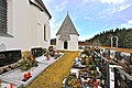
Former mortuary at the churchyardDeutsch:
Vormalige Aufbahrungshalle am Friedhof -
 English:
Former mortuary at the churchyardDeutsch:
Vormalige Aufbahrungshalle am Friedhof -
 English:
Door of the former mortuary at the cemeteryDeutsch:
Türe der vormaligen Aufbahrungshalle


#9: Wayside chapel | Nr. 9: Wegkapelle
[edit]-
 English:
Southern viewDeutsch:
Süd-Ansicht -
 English:
Eastern viewDeutsch:
Ost-Ansicht -
 English:
Saint LucyDeutsch:
Hl. Lucia


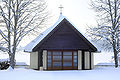
#12: Mortuary | Nr. 12: Aufbahrungshalle
[edit]-
 English:
Southern viewDeutsch:
Süd-Ansicht

Miscellaneous |Diverses
[edit]-
 English:
Bikeway along the DravaDeutsch:
Drauradweg -

-
 English:
Drava (Obitschach above)Deutsch:
Drau (Obitschach oberhalb) -
 English:
View from ObitschachDeutsch:
Blick von Obitschach -
 English:
View from ObitschachDeutsch:
Blick von Obitschach


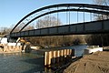
Bridge across the Drava | Draubrücke
[edit]-
 English:
Southeastern viewDeutsch:
SO-Ansicht -
 English:
Southeastern viewDeutsch:
SO-Ansicht -
 English:
Southeastern viewDeutsch:
SO-Ansicht -
 English:
Southwestern viewDeutsch:
SW-Ansicht -
 English:
Southwestern viewDeutsch:
SW-Ansicht -
 English:
Southwestern viewDeutsch:
SW-Ansicht -
 English:
Southwestern viewDeutsch:
SW-Ansicht -
 English:
Northern viewDeutsch:
Nord-Ansicht


Saager
[edit]-
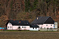
 Number 12, farmstead "vulgo Petschnig" - Nummer 12, Gehöft „vulgo Petschnig
 -
 Number 13, homestead of the artist Prof. Karl Brandstaetter - Nummer 13, Anwesen des bildenden Künstlers Prof. Karl Brandstätter


Sabuatach
[edit]-
 Homestead - Gehöft
 -
 Homestead Primaschitz - Gehöft Primaschitz


Schwarz
[edit]-
 Number 1, farmstead “vulgo Sekun” - Nummer 1, Gehöft „vulgo Sekun“
 -
 Number 1, farmstead “vulgo Sekun” - Nummer 1, Gehöft „vulgo Sekun“
 -
 View from the north - Nordansicht
 -
 Elementary school - Volksschule
 -
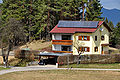
 Number 5, "vulgo Pottak", restaurant Thomas Uschounig - Nummer 5, „Pottakhube“ und Gasthaus Thomas Uschounig
 -
 Number 11, farmstead “vulgo Juch“ (owner: Andreas Lambichler) - Nummer 11, „Juchhube“ des Andreas Lambichler
 -
 Number 13, farmstead "vulgo Rudnitz" - Nummer 13, „Vulgo Rudnitz
 -
 Retirement home Buerger - Seniorenwohnheim Bürger
 -
 Farmstead "vulgo Nuvin" - Bauernhof „vulgo Nuvin“
 -
 Farmstead "vulgo Nuvin" - Bauernhof „vulgo Nuvin“


Spitzach
[edit]-
 Farmstead ruin "vulgo Kaprol" - Gehöft-Ruine „vulgo Kaprol“

Tutzach
[edit]-
 Wayside shrine - Bildstock
 -
 View from the east - Ansicht von Osten
 -
 Number 4, Raunig´s farmstead - Nummer 4, Rauhnigs Bauernhof
 -
 Number 5, Hribernig´s farmstead - Nummer 5, Hribernigs Bauernhof
 -
 Number 12, Valentin Buerger`s farmstead - Nummer 12, Valentin Bürgers Bauernhof


Unterkreuth
[edit]-
Barn - Heuschuppen
-
 Number 23, “Vulgo Metauer” (owner Josef Schuschnig) - Nummer 23, „Vulgo Metauer“ (Besitzer Josef Schuschnig)
 -
 Number 23, “Vulgo Metauer” (residence of Agnes Schuschnig) - Nummer 23, „Vulgo Metauer“ (Auszughaus der Agnes Schuschnig)


Untermieger
[edit]Werouzach
[edit]-
 Number 1, farmstead “vulgo Pridounig” - Nummer 1, Gehöft „vulgo Pridounig“
 -
 Number 1, farmstead “vulgo Pridounig” - Nummer 1, Gehöft „vulgo Pridounig“
 -
 Number 1, farmstead “vulgo Pridounig” - Nummer 1, Gehöft „vulgo Pridounig“
 -
 Number 5, farmstead - Nummer 5, Gehöft
 -
 Number 6, small farmstead - Nummer 6, Keusche (landwirtschaftlicher Kleinbetrieb)
 -
 Number 7, farmstead - Nummer 7, Gehöft
 -
 Number 8, painter Karl Truppe`s birthplace - Nummer 8, Geburtshaus des Malers Karl Truppe
 -
 Number 8, painter Karl Truppe`s birthplace - Nummer 8, Geburtshaus des Malers Karl Truppe
 -
 Memorial plaque on the painter Karl Truppe`s birthplace - Gedenktafel am Geburtshaus des Malers Karl Truppe
 -
 Apartment house - Wohnhaus
 -
 Number 9, apartment house - Nummer 9, Wohnhaus


Zell
[edit]-
 View at Zell on the Zettereier Street - Blick auf Zell in der Zettereier Straße
 -
Unmanned station - Freiwillige Feuerwehr

Zetterei
[edit]-
 Zettereier Street number 19 - Zettereier Straße 19
 -
 Farmhouse on the Schauerweg - Stadel am Schauerweg
 -
 Ackerstreet number 1 - Ackerstraße 1
 -
 Zettereier Street - Zettereier Straße
 -
 Zettereier Street number 24 - Zettereier Straße 24
 -
 Zettereier Street - Zettereier Straße
 -
 Glan river - Glan-Fluss


Zwanzgerberg
[edit]-
 View at the “Predigtstuhl” mountain - Blick auf den „Predigtstuhl“-Berg
 -
 View from the east - Ansicht von Osten
 -
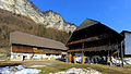
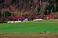
 Bauernhöfe Nummer 10 und 11


Symbols and maps
[edit]-
 Coat of arms
 -
 Position of Ebenthal in Austria
 -
 Position of Ebenthal (2) within the Klagenfurt-Land district

